Property Record
481 Batavia Pike, Cincinnati, OH 45244


Save to a Folder
{{folder.Name}}
{{folder.ListingIds.length}} Properties
{{folder.ListingIds.length}} Property
Create a New Folder
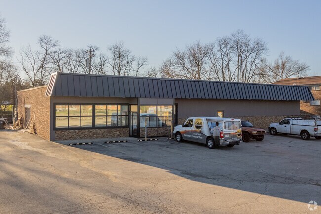
Property Detail
481 Batavia Pike
41-32-13C-325
SEE 413213C325T FOR TIF
Commercialnec
Clermont
B and X Area of moderate flood hazard, usually the area between the limits of the 100-year and 500-year floods.
Ohio
2025
1 AC
2025
Eastgate/Anderson Twp
041403
Cincinnati/Dayton
7,027 SF
Cincinnati, OH-KY-IN
NEARBY LISTINGS FOR SALE OR LEASE
DEMOGRAPHICS near 481 Batavia Pike
1 mile
3 mile
5 mile
2025 Total Population
7,388
51,340
120,977
2030 Population
7,657
52,045
122,607
Pop Growth 2025-2030
+ 3.64%
+ 1.37%
+ 1.35%
Average Age
41
41
41
2025 Total Households
3,219
20,669
49,859
HH Growth 2025-2030
+ 3.98%
+ 1.76%
+ 1.59%
Median Household Inc
$65,842
$84,671
$85,577
Avg Household Size
2.30
2.40
2.40
2025 Avg HH Vehicles
2.00
2.00
2.00
Median Home Value
$242,759
$295,023
$308,121
Median Year Built
1979
1981
1978
Nearby Places
Map Layers
Map Styles
 Street
 Aerial
Layers
 Traffic
 Biking
Places
Listings with unknown addresses are not visible on the map
- Restaurants
- Banks
- Shops
- Fitness
- Groceries
PUBLIC TRANSPORTATION
AIRPORT
Cincinnati/Northern Kentucky International
Drive
Walk
Distance
Cincinnati/Northern Kentucky International
26 min
26.2 mi
SALE & LEASE HISTORY
LISTING DATE
SALE/LEASE

Sep 24, 2016
For Sale
Oct 21, 2020
For Lease
Oct 21, 2020
For Sale
Mar 23, 2017
For Sale
Mar 06, 2017
For Lease
Mar 01, 2017
For Sale
Jan 31, 2019
For Lease
Jan 30, 2019
For Sale
Feb 12, 2025
For Sale
Feb 11, 2025
For Sale
Nearby Properties
Address
Land Use
TOTAL SIZE
Lot Size
Zoning
Address
Land Use
TOTAL SIZE
Lot Size
Zoning
26.42 AC
Address
Land Use
TOTAL SIZE
Lot Size
Zoning
50,382 SF
33.05 AC
Address
Land Use
TOTAL SIZE
Lot Size
Zoning
154,426 SF
35.05 AC
Address
Land Use
TOTAL SIZE
Lot Size
Zoning
Address
Land Use
TOTAL SIZE
Lot Size
Zoning
52,178 SF
5.98 AC
Address
Land Use
TOTAL SIZE
Lot Size
Zoning
11.96 AC
Address
Land Use
TOTAL SIZE
Lot Size
Zoning
4,938 SF
18.99 AC
Address
Land Use
TOTAL SIZE
Lot Size
Zoning
236,920 SF
18.94 AC
Address
Land Use
TOTAL SIZE
Lot Size
Zoning
36.96 AC
Address
Land Use
TOTAL SIZE
Lot Size
Zoning
88,932 SF
11.21 AC
Address
Land Use
TOTAL SIZE
Lot Size
Zoning
16.77 AC
Address
Land Use
TOTAL SIZE
Lot Size
Zoning
56,080 SF
4.40 AC
Address
Land Use
TOTAL SIZE
Lot Size
Zoning
72,272 SF
20.31 AC
Address
Land Use
TOTAL SIZE
Lot Size
Zoning
49.27 AC
Address
Land Use
TOTAL SIZE
Lot Size
Zoning
1,134,029 SF
229.73 AC
Address
Land Use
TOTAL SIZE
Lot Size
Zoning
78,145 SF
19.91 AC
Address
Land Use
TOTAL SIZE
Lot Size
Zoning
25.59 AC
Address
Land Use
TOTAL SIZE
Lot Size
Zoning
26,637 SF
6.97 AC
Address
Land Use
TOTAL SIZE
Lot Size
Zoning
55,848 SF
12.51 AC
Address
Land Use
TOTAL SIZE
Lot Size
Zoning
27.01 AC
Address
Land Use
TOTAL SIZE
Lot Size
Zoning
9,088 SF
42.09 AC
Address
Land Use
TOTAL SIZE
Lot Size
Zoning
980 SF
5.01 AC
Address
Land Use
TOTAL SIZE
Lot Size
Zoning
3,803 SF
21.34 AC
Address
Land Use
TOTAL SIZE
Lot Size
Zoning
49.66 AC
Address
Land Use
TOTAL SIZE
Lot Size
Zoning
70,456 SF
15.28 AC
Address
Land Use
TOTAL SIZE
Lot Size
Zoning
44,047 SF
3.37 AC
Address
Land Use
TOTAL SIZE
Lot Size
Zoning
79,064 SF
6.27 AC
Address
Land Use
TOTAL SIZE
Lot Size
Zoning
83,608 SF
4.45 AC
Address
Land Use
TOTAL SIZE
Lot Size
Zoning
Address
Land Use
TOTAL SIZE
Lot Size
Zoning
59,730 SF
19.46 AC
The World's #1 Commercial Real Estate Marketplace
Connect with us
© 2026 CoStar Group
The information above has been obtained from sources believed reliable. While we do not doubt its accuracy we have not verified it and make no guarantee, warranty or representation about it. It is your responsibility to independently confirm its accuracy and completeness. Any projections, opinions, assumptions, or estimates used are for example only and do not represent the current or future performance of the property. The value of this transaction to you depends on tax and other factors which should be evaluated by your tax, financial, and legal advisors. You and your advisors should conduct a careful, independent investigation of the property to determine to your satisfaction the suitability of the property for your needs.