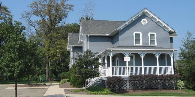
Property Record
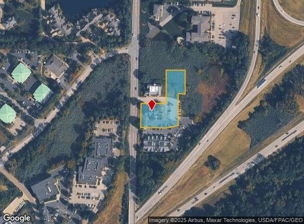
491 N Cleveland Massillon Rd, Akron, OH 44333
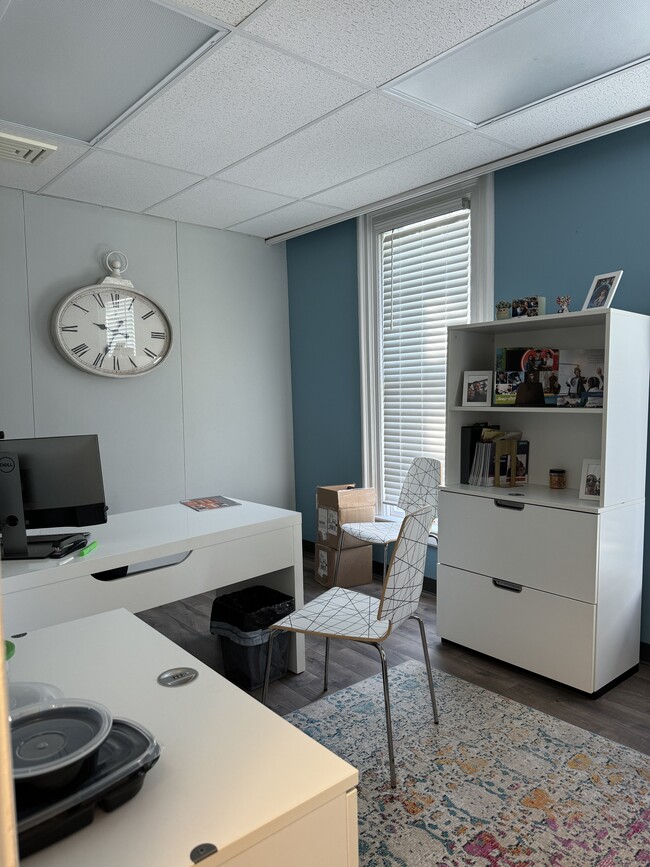
Current Lease Availabilities
NEARBY LISTINGS FOR SALE OR LEASE
Property Detail
491 N Cleveland Massillon Rd
04-07536
LOT 86 E CLEVELAND MASSILLON RD 1.2966 AC
Officebuilding
Summit
X
Ohio
39153C0094F
86
2023
1.20 AC
2025
Fairlawn/Montrose
532301
Cleveland
5,621 SF
Akron, OH
DEMOGRAPHICS near 491 N Cleveland Massillon Rd
1 Mile
3 Mile
5 Mile
2024 Total Population
1,495
28,867
60,347
2029 Population
1,459
28,496
59,605
Pop Growth 2024-2029
(2.41%)
(1.29%)
(1.23%)
Average Age
49
44
43
2024 Total Households
635
11,735
25,949
HH Growth 2024-2029
(2.52%)
(1.33%)
(1.28%)
Median Household Inc
$146,666
$110,239
$89,341
Avg Household Size
2.20
2.40
2.30
2024 Avg HH Vehicles
2.00
2.00
2.00
Median Home Value
$435,465
$326,149
$267,816
Median Year Built
1974
1980
1972
Nearby Places
- Restaurants
- Banks
- Shops
- Fitness
- Groceries
PUBLIC TRANSPORTATION
COMMUTER RAIL
DRIVE
WALK
Distance
11 min
4.5 mi
DRIVE
WALK
Distance
13 min
6.0 mi
AIRPORT
Akron-Canton Regional
DRIVE
WALK
Distance
Akron-Canton Regional
33 min
25.2 mi
Cleveland-Hopkins International
DRIVE
WALK
Distance
Cleveland-Hopkins International
44 min
30.4 mi
Nearby Properties
Address
Land Use
TOTAL SIZE
Lot Size
Zoning
Address
Land Use
TOTAL SIZE
Lot Size
Zoning
12.92 AC
Address
Land Use
TOTAL SIZE
Lot Size
Zoning
676,403 SF
39.06 AC
Address
Land Use
TOTAL SIZE
Lot Size
Zoning
Address
Land Use
TOTAL SIZE
Lot Size
Zoning
324,548 SF
64.18 AC
Address
Land Use
TOTAL SIZE
Lot Size
Zoning
311,093 SF
32.53 AC
Address
Land Use
TOTAL SIZE
Lot Size
Zoning
72,026 SF
7.92 AC
Address
Land Use
TOTAL SIZE
Lot Size
Zoning
192,658 SF
15.34 AC
Address
Land Use
TOTAL SIZE
Lot Size
Zoning
411,220 SF
54.72 AC
Address
Land Use
TOTAL SIZE
Lot Size
Zoning
439,456 SF
26.40 AC
Address
Land Use
TOTAL SIZE
Lot Size
Zoning
164,214 SF
12.92 AC
Address
Land Use
TOTAL SIZE
Lot Size
Zoning
214,600 SF
14.12 AC
Address
Land Use
TOTAL SIZE
Lot Size
Zoning
135,300 SF
6.75 AC
Address
Land Use
TOTAL SIZE
Lot Size
Zoning
226,341 SF
18.81 AC
Address
Land Use
TOTAL SIZE
Lot Size
Zoning
77,096 SF
6.21 AC
Address
Land Use
TOTAL SIZE
Lot Size
Zoning
Address
Land Use
TOTAL SIZE
Lot Size
Zoning
54,592 SF
11.32 AC
Address
Land Use
TOTAL SIZE
Lot Size
Zoning
87,071 SF
18.03 AC
Address
Land Use
TOTAL SIZE
Lot Size
Zoning
148,292 SF
18.43 AC
Address
Land Use
TOTAL SIZE
Lot Size
Zoning
Address
Land Use
TOTAL SIZE
Lot Size
Zoning
73,301 SF
5.55 AC
Address
Land Use
TOTAL SIZE
Lot Size
Zoning
129,308 SF
19.02 AC
Address
Land Use
TOTAL SIZE
Lot Size
Zoning
179,805 SF
12.87 AC
Address
Land Use
TOTAL SIZE
Lot Size
Zoning
132,886 SF
10.87 AC
Address
Land Use
TOTAL SIZE
Lot Size
Zoning
148,199 SF
58.56 AC
Address
Land Use
TOTAL SIZE
Lot Size
Zoning
126,710 SF
12.67 AC
Address
Land Use
TOTAL SIZE
Lot Size
Zoning
61,414 SF
4.88 AC
Address
Land Use
TOTAL SIZE
Lot Size
Zoning
159,086 SF
8.36 AC
Address
Land Use
TOTAL SIZE
Lot Size
Zoning
2,400 SF
59.20 AC
Address
Land Use
TOTAL SIZE
Lot Size
Zoning
72,219 SF
5.15 AC
Address
Land Use
TOTAL SIZE
Lot Size
Zoning
57,553 SF
4.35 AC
The World's #1 Commercial Real Estate Marketplace
Connect with us
© 2025 CoStar Group
The information above has been obtained from sources believed reliable. While we do not doubt its accuracy we have not verified it and make no guarantee, warranty or representation about it. It is your responsibility to independently confirm its accuracy and completeness. Any projections, opinions, assumptions, or estimates used are for example only and do not represent the current or future performance of the property. The value of this transaction to you depends on tax and other factors which should be evaluated by your tax, financial, and legal advisors. You and your advisors should conduct a careful, independent investigation of the property to determine to your satisfaction the suitability of the property for your needs.