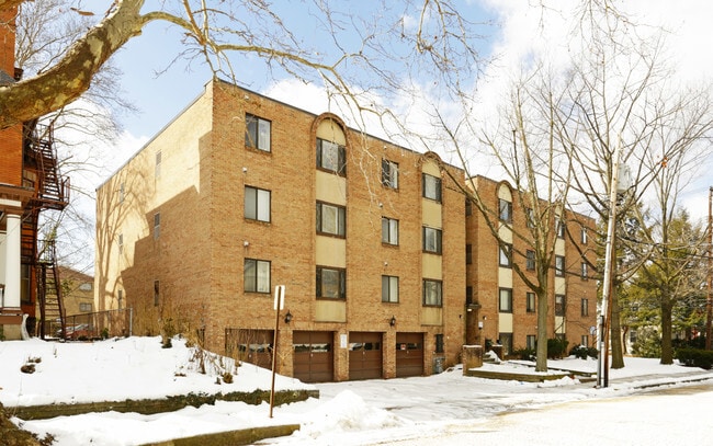
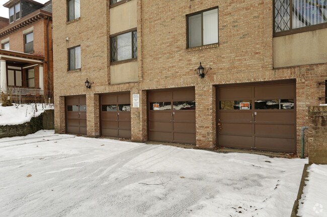
Property Record
481 Dawson Ave, Pittsburgh, PA 15202
NEARBY LISTINGS FOR SALE OR LEASE
Property Detail
481 Dawson Ave
Pittsburgh, PA
Sunnyside Plan
0160-G-00022-0000-00
SUNNYSIDE PLAN 49-50 LOT 137.55X AVG 150.50X119.95 IN ALL DAWSON AVE 4 STY CB & BRK APT BLDG
Apartment
Allegheny
X
Pennsylvania
42003C0331H
22
2024
0.42 AC
2025
Avalon-Bellevue-Ben Avon
431500
Pittsburgh
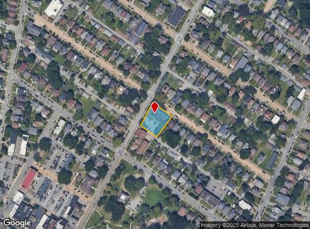
DEMOGRAPHICS near 481 Dawson Ave
1 Mile
3 Mile
5 Mile
2024 Total Population
13,849
78,018
197,563
2029 Population
13,353
76,248
194,001
Pop Growth 2024-2029
(3.58%)
(2.27%)
(1.80%)
Average Age
41
41
42
2024 Total Households
7,094
35,231
90,758
HH Growth 2024-2029
(3.69%)
(2.42%)
(1.77%)
Median Household Inc
$57,030
$60,254
$70,585
Avg Household Size
1.90
2.20
2.10
2024 Avg HH Vehicles
1.00
1.00
1.00
Median Home Value
$166,398
$164,785
$195,685
Median Year Built
1948
1949
1955
Nearby Places
Map Layers
Map Styles
 Street
 Aerial
- Restaurants
- Banks
- Shops
- Fitness
- Groceries
PUBLIC TRANSPORTATION
COMMUTER RAIL
DRIVE
WALK
Distance
14 min
6.4 mi
AIRPORT
Pittsburgh International
DRIVE
WALK
Distance
Pittsburgh International
29 min
13.6 mi
Arnold Palmer Regional
DRIVE
WALK
Distance
Arnold Palmer Regional
79 min
49.1 mi
Nearby Properties
Address
Land Use
TOTAL SIZE
Lot Size
Zoning
Address
Land Use
TOTAL SIZE
Lot Size
Zoning
26.68 AC
Address
Land Use
TOTAL SIZE
Lot Size
Zoning
21.20 AC
Address
Land Use
TOTAL SIZE
Lot Size
Zoning
33.85 AC
Address
Land Use
TOTAL SIZE
Lot Size
Zoning
25.70 AC
Address
Land Use
TOTAL SIZE
Lot Size
Zoning
Address
Land Use
TOTAL SIZE
Lot Size
Zoning
45.85 AC
Address
Land Use
TOTAL SIZE
Lot Size
Zoning
25.09 AC
Address
Land Use
TOTAL SIZE
Lot Size
Zoning
88.84 AC
Address
Land Use
TOTAL SIZE
Lot Size
Zoning
Address
Land Use
TOTAL SIZE
Lot Size
Zoning
3.83 AC
Address
Land Use
TOTAL SIZE
Lot Size
Zoning
13.86 AC
Address
Land Use
TOTAL SIZE
Lot Size
Zoning
Address
Land Use
TOTAL SIZE
Lot Size
Zoning
6.52 AC
Address
Land Use
TOTAL SIZE
Lot Size
Zoning
Address
Land Use
TOTAL SIZE
Lot Size
Zoning
15.86 AC
Address
Land Use
TOTAL SIZE
Lot Size
Zoning
Address
Land Use
TOTAL SIZE
Lot Size
Zoning
9.18 AC
Address
Land Use
TOTAL SIZE
Lot Size
Zoning
21.49 AC
Address
Land Use
TOTAL SIZE
Lot Size
Zoning
Address
Land Use
TOTAL SIZE
Lot Size
Zoning
Address
Land Use
TOTAL SIZE
Lot Size
Zoning
5.74 AC
Address
Land Use
TOTAL SIZE
Lot Size
Zoning
18.19 AC
Address
Land Use
TOTAL SIZE
Lot Size
Zoning
Address
Land Use
TOTAL SIZE
Lot Size
Zoning
44.02 AC
Address
Land Use
TOTAL SIZE
Lot Size
Zoning
Address
Land Use
TOTAL SIZE
Lot Size
Zoning
5.58 AC
Address
Land Use
TOTAL SIZE
Lot Size
Zoning
Address
Land Use
TOTAL SIZE
Lot Size
Zoning
48.63 AC
Address
Land Use
TOTAL SIZE
Lot Size
Zoning
Address
Land Use
TOTAL SIZE
Lot Size
Zoning
2.20 AC
The World's #1 Commercial Real Estate Marketplace
Connect with us
© 2026 CoStar Group
The information above has been obtained from sources believed reliable. While we do not doubt its accuracy we have not verified it and make no guarantee, warranty or representation about it. It is your responsibility to independently confirm its accuracy and completeness. Any projections, opinions, assumptions, or estimates used are for example only and do not represent the current or future performance of the property. The value of this transaction to you depends on tax and other factors which should be evaluated by your tax, financial, and legal advisors. You and your advisors should conduct a careful, independent investigation of the property to determine to your satisfaction the suitability of the property for your needs.