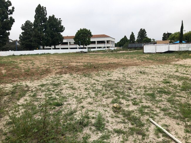
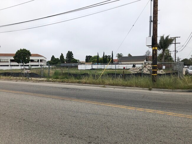
Property Record
481 Ventura Blvd, Oxnard, CA 93036

Current Lease Availabilities
Property Detail
481 Ventura Blvd
145-0-211-175
REF: 008MR 038
Vacantlandnec
Ventura
CPD
California
AO River or stream flood hazard areas, and areas with a 1% or greater chance of shallow flooding each year. These areas have a 26% chance of flooding over the life of a 30-year mortgage.
0.54 AC
2024
Oxnard/Port Hueneme
2025
Los Angeles
005005
Oxnard-Thousand Oaks-Ventura, CA
NEARBY LISTINGS FOR SALE OR LEASE
DEMOGRAPHICS near 481 Ventura Blvd
1 mile
3 mile
5 mile
2024 Total Population
23,811
121,413
268,180
2029 Population
23,715
119,949
266,022
Pop Growth 2024-2029
(0.40%)
(1.21%)
(0.80%)
Average Age
36
38
39
2024 Total Households
6,873
34,808
79,659
HH Growth 2024-2029
(0.49%)
(1.32%)
(0.74%)
Median Household Inc
$98,892
$100,689
$98,844
Avg Household Size
3.40
3.30
3.20
2024 Avg HH Vehicles
2.00
2.00
2.00
Median Home Value
$664,629
$719,915
$719,764
Median Year Built
1986
1979
1975
Nearby Places
Map Layers
Map Styles
 Street
 Aerial
Transit
 Traffic
 Biking
Places
Listings with unknown addresses are not visible on the map
- Restaurants
- Banks
- Shops
- Fitness
- Groceries
PUBLIC TRANSPORTATION
COMMUTER RAIL
East Ventura Metrolink Station (Metrolink Ventura County Line - Metrolink Trains)
Drive
Walk
Distance
East Ventura Metrolink Station (Metrolink Ventura County Line - Metrolink Trains)
5 min
2.8 mi
Oxnard (Ventura County Line - Southern California Regional Rail Authority (Metrolink))
Drive
Walk
Distance
Oxnard (Ventura County Line - Southern California Regional Rail Authority (Metrolink))
6 min
2.9 mi
Freight Ports
The Port of Hueneme
Drive
Walk
Distance
The Port of Hueneme
14 min
7.4 mi
Nearby Properties
Address
Land Use
TOTAL SIZE
Lot Size
Zoning
Address
Land Use
TOTAL SIZE
Lot Size
Zoning
135,631 SF
74.32 AC
Address
Land Use
TOTAL SIZE
Lot Size
Zoning
25.09 AC
Address
Land Use
TOTAL SIZE
Lot Size
Zoning
35.90 AC
BRP
Address
Land Use
TOTAL SIZE
Lot Size
Zoning
8.03 AC
CPD
Address
Land Use
TOTAL SIZE
Lot Size
Zoning
480,733 SF
14.26 AC
Address
Land Use
TOTAL SIZE
Lot Size
Zoning
31.75 AC
Address
Land Use
TOTAL SIZE
Lot Size
Zoning
505,728 SF
20.81 AC
Address
Land Use
TOTAL SIZE
Lot Size
Zoning
15.09 AC
Address
Land Use
TOTAL SIZE
Lot Size
Zoning
95,637 SF
40.70 AC
Address
Land Use
TOTAL SIZE
Lot Size
Zoning
6.14 AC
Address
Land Use
TOTAL SIZE
Lot Size
Zoning
352,898 SF
16.57 AC
ML
Address
Land Use
TOTAL SIZE
Lot Size
Zoning
3.96 AC
Address
Land Use
TOTAL SIZE
Lot Size
Zoning
11.28 AC
CMPD
Address
Land Use
TOTAL SIZE
Lot Size
Zoning
2.63 AC
Address
Land Use
TOTAL SIZE
Lot Size
Zoning
3.12 AC
Address
Land Use
TOTAL SIZE
Lot Size
Zoning
24,154 SF
12.67 AC
R3-1
Address
Land Use
TOTAL SIZE
Lot Size
Zoning
30,800 SF
32.79 AC
M-1-
Address
Land Use
TOTAL SIZE
Lot Size
Zoning
1,675 SF
18.62 AC
Address
Land Use
TOTAL SIZE
Lot Size
Zoning
110,434 SF
3.81 AC
Address
Land Use
TOTAL SIZE
Lot Size
Zoning
15.59 AC
Address
Land Use
TOTAL SIZE
Lot Size
Zoning
70,392 SF
19.97 AC
4
Address
Land Use
TOTAL SIZE
Lot Size
Zoning
191,035 SF
8.54 AC
R3PD
Address
Land Use
TOTAL SIZE
Lot Size
Zoning
158,736 SF
6.33 AC
Address
Land Use
TOTAL SIZE
Lot Size
Zoning
41,327 SF
7.04 AC
Address
Land Use
TOTAL SIZE
Lot Size
Zoning
770 SF
9.80 AC
M1
Address
Land Use
TOTAL SIZE
Lot Size
Zoning
13,833 SF
13.91 AC
Address
Land Use
TOTAL SIZE
Lot Size
Zoning
138,475 SF
2.77 AC
Address
Land Use
TOTAL SIZE
Lot Size
Zoning
138,475 SF
2.77 AC
Address
Land Use
TOTAL SIZE
Lot Size
Zoning
72,335 SF
10.67 AC
Address
Land Use
TOTAL SIZE
Lot Size
Zoning
2,440 SF
7.49 AC
C2
The World's #1 Commercial Real Estate Marketplace
Connect with us
© 2026 CoStar Group
The information above has been obtained from sources believed reliable. While we do not doubt its accuracy we have not verified it and make no guarantee, warranty or representation about it. It is your responsibility to independently confirm its accuracy and completeness. Any projections, opinions, assumptions, or estimates used are for example only and do not represent the current or future performance of the property. The value of this transaction to you depends on tax and other factors which should be evaluated by your tax, financial, and legal advisors. You and your advisors should conduct a careful, independent investigation of the property to determine to your satisfaction the suitability of the property for your needs.