Property Record
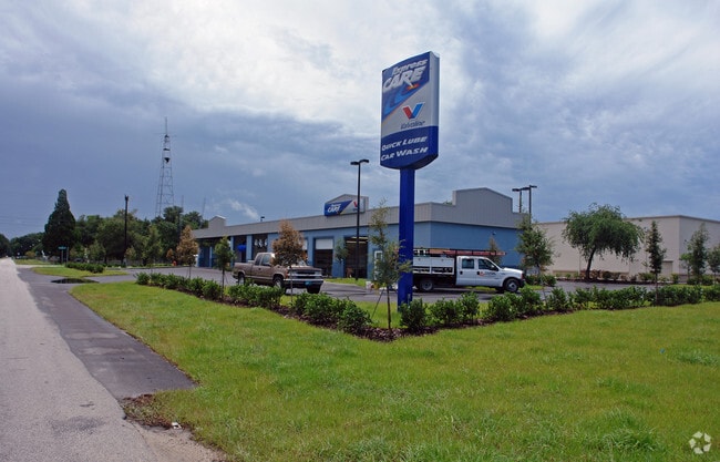
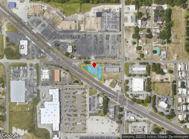
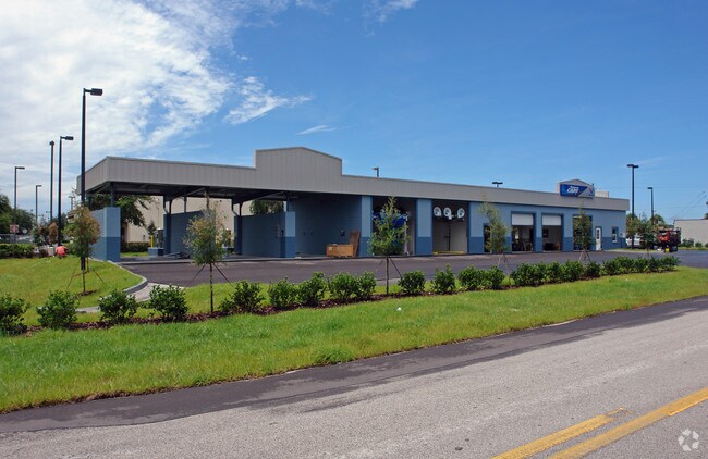
481 Havendale Blvd, Auburndale, FL 33823
NEARBY LISTINGS FOR SALE OR LEASE
Property Detail
481 Havendale Blvd
25-28-14-000000-011030
Brierwood No 2
Restaurantdrivein
BEG 230 FT W & 30 FT S OF NE COR OF NE1/4 OF NE1/4 RUN S TO HAVENDALE BLVD NWLY ALONG BLVD TO EAST WEST CO RD E TO BEG
X
Polk
12105C0345G
Florida
2024
0.70 AC
2025
Polk County
013300
Tampa/St Petersburg
2,142 SF
Lakeland-Winter Haven, FL
DEMOGRAPHICS near 481 Havendale Blvd
1 Mile
3 Mile
5 Mile
2024 Total Population
6,830
44,278
102,322
2029 Population
8,182
53,390
123,350
Pop Growth 2024-2029
+ 19.80%
+ 20.58%
+ 20.55%
Average Age
39
40
41
2024 Total Households
2,528
17,148
39,628
HH Growth 2024-2029
+ 19.66%
+ 20.54%
+ 20.47%
Median Household Inc
$40,188
$50,468
$52,013
Avg Household Size
2.60
2.50
2.50
2024 Avg HH Vehicles
2.00
2.00
2.00
Median Home Value
$106,750
$181,748
$181,797
Median Year Built
1970
1977
1982
Nearby Places
Map Layers
Map Styles
 Street
 Aerial
- Restaurants
- Banks
- Shops
- Fitness
- Groceries
PUBLIC TRANSPORTATION
COMMUTER RAIL
Winter Haven (Silver Meteor - Amtrak, Silver Star - Amtrak)
DRIVE
WALK
Distance
Winter Haven (Silver Meteor - Amtrak, Silver Star - Amtrak)
12 min
5.8 mi
Freight Ports
Port of Tampa Bay
DRIVE
WALK
Distance
Port of Tampa Bay
64 min
45.3 mi
Nearby Properties
Address
Land Use
TOTAL SIZE
Lot Size
Zoning
Address
Land Use
TOTAL SIZE
Lot Size
Zoning
942,646 SF
91.30 AC
R3
Address
Land Use
TOTAL SIZE
Lot Size
Zoning
250,170 SF
24.21 AC
Address
Land Use
TOTAL SIZE
Lot Size
Zoning
238,721 SF
11.66 AC
GI
Address
Land Use
TOTAL SIZE
Lot Size
Zoning
282,400 SF
19.59 AC
XX
Address
Land Use
TOTAL SIZE
Lot Size
Zoning
136,724 SF
4.62 AC
GI
Address
Land Use
TOTAL SIZE
Lot Size
Zoning
200,200 SF
10.29 AC
Address
Land Use
TOTAL SIZE
Lot Size
Zoning
503,625 SF
20.61 AC
Address
Land Use
TOTAL SIZE
Lot Size
Zoning
108,360 SF
4.23 AC
GI
Address
Land Use
TOTAL SIZE
Lot Size
Zoning
148,390 SF
10.42 AC
R1
Address
Land Use
TOTAL SIZE
Lot Size
Zoning
188,553 SF
29.12 AC
Address
Land Use
TOTAL SIZE
Lot Size
Zoning
178,899 SF
10.09 AC
GI
Address
Land Use
TOTAL SIZE
Lot Size
Zoning
241,319 SF
5.67 AC
Address
Land Use
TOTAL SIZE
Lot Size
Zoning
291,428 SF
59.34 AC
Address
Land Use
TOTAL SIZE
Lot Size
Zoning
188,403 SF
27.79 AC
BT
Address
Land Use
TOTAL SIZE
Lot Size
Zoning
123,540 SF
5.89 AC
Address
Land Use
TOTAL SIZE
Lot Size
Zoning
135,885 SF
10.12 AC
Address
Land Use
TOTAL SIZE
Lot Size
Zoning
173,328 SF
37.45 AC
C3
Address
Land Use
TOTAL SIZE
Lot Size
Zoning
129,567 SF
11.72 AC
C3
Address
Land Use
TOTAL SIZE
Lot Size
Zoning
277,729 SF
423.34 AC
Address
Land Use
TOTAL SIZE
Lot Size
Zoning
135,247 SF
22.49 AC
C4
Address
Land Use
TOTAL SIZE
Lot Size
Zoning
91,962 SF
19.46 AC
R4
Address
Land Use
TOTAL SIZE
Lot Size
Zoning
76,664 SF
18.64 AC
RP
Address
Land Use
TOTAL SIZE
Lot Size
Zoning
191,975 SF
14.28 AC
HI
Address
Land Use
TOTAL SIZE
Lot Size
Zoning
174,108 SF
4.82 AC
Address
Land Use
TOTAL SIZE
Lot Size
Zoning
126,384 SF
4.67 AC
CH
Address
Land Use
TOTAL SIZE
Lot Size
Zoning
320,765 SF
14.93 AC
GI
Address
Land Use
TOTAL SIZE
Lot Size
Zoning
268,800 SF
9.22 AC
Address
Land Use
TOTAL SIZE
Lot Size
Zoning
42,400 SF
121.06 AC
RC
Address
Land Use
TOTAL SIZE
Lot Size
Zoning
106,376 SF
18.36 AC
Address
Land Use
TOTAL SIZE
Lot Size
Zoning
243,600 SF
35.47 AC
C4
The World's #1 Commercial Real Estate Marketplace
Connect with us
© 2025 CoStar Group
The information above has been obtained from sources believed reliable. While we do not doubt its accuracy we have not verified it and make no guarantee, warranty or representation about it. It is your responsibility to independently confirm its accuracy and completeness. Any projections, opinions, assumptions, or estimates used are for example only and do not represent the current or future performance of the property. The value of this transaction to you depends on tax and other factors which should be evaluated by your tax, financial, and legal advisors. You and your advisors should conduct a careful, independent investigation of the property to determine to your satisfaction the suitability of the property for your needs.