Property Record
481 State Route 179, Sedona, AZ 86336


Property Detail
481 State Route 179
401-19-004C
SIXTEENTH: NE QUARTER: NE SECTION: 18 TOWNSHIP: 17N RANGE: 06E PCL IN NE4NE4 DESC AS FLLWS:BEGIN NE COR SEC 18; TH N 89-42-41 W 36.10;TH S 18-71-00 W 276.70 TO POB; TH S 03-24-31 W 85.35;TH N 84-14-23 E 135.60;TH S 01-08-45 E 48.24;TH S 01-08-29 E 13
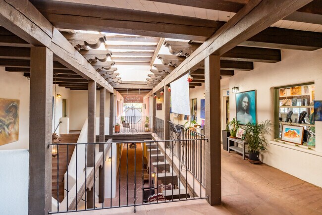
Storebuilding
COCONINO
B and X Area of moderate flood hazard, usually the area between the limits of the 100-year and 500-year floods.
Arizona
2024
1.42 AC
2025
Prescott & Sedona
001804
Other Market Areas
9,996 SF
Flagstaff, AZ
NEARBY LISTINGS FOR SALE OR LEASE
DEMOGRAPHICS near 481 State Route 179
1 mile
3 mile
5 mile
2024 Total Population
1,583
9,646
12,849
2029 Population
1,626
10,127
13,564
Pop Growth 2024-2029
+ 2.72%
+ 4.99%
+ 5.56%
Average Age
58
57
57
2024 Total Households
852
4,946
6,522
HH Growth 2024-2029
+ 1.88%
+ 4.65%
+ 5.26%
Median Household Inc
$44,295
$69,370
$70,101
Avg Household Size
1.80
1.90
1.90
2024 Avg HH Vehicles
2.00
2.00
2.00
Median Home Value
$852,419
$798,039
$809,006
Median Year Built
1985
1988
1988
Nearby Places
Map Layers
Map Styles
 Street
 Aerial
Transit
 Traffic
 Biking
Places
Listings with unknown addresses are not visible on the map
- Restaurants
- Banks
- Shops
- Fitness
- Groceries
PUBLIC TRANSPORTATION
AIRPORT
Flagstaff Pulliam
Drive
Walk
Distance
Flagstaff Pulliam
53 min
26.1 mi
SALE & LEASE HISTORY
LISTING DATE
SALE/LEASE

Sep 25, 2016
For Lease
Nov 12, 2019
For Lease
Nearby Properties
Address
Land Use
TOTAL SIZE
Lot Size
Zoning
Address
Land Use
TOTAL SIZE
Lot Size
Zoning
1 SF
23.98 AC
Address
Land Use
TOTAL SIZE
Lot Size
Zoning
71,345 SF
4.70 AC
Address
Land Use
TOTAL SIZE
Lot Size
Zoning
97,885 SF
10.15 AC
Address
Land Use
TOTAL SIZE
Lot Size
Zoning
42,008 SF
4.99 AC
Address
Land Use
TOTAL SIZE
Lot Size
Zoning
44,792 SF
3.69 AC
Address
Land Use
TOTAL SIZE
Lot Size
Zoning
33,373 SF
3.33 AC
Address
Land Use
TOTAL SIZE
Lot Size
Zoning
22,132 SF
1.23 AC
Address
Land Use
TOTAL SIZE
Lot Size
Zoning
109,033 SF
11.36 AC
Address
Land Use
TOTAL SIZE
Lot Size
Zoning
20,404 SF
1.12 AC
Address
Land Use
TOTAL SIZE
Lot Size
Zoning
8,000 SF
20.08 AC
Address
Land Use
TOTAL SIZE
Lot Size
Zoning
29,489 SF
2.33 AC
Address
Land Use
TOTAL SIZE
Lot Size
Zoning
27,176 SF
1.77 AC
Address
Land Use
TOTAL SIZE
Lot Size
Zoning
10,489 SF
0.73 AC
Address
Land Use
TOTAL SIZE
Lot Size
Zoning
12,780 SF
5.28 AC
Address
Land Use
TOTAL SIZE
Lot Size
Zoning
29,691 SF
2.66 AC
Address
Land Use
TOTAL SIZE
Lot Size
Zoning
57,544 SF
2.70 AC
Address
Land Use
TOTAL SIZE
Lot Size
Zoning
20,012 SF
1.57 AC
Address
Land Use
TOTAL SIZE
Lot Size
Zoning
24,650 SF
2.14 AC
Address
Land Use
TOTAL SIZE
Lot Size
Zoning
13,324 SF
1.61 AC
Address
Land Use
TOTAL SIZE
Lot Size
Zoning
17,069 SF
2.31 AC
Address
Land Use
TOTAL SIZE
Lot Size
Zoning
17,505 SF
2 AC
Address
Land Use
TOTAL SIZE
Lot Size
Zoning
10,019 SF
1.30 AC
Address
Land Use
TOTAL SIZE
Lot Size
Zoning
24,508 SF
0.64 AC
Address
Land Use
TOTAL SIZE
Lot Size
Zoning
606 SF
7.88 AC
Address
Land Use
TOTAL SIZE
Lot Size
Zoning
9,457 SF
1.06 AC
Address
Land Use
TOTAL SIZE
Lot Size
Zoning
11,219 SF
2.03 AC
Address
Land Use
TOTAL SIZE
Lot Size
Zoning
22,134 SF
15.01 AC
Address
Land Use
TOTAL SIZE
Lot Size
Zoning
20,731 SF
1.87 AC
Address
Land Use
TOTAL SIZE
Lot Size
Zoning
5,462 SF
37.30 AC
Address
Land Use
TOTAL SIZE
Lot Size
Zoning
8,636 SF
1.50 AC
The World's #1 Commercial Real Estate Marketplace
Connect with us
© 2026 CoStar Group
The information above has been obtained from sources believed reliable. While we do not doubt its accuracy we have not verified it and make no guarantee, warranty or representation about it. It is your responsibility to independently confirm its accuracy and completeness. Any projections, opinions, assumptions, or estimates used are for example only and do not represent the current or future performance of the property. The value of this transaction to you depends on tax and other factors which should be evaluated by your tax, financial, and legal advisors. You and your advisors should conduct a careful, independent investigation of the property to determine to your satisfaction the suitability of the property for your needs.