Property Record
4810 N Highway 183, Liberty Hill, TX 78642
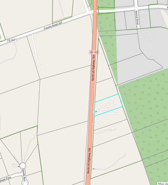

Property Detail
4810 N Highway 183
Austin-Round Rock-San Marcos, TX
S7737 - WILD LIFE SUB, LOT 3, ACRES 2.04
R415249
WILLIAMSON
Commercialnec
Texas
B and X Area of moderate flood hazard, usually the area between the limits of the 100-year and 500-year floods.
3
2024
2.04 AC
2025
Georgetown
020205
Austin
88,000 SF
NEARBY LISTINGS FOR SALE OR LEASE
DEMOGRAPHICS near 4810 N Highway 183
1 mile
3 mile
5 mile
2024 Total Population
934
6,218
25,979
2029 Population
1,082
7,231
30,748
Pop Growth 2024-2029
+ 15.85%
+ 16.29%
+ 18.36%
Average Age
42
42
39
2024 Total Households
325
2,225
8,878
HH Growth 2024-2029
+ 16.31%
+ 16.85%
+ 18.83%
Median Household Inc
$137,500
$130,900
$130,027
Avg Household Size
2.80
2.80
2.90
2024 Avg HH Vehicles
2.00
2.00
2.00
Median Home Value
$688,775
$630,642
$596,686
Median Year Built
2010
2010
2011
Nearby Places
Map Layers
Map Styles
 Street
 Aerial
Transit
 Traffic
 Biking
Places
Listings with unknown addresses are not visible on the map
- Restaurants
- Banks
- Shops
- Fitness
- Groceries
PUBLIC TRANSPORTATION
AIRPORT
Robert Gray AAF
Drive
Walk
Distance
Robert Gray AAF
49 min
29.8 mi
Killeen Municipal
Drive
Walk
Distance
Killeen Municipal
47 min
35.9 mi
Freight Ports
Calhoun Port
Drive
Walk
Distance
Calhoun Port
225 min
189.9 mi
SALE & LEASE HISTORY
LISTING DATE
SALE/LEASE

Feb 28, 2025
For Lease
Nearby Properties
Address
Land Use
TOTAL SIZE
Lot Size
Zoning
Address
Land Use
TOTAL SIZE
Lot Size
Zoning
129.94 AC
Address
Land Use
TOTAL SIZE
Lot Size
Zoning
2,604 SF
19.84 AC
Address
Land Use
TOTAL SIZE
Lot Size
Zoning
95 SF
10.10 AC
Address
Land Use
TOTAL SIZE
Lot Size
Zoning
2,475 SF
21.93 AC
Address
Land Use
TOTAL SIZE
Lot Size
Zoning
2,475 SF
41.70 AC
Address
Land Use
TOTAL SIZE
Lot Size
Zoning
766 SF
14.03 AC
Address
Land Use
TOTAL SIZE
Lot Size
Zoning
171.90 AC
Address
Land Use
TOTAL SIZE
Lot Size
Zoning
39,600 SF
6.10 AC
Address
Land Use
TOTAL SIZE
Lot Size
Zoning
3,168 SF
149.88 AC
Address
Land Use
TOTAL SIZE
Lot Size
Zoning
1,871 SF
10.10 AC
Address
Land Use
TOTAL SIZE
Lot Size
Zoning
13,407 SF
41.29 AC
Address
Land Use
TOTAL SIZE
Lot Size
Zoning
8,158 SF
39.43 AC
Address
Land Use
TOTAL SIZE
Lot Size
Zoning
1,315 SF
7.83 AC
Address
Land Use
TOTAL SIZE
Lot Size
Zoning
18,700 SF
16.10 AC
Address
Land Use
TOTAL SIZE
Lot Size
Zoning
1,051 SF
14.09 AC
Address
Land Use
TOTAL SIZE
Lot Size
Zoning
2,415 SF
41.83 AC
Address
Land Use
TOTAL SIZE
Lot Size
Zoning
2,116 SF
34.67 AC
Address
Land Use
TOTAL SIZE
Lot Size
Zoning
2,400 SF
15.01 AC
Address
Land Use
TOTAL SIZE
Lot Size
Zoning
12.89 AC
Address
Land Use
TOTAL SIZE
Lot Size
Zoning
12.89 AC
Address
Land Use
TOTAL SIZE
Lot Size
Zoning
633 SF
8.76 AC
Address
Land Use
TOTAL SIZE
Lot Size
Zoning
17,832 SF
5.98 AC
Address
Land Use
TOTAL SIZE
Lot Size
Zoning
4,440 SF
9.38 AC
Address
Land Use
TOTAL SIZE
Lot Size
Zoning
58 SF
9.45 AC
Address
Land Use
TOTAL SIZE
Lot Size
Zoning
Address
Land Use
TOTAL SIZE
Lot Size
Zoning
61.88 AC
Address
Land Use
TOTAL SIZE
Lot Size
Zoning
13,780 SF
4.60 AC
Address
Land Use
TOTAL SIZE
Lot Size
Zoning
17,750 SF
4 AC
Address
Land Use
TOTAL SIZE
Lot Size
Zoning
545 SF
22 AC
Address
Land Use
TOTAL SIZE
Lot Size
Zoning
10,000 SF
3.61 AC
The World's #1 Commercial Real Estate Marketplace
Connect with us
© 2026 CoStar Group
The information above has been obtained from sources believed reliable. While we do not doubt its accuracy we have not verified it and make no guarantee, warranty or representation about it. It is your responsibility to independently confirm its accuracy and completeness. Any projections, opinions, assumptions, or estimates used are for example only and do not represent the current or future performance of the property. The value of this transaction to you depends on tax and other factors which should be evaluated by your tax, financial, and legal advisors. You and your advisors should conduct a careful, independent investigation of the property to determine to your satisfaction the suitability of the property for your needs.