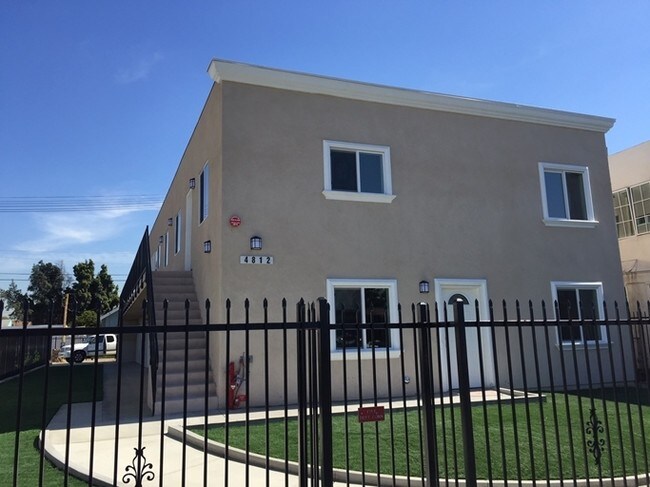
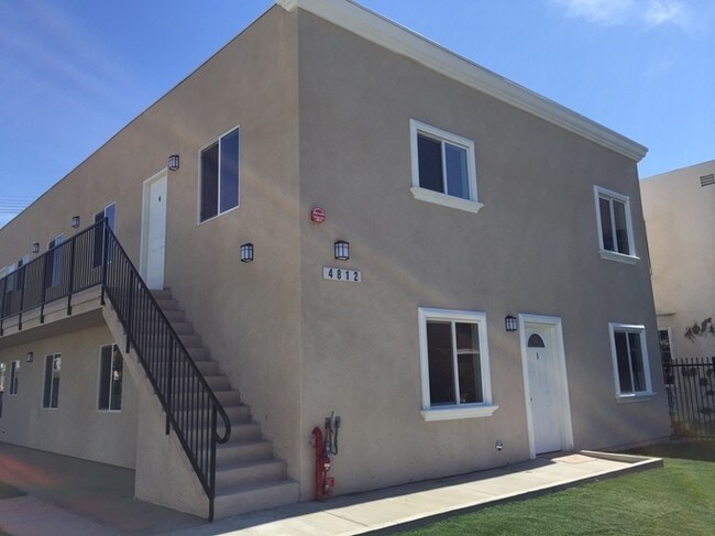
Property Record
4812 Avalon Blvd, Los Angeles, CA 90011

NEARBY LISTINGS FOR SALE OR LEASE
Property Detail
4812 Avalon Blvd
Los Angeles-Long Beach-Glendale, CA
Mckinley Place Tract
5108-009-035
MCKINLEY PLACE EX OF ST LOT 55 BLK B
Multifamilydwelling
Los Angeles
X
California
06037C1785G
55
2024
0.18 AC
2025
Vernon-Main
229200
Los Angeles
5,549 SF
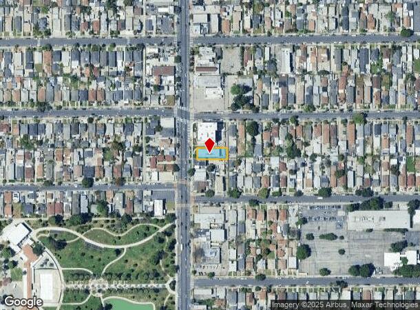
DEMOGRAPHICS near 4812 Avalon Blvd
1 Mile
3 Mile
5 Mile
2024 Total Population
60,073
410,248
1,229,484
2029 Population
56,181
391,778
1,184,469
Pop Growth 2024-2029
(6.48%)
(4.50%)
(3.66%)
Average Age
33
35
37
2024 Total Households
13,756
110,061
386,273
HH Growth 2024-2029
(7.04%)
(4.52%)
(3.52%)
Median Household Inc
$47,579
$47,378
$49,426
Avg Household Size
4.00
3.40
3.00
2024 Avg HH Vehicles
2.00
2.00
1.00
Median Home Value
$539,062
$597,920
$658,923
Median Year Built
1951
1952
1955
Nearby Places
Map Layers
Map Styles
 Street
 Aerial
- Restaurants
- Banks
- Shops
- Fitness
- Groceries
PUBLIC TRANSPORTATION
COMMUTER RAIL
DRIVE
WALK
Distance
10 min
4.6 mi
Union Station (91 Line - Southern California Regional Rail Authority (Metrolink), Antelope Valley Line - Southern California Regional Rail Authority (Metrolink), Orange County Line - Southern California Regional Rail Authority (Metrolink), Riverside Line - Southern California Regional Rail Authority (Metrolink), San Bernardino Line - Southern California Regional Rail Authority (Metrolink), Ventura County Line - Southern California Regional Rail Authority (Metrolink))
DRIVE
WALK
Distance
Union Station (91 Line - Southern California Regional Rail Authority (Metrolink), Antelope Valley Line - Southern California Regional Rail Authority (Metrolink), Orange County Line - Southern California Regional Rail Authority (Metrolink), Riverside Line - Southern California Regional Rail Authority (Metrolink), San Bernardino Line - Southern California Regional Rail Authority (Metrolink), Ventura County Line - Southern California Regional Rail Authority (Metrolink))
13 min
5.0 mi
AIRPORT
Los Angeles International
DRIVE
WALK
Distance
Los Angeles International
21 min
11.2 mi
Long Beach (Daugherty Field)
DRIVE
WALK
Distance
Long Beach (Daugherty Field)
27 min
19.5 mi
Bob Hope
DRIVE
WALK
Distance
Bob Hope
31 min
22.0 mi
Freight Ports
Port of Long Beach
DRIVE
WALK
Distance
Port of Long Beach
30 min
21.4 mi
SALE & LEASE HISTORY
LISTING DATE
SALE/LEASE

Mar 20, 2019
For Sale
Jan 11, 2018
For Sale
Nearby Properties
Address
Land Use
TOTAL SIZE
Lot Size
Zoning
Address
Land Use
TOTAL SIZE
Lot Size
Zoning
969,516 SF
14.75 AC
Address
Land Use
TOTAL SIZE
Lot Size
Zoning
200,811 SF
4.59 AC
LALASED
Address
Land Use
TOTAL SIZE
Lot Size
Zoning
1,178,786 SF
3.89 AC
LAC2
Address
Land Use
TOTAL SIZE
Lot Size
Zoning
764,804 SF
1.48 AC
Address
Land Use
TOTAL SIZE
Lot Size
Zoning
420,864 SF
63.07 AC
LAUSC-1A
Address
Land Use
TOTAL SIZE
Lot Size
Zoning
574,047 SF
1.70 AC
LAR5
Address
Land Use
TOTAL SIZE
Lot Size
Zoning
2,697,158 SF
20.18 AC
LAM2
Address
Land Use
TOTAL SIZE
Lot Size
Zoning
256,059 SF
Address
Land Use
TOTAL SIZE
Lot Size
Zoning
200,689 SF
5.79 AC
LAUSC-1A
Address
Land Use
TOTAL SIZE
Lot Size
Zoning
50,048 SF
1.16 AC
LAR5
Address
Land Use
TOTAL SIZE
Lot Size
Zoning
337,025 SF
14.59 AC
LAUSC-1A
Address
Land Use
TOTAL SIZE
Lot Size
Zoning
666,499 SF
10.63 AC
LAC2
Address
Land Use
TOTAL SIZE
Lot Size
Zoning
298,630 SF
4.64 AC
LAUSC-1B
Address
Land Use
TOTAL SIZE
Lot Size
Zoning
466,058 SF
2.54 AC
Address
Land Use
TOTAL SIZE
Lot Size
Zoning
448,914 SF
2.67 AC
LAC2
Address
Land Use
TOTAL SIZE
Lot Size
Zoning
311,717 SF
1.45 AC
LAR5
Address
Land Use
TOTAL SIZE
Lot Size
Zoning
1,027,870 SF
2.02 AC
LAC2
Address
Land Use
TOTAL SIZE
Lot Size
Zoning
1,088,170 SF
15.98 AC
LAM3
Address
Land Use
TOTAL SIZE
Lot Size
Zoning
1,810,830 SF
4.28 AC
LAM2
Address
Land Use
TOTAL SIZE
Lot Size
Zoning
377,946 SF
5.03 AC
LAUSC-1A
Address
Land Use
TOTAL SIZE
Lot Size
Zoning
279,351 SF
1.25 AC
LAC2
Address
Land Use
TOTAL SIZE
Lot Size
Zoning
277,250 SF
1.60 AC
LAC2
Address
Land Use
TOTAL SIZE
Lot Size
Zoning
306,816 SF
1.48 AC
LAR5
Address
Land Use
TOTAL SIZE
Lot Size
Zoning
235,687 SF
0.66 AC
LAR5
Address
Land Use
TOTAL SIZE
Lot Size
Zoning
186,931 SF
1.15 AC
LAR5
Address
Land Use
TOTAL SIZE
Lot Size
Zoning
242,190 SF
1.84 AC
LAC-4D-O
Address
Land Use
TOTAL SIZE
Lot Size
Zoning
152,000 SF
1.04 AC
LAC2
Address
Land Use
TOTAL SIZE
Lot Size
Zoning
227,179 SF
10.46 AC
VEM*
Address
Land Use
TOTAL SIZE
Lot Size
Zoning
690,514 SF
LACM
Address
Land Use
TOTAL SIZE
Lot Size
Zoning
112,636 SF
24.20 AC
LAUSC-1A
The World's #1 Commercial Real Estate Marketplace
Connect with us
© 2025 CoStar Group
The information above has been obtained from sources believed reliable. While we do not doubt its accuracy we have not verified it and make no guarantee, warranty or representation about it. It is your responsibility to independently confirm its accuracy and completeness. Any projections, opinions, assumptions, or estimates used are for example only and do not represent the current or future performance of the property. The value of this transaction to you depends on tax and other factors which should be evaluated by your tax, financial, and legal advisors. You and your advisors should conduct a careful, independent investigation of the property to determine to your satisfaction the suitability of the property for your needs.