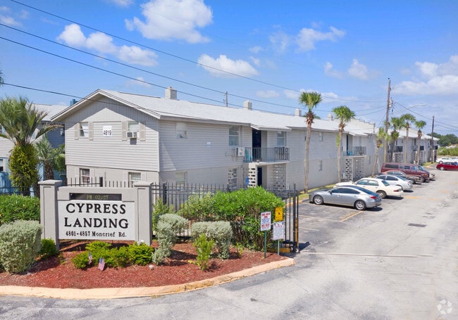
Property Record
4801 Moncrief Rd, Jacksonville, FL 32209

NEARBY LISTINGS FOR SALE OR LEASE
Property Detail
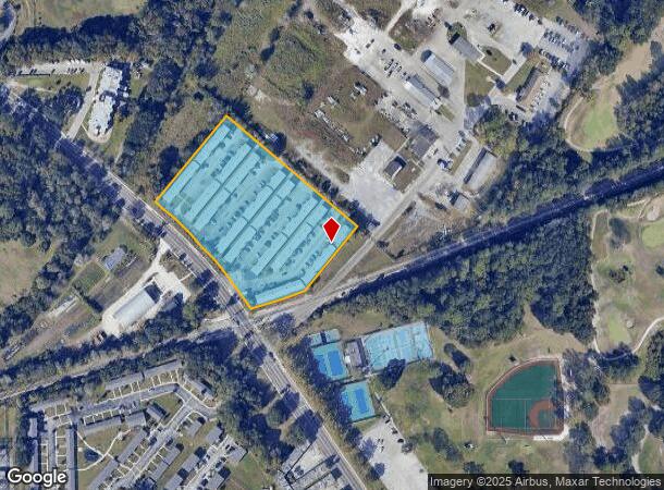
4801 Moncrief Rd
030056-0000
Section Land
Multifamilydwelling
39-1S-26E 4.4 SIBBALD GRANT PT RECD O/R 18898-1379
X
Duval
12031C0356H
Florida
2025
4.41 AC
2026
45th & Moncrief
001401
Jacksonville (Florida)
105,082 SF
Jacksonville, FL
DEMOGRAPHICS near 4801 Moncrief Rd
1 mile
3 mile
5 mile
2024 Total Population
11,741
89,512
184,836
2029 Population
12,530
95,016
195,834
Pop Growth 2024-2029
+ 6.72%
+ 6.15%
+ 5.95%
Average Age
37
38
39
2024 Total Households
4,514
35,495
75,539
HH Growth 2024-2029
+ 6.89%
+ 6.30%
+ 6.20%
Median Household Inc
$29,243
$31,112
$37,951
Avg Household Size
2.50
2.40
2.30
2024 Avg HH Vehicles
1.00
1.00
1.00
Median Home Value
$81,940
$98,833
$150,419
Median Year Built
1964
1960
1963
Nearby Places
Map Layers
Map Styles
 Street
 Aerial
Transit
 Traffic
 Biking
Places
Listings with unknown addresses are not visible on the map
- Restaurants
- Banks
- Shops
- Fitness
- Groceries
PUBLIC TRANSPORTATION
COMMUTER RAIL
Jacksonville (Silver Meteor - Amtrak, Silver Star - Amtrak)
Drive
Walk
Distance
Jacksonville (Silver Meteor - Amtrak, Silver Star - Amtrak)
7 min
2.8 mi
AIRPORT
Jacksonville International
Drive
Walk
Distance
Jacksonville International
21 min
12.9 mi
Freight Ports
Jacksonville Port
Drive
Walk
Distance
Jacksonville Port
9 min
4.4 mi
SALE & LEASE HISTORY
LISTING DATE
SALE/LEASE

Sep 24, 2016
For Sale
Sep 23, 2016
For Sale
Oct 22, 2018
For Sale
Jan 17, 2019
For Sale
Nearby Properties
Address
Land Use
TOTAL SIZE
Lot Size
Zoning
Address
Land Use
TOTAL SIZE
Lot Size
Zoning
543,383 SF
7.87 AC
CCBD
Address
Land Use
TOTAL SIZE
Lot Size
Zoning
705,940 SF
25.12 AC
PBF-1
Address
Land Use
TOTAL SIZE
Lot Size
Zoning
313,472 SF
35.44 AC
CCBD
Address
Land Use
TOTAL SIZE
Lot Size
Zoning
299,055 SF
18.93 AC
CCBD
Address
Land Use
TOTAL SIZE
Lot Size
Zoning
163,471 SF
7.85 AC
PBF-2
Address
Land Use
TOTAL SIZE
Lot Size
Zoning
313,741 SF
37.05 AC
RMD-C
Address
Land Use
TOTAL SIZE
Lot Size
Zoning
276,156 SF
2.41 AC
CCG-S
Address
Land Use
TOTAL SIZE
Lot Size
Zoning
144,400 SF
10.32 AC
PBF-2
Address
Land Use
TOTAL SIZE
Lot Size
Zoning
311,068 SF
18.91 AC
PBF-1
Address
Land Use
TOTAL SIZE
Lot Size
Zoning
255,048 SF
20.15 AC
IL
Address
Land Use
TOTAL SIZE
Lot Size
Zoning
77,356 SF
2.15 AC
PBF-2
Address
Land Use
TOTAL SIZE
Lot Size
Zoning
186,773 SF
9.77 AC
CCG-2
Address
Land Use
TOTAL SIZE
Lot Size
Zoning
119,362 SF
20.32 AC
RMD-C
Address
Land Use
TOTAL SIZE
Lot Size
Zoning
40,984 SF
2.33 AC
CCBD
Address
Land Use
TOTAL SIZE
Lot Size
Zoning
117,227 SF
14.32 AC
CCG-2
Address
Land Use
TOTAL SIZE
Lot Size
Zoning
317,474 SF
17.74 AC
IL
Address
Land Use
TOTAL SIZE
Lot Size
Zoning
258,700 SF
25.43 AC
RMD-D
Address
Land Use
TOTAL SIZE
Lot Size
Zoning
679,901 SF
18.30 AC
PBF-1
Address
Land Use
TOTAL SIZE
Lot Size
Zoning
110,290 SF
3.72 AC
PBF-1
Address
Land Use
TOTAL SIZE
Lot Size
Zoning
267,290 SF
11.81 AC
IL
Address
Land Use
TOTAL SIZE
Lot Size
Zoning
764,894 SF
48.70 AC
IW
Address
Land Use
TOTAL SIZE
Lot Size
Zoning
154,437 SF
29.28 AC
IL
Address
Land Use
TOTAL SIZE
Lot Size
Zoning
571,292 SF
16.73 AC
IL
Address
Land Use
TOTAL SIZE
Lot Size
Zoning
138,076 SF
20.68 AC
RLD-60
Address
Land Use
TOTAL SIZE
Lot Size
Zoning
189,046 SF
9.43 AC
RMD-D
Address
Land Use
TOTAL SIZE
Lot Size
Zoning
165,626 SF
10.12 AC
PUD
Address
Land Use
TOTAL SIZE
Lot Size
Zoning
190,264 SF
14.62 AC
RMD-D
Address
Land Use
TOTAL SIZE
Lot Size
Zoning
175,436 SF
10.62 AC
RMD-D
Address
Land Use
TOTAL SIZE
Lot Size
Zoning
184,283 SF
13.09 AC
RMD-D
Address
Land Use
TOTAL SIZE
Lot Size
Zoning
27,722 SF
1.61 AC
PBF-1
The World's #1 Commercial Real Estate Marketplace
Connect with us
© 2026 CoStar Group
The information above has been obtained from sources believed reliable. While we do not doubt its accuracy we have not verified it and make no guarantee, warranty or representation about it. It is your responsibility to independently confirm its accuracy and completeness. Any projections, opinions, assumptions, or estimates used are for example only and do not represent the current or future performance of the property. The value of this transaction to you depends on tax and other factors which should be evaluated by your tax, financial, and legal advisors. You and your advisors should conduct a careful, independent investigation of the property to determine to your satisfaction the suitability of the property for your needs.