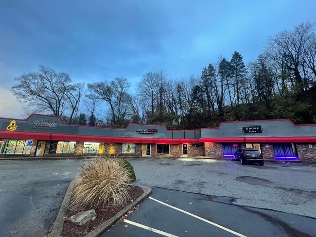
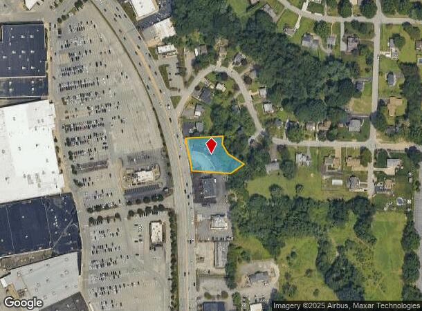
Property Record
4818 Mcknight Rd, Pittsburgh, PA 15237
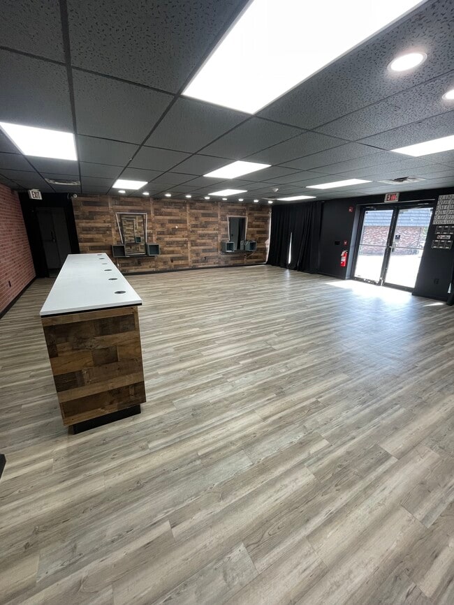

Current Lease Availabilities
NEARBY LISTINGS FOR SALE OR LEASE
Property Detail
4818 Mcknight Rd
Pittsburgh, PA
Davis Fred E Subdivision
0352-G-00274-0000-00
DAVIS FRED E SUBDIVISION PT PLAN 1 LOT 143.13XAVG79.74X147.42 MCKNIGHT RD DAVIS FRED E SUBDIVISION PLAN 2 IRREG LOT 147.4
Regionalshoppingcenterormallwithanchorstore
Allegheny
X
Pennsylvania
42003C0194H
274
2024
0.62 AC
2025
North Pittsburgh/Rte 19
429202
Pittsburgh
DEMOGRAPHICS near 4818 Mcknight Rd
1 Mile
3 Mile
5 Mile
2024 Total Population
6,522
67,160
188,459
2029 Population
6,329
65,085
184,117
Pop Growth 2024-2029
(2.96%)
(3.09%)
(2.30%)
Average Age
43
44
42
2024 Total Households
2,735
29,242
84,728
HH Growth 2024-2029
(3.07%)
(3.24%)
(2.33%)
Median Household Inc
$107,460
$85,960
$75,408
Avg Household Size
2.30
2.20
2.20
2024 Avg HH Vehicles
2.00
2.00
2.00
Median Home Value
$254,987
$224,125
$226,418
Median Year Built
1960
1959
1956
Nearby Places
Map Layers
Map Styles
 Street
 Aerial
- Restaurants
- Banks
- Shops
- Fitness
- Groceries
PUBLIC TRANSPORTATION
COMMUTER RAIL
Pittsburgh Amtrak Station (Capitol Limited - Amtrak, Pennsylvanian - Amtrak)
DRIVE
WALK
Distance
Pittsburgh Amtrak Station (Capitol Limited - Amtrak, Pennsylvanian - Amtrak)
12 min
7.0 mi
AIRPORT
Pittsburgh International
DRIVE
WALK
Distance
Pittsburgh International
36 min
23.5 mi
Freight Ports
Port of Toledo
DRIVE
WALK
Distance
Port of Toledo
261 min
225.2 mi
Nearby Properties
Address
Land Use
TOTAL SIZE
Lot Size
Zoning
Address
Land Use
TOTAL SIZE
Lot Size
Zoning
Address
Land Use
TOTAL SIZE
Lot Size
Zoning
24.94 AC
Address
Land Use
TOTAL SIZE
Lot Size
Zoning
33.85 AC
Address
Land Use
TOTAL SIZE
Lot Size
Zoning
0.67 AC
Address
Land Use
TOTAL SIZE
Lot Size
Zoning
51.36 AC
Address
Land Use
TOTAL SIZE
Lot Size
Zoning
80.99 AC
Address
Land Use
TOTAL SIZE
Lot Size
Zoning
21.56 AC
Address
Land Use
TOTAL SIZE
Lot Size
Zoning
11.35 AC
Address
Land Use
TOTAL SIZE
Lot Size
Zoning
19.84 AC
Address
Land Use
TOTAL SIZE
Lot Size
Zoning
Address
Land Use
TOTAL SIZE
Lot Size
Zoning
Address
Land Use
TOTAL SIZE
Lot Size
Zoning
27.50 AC
Address
Land Use
TOTAL SIZE
Lot Size
Zoning
Address
Land Use
TOTAL SIZE
Lot Size
Zoning
Address
Land Use
TOTAL SIZE
Lot Size
Zoning
626 SF
51.78 AC
Address
Land Use
TOTAL SIZE
Lot Size
Zoning
9.74 AC
Address
Land Use
TOTAL SIZE
Lot Size
Zoning
6.50 AC
Address
Land Use
TOTAL SIZE
Lot Size
Zoning
6.52 AC
Address
Land Use
TOTAL SIZE
Lot Size
Zoning
18.25 AC
Address
Land Use
TOTAL SIZE
Lot Size
Zoning
15.86 AC
Address
Land Use
TOTAL SIZE
Lot Size
Zoning
Address
Land Use
TOTAL SIZE
Lot Size
Zoning
22.51 AC
Address
Land Use
TOTAL SIZE
Lot Size
Zoning
Address
Land Use
TOTAL SIZE
Lot Size
Zoning
5.74 AC
Address
Land Use
TOTAL SIZE
Lot Size
Zoning
Address
Land Use
TOTAL SIZE
Lot Size
Zoning
Address
Land Use
TOTAL SIZE
Lot Size
Zoning
23.87 AC
Address
Land Use
TOTAL SIZE
Lot Size
Zoning
11.67 AC
Address
Land Use
TOTAL SIZE
Lot Size
Zoning
19.66 AC
Address
Land Use
TOTAL SIZE
Lot Size
Zoning
44.02 AC
The World's #1 Commercial Real Estate Marketplace
Connect with us
© 2025 CoStar Group
The information above has been obtained from sources believed reliable. While we do not doubt its accuracy we have not verified it and make no guarantee, warranty or representation about it. It is your responsibility to independently confirm its accuracy and completeness. Any projections, opinions, assumptions, or estimates used are for example only and do not represent the current or future performance of the property. The value of this transaction to you depends on tax and other factors which should be evaluated by your tax, financial, and legal advisors. You and your advisors should conduct a careful, independent investigation of the property to determine to your satisfaction the suitability of the property for your needs.