Property Record
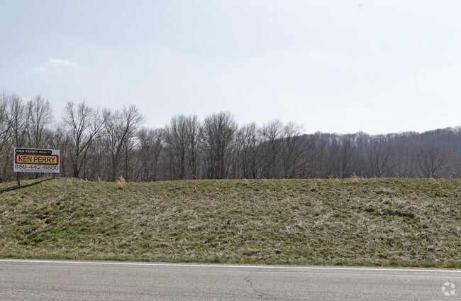
4815 Kay Wright Ln, Silver Grove, KY 41085

Property Detail
4815 Kay Wright Ln
Cincinnati, OH-KY-IN
22.3164 ACRES COMBINED 27-449.00 & 28-463.00 TO THIS PARCEL
999-99-28-030.00
CAMPBELL
Agriculturalland
Kentucky
AE The base floodplain where base flood elevations are provided. AE Zones are now used on new format FIRMs instead of A1-A30 Zones.
22.32 AC
2025
Outlying N Kentucky
2025
Cincinnati/Dayton
0531003023
NEARBY LISTINGS FOR SALE OR LEASE
DEMOGRAPHICS near 4815 Kay Wright Ln
1 mile
3 mile
5 mile
2025 Total Population
1,136
23,979
90,992
2030 Population
1,136
23,961
91,723
Pop Growth 2025-2030
0.00%
(0.08%)
+ 0.80%
Average Age
41
42
41
2025 Total Households
438
9,567
38,148
HH Growth 2025-2030
(0.23%)
(0.14%)
+ 0.82%
Median Household Inc
$64,859
$85,362
$84,836
Avg Household Size
2.60
2.40
2.30
2025 Avg HH Vehicles
2.00
2.00
2.00
Median Home Value
$153,499
$270,921
$279,490
Median Year Built
1951
1973
1974
Nearby Places
Map Layers
Map Styles
 Street
 Aerial
Layers
 Traffic
 Biking
Places
Listings with unknown addresses are not visible on the map
- Restaurants
- Banks
- Shops
- Fitness
- Groceries
PUBLIC TRANSPORTATION
AIRPORT
Cincinnati/Northern Kentucky International
Drive
Walk
Distance
Cincinnati/Northern Kentucky International
35 min
19.0 mi
Freight Ports
Port of Toledo
Drive
Walk
Distance
Port of Toledo
259 min
212.5 mi
Nearby Properties
Address
Land Use
TOTAL SIZE
Lot Size
Zoning
Address
Land Use
TOTAL SIZE
Lot Size
Zoning
243,000 SF
11.30 AC
Address
Land Use
TOTAL SIZE
Lot Size
Zoning
0.95 AC
Address
Land Use
TOTAL SIZE
Lot Size
Zoning
0.83 AC
Address
Land Use
TOTAL SIZE
Lot Size
Zoning
0.74 AC
Address
Land Use
TOTAL SIZE
Lot Size
Zoning
0.71 AC
Address
Land Use
TOTAL SIZE
Lot Size
Zoning
0.71 AC
Address
Land Use
TOTAL SIZE
Lot Size
Zoning
0.57 AC
Address
Land Use
TOTAL SIZE
Lot Size
Zoning
0.53 AC
Address
Land Use
TOTAL SIZE
Lot Size
Zoning
0.59 AC
Address
Land Use
TOTAL SIZE
Lot Size
Zoning
0.49 AC
Address
Land Use
TOTAL SIZE
Lot Size
Zoning
0.56 AC
Address
Land Use
TOTAL SIZE
Lot Size
Zoning
0.48 AC
Address
Land Use
TOTAL SIZE
Lot Size
Zoning
0.40 AC
Address
Land Use
TOTAL SIZE
Lot Size
Zoning
567,000 SF
183.83 AC
Address
Land Use
TOTAL SIZE
Lot Size
Zoning
1,049,050 SF
8.60 AC
Address
Land Use
TOTAL SIZE
Lot Size
Zoning
0.33 AC
Address
Land Use
TOTAL SIZE
Lot Size
Zoning
21,600 SF
98.32 AC
Address
Land Use
TOTAL SIZE
Lot Size
Zoning
1,800 SF
10.18 AC
Address
Land Use
TOTAL SIZE
Lot Size
Zoning
16.50 AC
Address
Land Use
TOTAL SIZE
Lot Size
Zoning
15,570 SF
21.35 AC
Address
Land Use
TOTAL SIZE
Lot Size
Zoning
46,600 SF
52.47 AC
Address
Land Use
TOTAL SIZE
Lot Size
Zoning
2,837 SF
3.77 AC
Address
Land Use
TOTAL SIZE
Lot Size
Zoning
385,100 SF
4.60 AC
Address
Land Use
TOTAL SIZE
Lot Size
Zoning
Address
Land Use
TOTAL SIZE
Lot Size
Zoning
66,540 SF
4 AC
Address
Land Use
TOTAL SIZE
Lot Size
Zoning
175,481 SF
38.92 AC
Address
Land Use
TOTAL SIZE
Lot Size
Zoning
3,726,400 SF
12.60 AC
Address
Land Use
TOTAL SIZE
Lot Size
Zoning
173,940 SF
22.52 AC
Address
Land Use
TOTAL SIZE
Lot Size
Zoning
Address
Land Use
TOTAL SIZE
Lot Size
Zoning
29,264 SF
22.18 AC
The World's #1 Commercial Real Estate Marketplace
Connect with us
© 2026 CoStar Group
The information above has been obtained from sources believed reliable. While we do not doubt its accuracy we have not verified it and make no guarantee, warranty or representation about it. It is your responsibility to independently confirm its accuracy and completeness. Any projections, opinions, assumptions, or estimates used are for example only and do not represent the current or future performance of the property. The value of this transaction to you depends on tax and other factors which should be evaluated by your tax, financial, and legal advisors. You and your advisors should conduct a careful, independent investigation of the property to determine to your satisfaction the suitability of the property for your needs.