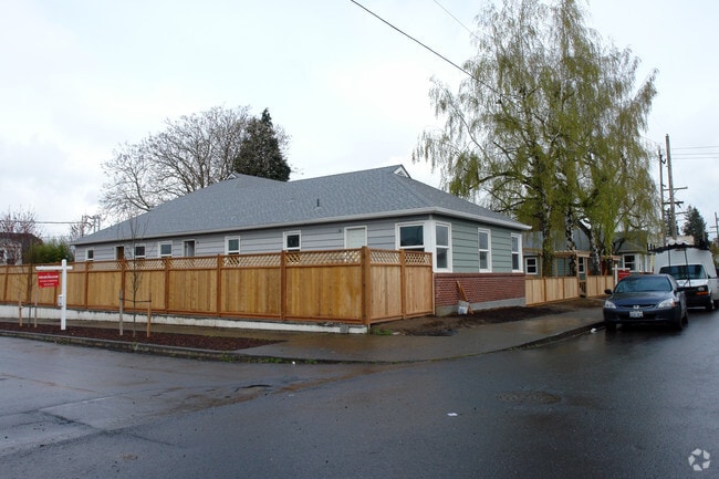
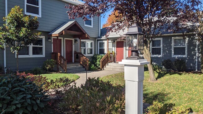
Property Record
4815 N Minnesota Ave, Portland, OR 97217


Property Detail
4815 N Minnesota Ave
R632523
M PATTONS ADD & 2ND, BLOCK 14, LOT 6-8
Multifamilydwelling
Multnomah
RM3
Oregon
B and X Area of moderate flood hazard, usually the area between the limits of the 100-year and 500-year floods.
6-8
2025
0.34 AC
2025
Humboldt
003501
Portland
8,678 SF
Portland-Vancouver-Hillsboro, OR-WA
NEARBY LISTINGS FOR SALE OR LEASE
DEMOGRAPHICS near 4815 N Minnesota Ave
1 mile
3 mile
5 mile
2025 Total Population
25,824
174,092
344,649
2030 Population
26,027
173,406
343,019
Pop Growth 2025-2030
+ 0.79%
(0.39%)
(0.47%)
Average Age
39
40
41
2025 Total Households
11,877
85,239
163,795
HH Growth 2025-2030
+ 0.64%
(0.44%)
(0.47%)
Median Household Inc
$98,407
$88,552
$92,553
Avg Household Size
2.10
1.90
2.00
2025 Avg HH Vehicles
2.00
1.00
1.00
Median Home Value
$690,764
$711,088
$699,104
Median Year Built
1951
1962
1962
Nearby Places
Map Layers
Map Styles
 Street
 Aerial
Transit
 Traffic
 Biking
Places
Listings with unknown addresses are not visible on the map
- Restaurants
- Banks
- Shops
- Fitness
- Groceries
PUBLIC TRANSPORTATION
TRANSIT/SUBWAY
N Prescott (MAX Yellow Line - Tri-County Metropolitan Transportation District of Oregon Rail (TriMet Rail))
Drive
Walk
Distance
N Prescott (MAX Yellow Line - Tri-County Metropolitan Transportation District of Oregon Rail (TriMet Rail))
2 min
6 min
0.3 mi
N Killingsworth (MAX Yellow Line - Tri-County Metropolitan Transportation District of Oregon Rail (TriMet Rail))
Drive
Walk
Distance
N Killingsworth (MAX Yellow Line - Tri-County Metropolitan Transportation District of Oregon Rail (TriMet Rail))
2 min
9 min
0.5 mi
Overlook Park (MAX Yellow Line - Tri-County Metropolitan Transportation District of Oregon Rail (TriMet Rail))
Drive
Walk
Distance
Overlook Park (MAX Yellow Line - Tri-County Metropolitan Transportation District of Oregon Rail (TriMet Rail))
4 min
16 min
0.8 mi
Rosa Parks (MAX Yellow Line - Tri-County Metropolitan Transportation District of Oregon Rail (TriMet Rail))
Drive
Walk
Distance
Rosa Parks (MAX Yellow Line - Tri-County Metropolitan Transportation District of Oregon Rail (TriMet Rail))
3 min
19 min
1.0 mi
COMMUTER RAIL
Drive
Walk
Distance
7 min
2.9 mi
Drive
Walk
Distance
13 min
6.4 mi
AIRPORT
Portland International
Drive
Walk
Distance
Portland International
20 min
8.6 mi
Freight Ports
Port of Portland
Drive
Walk
Distance
Port of Portland
8 min
3.6 mi
SALE & LEASE HISTORY
LISTING DATE
SALE/LEASE

Sep 14, 2018
For Sale
Mar 13, 2021
For Sale
Nearby Properties
Address
Land Use
TOTAL SIZE
Lot Size
Zoning
Address
Land Use
TOTAL SIZE
Lot Size
Zoning
395,815 SF
2.66 AC
IRD
Address
Land Use
TOTAL SIZE
Lot Size
Zoning
627,500 SF
16.60 AC
CX
Address
Land Use
TOTAL SIZE
Lot Size
Zoning
882,480 SF
80.73 AC
CI1
Address
Land Use
TOTAL SIZE
Lot Size
Zoning
560,000 SF
0.15 AC
CX
Address
Land Use
TOTAL SIZE
Lot Size
Zoning
20.71 AC
OS
Address
Land Use
TOTAL SIZE
Lot Size
Zoning
326,547 SF
2.42 AC
RH
Address
Land Use
TOTAL SIZE
Lot Size
Zoning
304,836 SF
10.85 AC
CX
Address
Land Use
TOTAL SIZE
Lot Size
Zoning
417,324 SF
0.68 AC
CX
Address
Land Use
TOTAL SIZE
Lot Size
Zoning
257,700 SF
2.89 AC
EX
Address
Land Use
TOTAL SIZE
Lot Size
Zoning
178,785 SF
10.20 AC
R5
Address
Land Use
TOTAL SIZE
Lot Size
Zoning
128,500 SF
6.95 AC
OS
Address
Land Use
TOTAL SIZE
Lot Size
Zoning
125,217 SF
0.23 AC
CX
Address
Land Use
TOTAL SIZE
Lot Size
Zoning
7.78 AC
EX
Address
Land Use
TOTAL SIZE
Lot Size
Zoning
Address
Land Use
TOTAL SIZE
Lot Size
Zoning
Address
Land Use
TOTAL SIZE
Lot Size
Zoning
426,742 SF
0.53 AC
RXD
Address
Land Use
TOTAL SIZE
Lot Size
Zoning
243,371 SF
0.67 AC
CI2
Address
Land Use
TOTAL SIZE
Lot Size
Zoning
584,483 SF
0.90 AC
CX
Address
Land Use
TOTAL SIZE
Lot Size
Zoning
645,294 SF
5.64 AC
CO2D
Address
Land Use
TOTAL SIZE
Lot Size
Zoning
247,520 SF
7.74 AC
CX
Address
Land Use
TOTAL SIZE
Lot Size
Zoning
596,161 SF
0.92 AC
CX
Address
Land Use
TOTAL SIZE
Lot Size
Zoning
456,760 SF
0.53 AC
EX
Address
Land Use
TOTAL SIZE
Lot Size
Zoning
193,898 SF
2.50 AC
IRD
Address
Land Use
TOTAL SIZE
Lot Size
Zoning
134,398 SF
3.17 AC
CG
Address
Land Use
TOTAL SIZE
Lot Size
Zoning
387,000 SF
0.88 AC
CXD
Address
Land Use
TOTAL SIZE
Lot Size
Zoning
1,660,710 SF
110.33 AC
IG2
Address
Land Use
TOTAL SIZE
Lot Size
Zoning
291,451 SF
1.64 AC
RH
Address
Land Use
TOTAL SIZE
Lot Size
Zoning
262,645 SF
1 AC
CX
Address
Land Use
TOTAL SIZE
Lot Size
Zoning
354,677 SF
0.79 AC
CX
Address
Land Use
TOTAL SIZE
Lot Size
Zoning
2,218,439 SF
21.88 AC
CX
The World's #1 Commercial Real Estate Marketplace
Connect with us
© 2026 CoStar Group
The information above has been obtained from sources believed reliable. While we do not doubt its accuracy we have not verified it and make no guarantee, warranty or representation about it. It is your responsibility to independently confirm its accuracy and completeness. Any projections, opinions, assumptions, or estimates used are for example only and do not represent the current or future performance of the property. The value of this transaction to you depends on tax and other factors which should be evaluated by your tax, financial, and legal advisors. You and your advisors should conduct a careful, independent investigation of the property to determine to your satisfaction the suitability of the property for your needs.