Property Record
4815 S River Rd, Saint George, UT 84790

Save to a Folder
{{folder.Name}}
{{folder.ListingIds.length}} Properties
{{folder.ListingIds.length}} Property
Create a New Folder
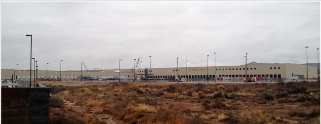
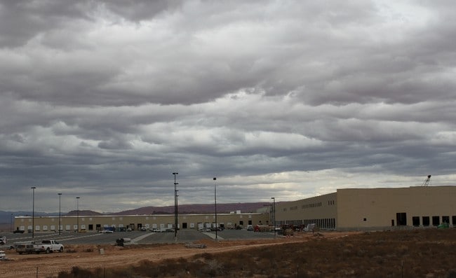
Property Detail
4815 S River Rd
St. George, UT
S: 20 T: 43S R: 15W BEG AT FND REBAR & RED PLASTIC CAP MARKED LR POPE ENG PLS UT 153069, SD PT BEING SE COR OF PARCEL OF GROUND KNWN AS UT STATE PATENT #19846 REC DEC 14, 2005 AS ENTRY #00991519, AKA PARCEL SG-5-3-20-240-CD, SD PT BEING N88*4510 W AL
0903980
Washington
Commercialnec
Utah
B and X Area of moderate flood hazard, usually the area between the limits of the 100-year and 500-year floods.
161
2024
88.46 AC
2025
Cedar City & St George
271702
Other Market Areas
823,767 SF
NEARBY LISTINGS FOR SALE OR LEASE
DEMOGRAPHICS near 4815 S River Rd
1 mile
3 mile
5 mile
2025 Total Population
469
21,559
56,693
2030 Population
514
23,815
62,287
Pop Growth 2025-2030
+ 9.59%
+ 10.46%
+ 9.87%
Average Age
38
36
40
2025 Total Households
140
6,415
18,758
HH Growth 2025-2030
+ 10.00%
+ 10.55%
+ 9.89%
Median Household Inc
$109,895
$100,351
$91,482
Avg Household Size
3.20
3.30
3.00
2025 Avg HH Vehicles
2.00
2.00
2.00
Median Home Value
$682,098
$654,302
$615,991
Median Year Built
2010
2010
2006
Nearby Places
Map Layers
Map Styles
 Street
 Aerial
Layers
 Traffic
 Biking
Places
Listings with unknown addresses are not visible on the map
- Restaurants
- Banks
- Shops
- Fitness
- Groceries
PUBLIC TRANSPORTATION
AIRPORT
St George Regional
Drive
Walk
Distance
St George Regional
18 min
8.3 mi
Freight Ports
Port of Long Beach
Drive
Walk
Distance
Port of Long Beach
443 min
401.5 mi
Nearby Properties
Address
Land Use
TOTAL SIZE
Lot Size
Zoning
Address
Land Use
TOTAL SIZE
Lot Size
Zoning
322,075 SF
26.62 AC
Address
Land Use
TOTAL SIZE
Lot Size
Zoning
3,188 SF
912.13 AC
Address
Land Use
TOTAL SIZE
Lot Size
Zoning
1,063.96 AC
R110
Address
Land Use
TOTAL SIZE
Lot Size
Zoning
259,012 SF
22 AC
M-1
Address
Land Use
TOTAL SIZE
Lot Size
Zoning
173,917 SF
50 AC
M-1
Address
Land Use
TOTAL SIZE
Lot Size
Zoning
152,090 SF
25 AC
M-1
Address
Land Use
TOTAL SIZE
Lot Size
Zoning
51,302 SF
56.23 AC
OST20
Address
Land Use
TOTAL SIZE
Lot Size
Zoning
87,750 SF
15.92 AC
Address
Land Use
TOTAL SIZE
Lot Size
Zoning
123,028 SF
12.87 AC
Address
Land Use
TOTAL SIZE
Lot Size
Zoning
91,798 SF
5 AC
M-1
Address
Land Use
TOTAL SIZE
Lot Size
Zoning
15,476 SF
7.71 AC
Address
Land Use
TOTAL SIZE
Lot Size
Zoning
169,923 SF
9.41 AC
Address
Land Use
TOTAL SIZE
Lot Size
Zoning
405 SF
407.69 AC
R110
Address
Land Use
TOTAL SIZE
Lot Size
Zoning
209,687 SF
7.54 AC
M-1
Address
Land Use
TOTAL SIZE
Lot Size
Zoning
16,800 SF
250 AC
OS
Address
Land Use
TOTAL SIZE
Lot Size
Zoning
40,908 SF
6.89 AC
Address
Land Use
TOTAL SIZE
Lot Size
Zoning
122,761 SF
10.22 AC
M-1
Address
Land Use
TOTAL SIZE
Lot Size
Zoning
97,357 SF
5.67 AC
M-1
Address
Land Use
TOTAL SIZE
Lot Size
Zoning
100,110 SF
8.48 AC
M-1
Address
Land Use
TOTAL SIZE
Lot Size
Zoning
57,607 SF
11.03 AC
M-1
Address
Land Use
TOTAL SIZE
Lot Size
Zoning
77,649 SF
2.43 AC
Address
Land Use
TOTAL SIZE
Lot Size
Zoning
67,583 SF
2.99 AC
PDCOM
Address
Land Use
TOTAL SIZE
Lot Size
Zoning
22,954 SF
10.79 AC
Address
Land Use
TOTAL SIZE
Lot Size
Zoning
102,157 SF
8 AC
M-1
Address
Land Use
TOTAL SIZE
Lot Size
Zoning
53,536 SF
11.04 AC
M-1
Address
Land Use
TOTAL SIZE
Lot Size
Zoning
81,279 SF
4.92 AC
M-1
Address
Land Use
TOTAL SIZE
Lot Size
Zoning
41,160 SF
5 AC
M-1
Address
Land Use
TOTAL SIZE
Lot Size
Zoning
31,917 SF
9.63 AC
The World's #1 Commercial Real Estate Marketplace
Connect with us
© 2026 CoStar Group
The information above has been obtained from sources believed reliable. While we do not doubt its accuracy we have not verified it and make no guarantee, warranty or representation about it. It is your responsibility to independently confirm its accuracy and completeness. Any projections, opinions, assumptions, or estimates used are for example only and do not represent the current or future performance of the property. The value of this transaction to you depends on tax and other factors which should be evaluated by your tax, financial, and legal advisors. You and your advisors should conduct a careful, independent investigation of the property to determine to your satisfaction the suitability of the property for your needs.