Property Record
4817 Andrews Hwy, Gardendale, TX 79758

NEARBY LISTINGS FOR SALE OR LEASE
Property Detail
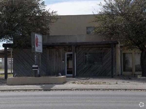
4817 Andrews Hwy
31640-00250-00000
Teepee Heights
Commercialnec
TEEPEE HEIGHTS TRACT 24 LESS S 20 OF W 150 & N 75 OF E 285.6 OF TRACT 25 (CARD #20)
X
Ector
48135C0220E
Texas
2025
1.42 AC
2025
Midland & Odessa
003002
Other Market Areas
1,507 SF
Odessa, TX
DEMOGRAPHICS near 4817 Andrews Hwy
1 Mile
3 Mile
5 Mile
2024 Total Population
7,856
62,616
112,260
2029 Population
7,682
61,428
110,119
Pop Growth 2024-2029
(2.21%)
(1.90%)
(1.91%)
Average Age
34
35
34
2024 Total Households
2,894
22,579
39,943
HH Growth 2024-2029
(2.56%)
(2.18%)
(2.19%)
Median Household Inc
$52,717
$57,275
$57,393
Avg Household Size
2.60
2.60
2.70
2024 Avg HH Vehicles
2.00
2.00
2.00
Median Home Value
$126,482
$151,195
$162,005
Median Year Built
1971
1970
1975
Nearby Places
Map Layers
Map Styles
 Street
 Aerial
- Restaurants
- Banks
- Shops
- Fitness
- Groceries
PUBLIC TRANSPORTATION
AIRPORT
Midland International Air And Space Port
DRIVE
WALK
Distance
Midland International Air And Space Port
21 min
14.4 mi
Freight Ports
Port of Corpus Christi
DRIVE
WALK
Distance
Port of Corpus Christi
507 min
487.3 mi
Nearby Properties
Address
Land Use
TOTAL SIZE
Lot Size
Zoning
Address
Land Use
TOTAL SIZE
Lot Size
Zoning
Address
Land Use
TOTAL SIZE
Lot Size
Zoning
Address
Land Use
TOTAL SIZE
Lot Size
Zoning
22,304 SF
67.42 AC
EB4
Address
Land Use
TOTAL SIZE
Lot Size
Zoning
Address
Land Use
TOTAL SIZE
Lot Size
Zoning
54,990 SF
46.21 AC
ED5
Address
Land Use
TOTAL SIZE
Lot Size
Zoning
Address
Land Use
TOTAL SIZE
Lot Size
Zoning
Address
Land Use
TOTAL SIZE
Lot Size
Zoning
Address
Land Use
TOTAL SIZE
Lot Size
Zoning
159,239 SF
6.64 AC
EE1
Address
Land Use
TOTAL SIZE
Lot Size
Zoning
57,566 SF
Address
Land Use
TOTAL SIZE
Lot Size
Zoning
87,558 SF
62.63 AC
ED3
Address
Land Use
TOTAL SIZE
Lot Size
Zoning
2,268 SF
15.91 AC
EB2
Address
Land Use
TOTAL SIZE
Lot Size
Zoning
Address
Land Use
TOTAL SIZE
Lot Size
Zoning
136,794 SF
631.22 AC
EC3
Address
Land Use
TOTAL SIZE
Lot Size
Zoning
124,185 SF
9.10 AC
ED3
Address
Land Use
TOTAL SIZE
Lot Size
Zoning
192,022 SF
8.83 AC
ED3
Address
Land Use
TOTAL SIZE
Lot Size
Zoning
80,722 SF
20.09 AC
ED3
Address
Land Use
TOTAL SIZE
Lot Size
Zoning
197,580 SF
8.77 AC
ED3
Address
Land Use
TOTAL SIZE
Lot Size
Zoning
Address
Land Use
TOTAL SIZE
Lot Size
Zoning
Address
Land Use
TOTAL SIZE
Lot Size
Zoning
111,278 SF
28.53 AC
EB6
Address
Land Use
TOTAL SIZE
Lot Size
Zoning
155,744 SF
49.20 AC
EA7
Address
Land Use
TOTAL SIZE
Lot Size
Zoning
99,244 SF
4.66 AC
EE1
Address
Land Use
TOTAL SIZE
Lot Size
Zoning
7,236 SF
10.80 AC
ED3
Address
Land Use
TOTAL SIZE
Lot Size
Zoning
348,480 SF
82.30 AC
EC4
Address
Land Use
TOTAL SIZE
Lot Size
Zoning
Address
Land Use
TOTAL SIZE
Lot Size
Zoning
169,332 SF
7.26 AC
ED3
Address
Land Use
TOTAL SIZE
Lot Size
Zoning
2,978 SF
56 AC
ED2
Address
Land Use
TOTAL SIZE
Lot Size
Zoning
109,381 SF
16.74 AC
EB3
Address
Land Use
TOTAL SIZE
Lot Size
Zoning
133,454 SF
25.41 AC
EE2
The World's #1 Commercial Real Estate Marketplace
Connect with us
© 2025 CoStar Group
The information above has been obtained from sources believed reliable. While we do not doubt its accuracy we have not verified it and make no guarantee, warranty or representation about it. It is your responsibility to independently confirm its accuracy and completeness. Any projections, opinions, assumptions, or estimates used are for example only and do not represent the current or future performance of the property. The value of this transaction to you depends on tax and other factors which should be evaluated by your tax, financial, and legal advisors. You and your advisors should conduct a careful, independent investigation of the property to determine to your satisfaction the suitability of the property for your needs.