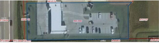
Property Record
4817 Fm 1463 Rd, Katy, TX 77494

Property Detail
4817 Fm 1463 Rd
Houston-Pasadena-The Woodlands, TX
0300 A PHILLIPS, ACRES 0.7849, (PT) UNRESTRICTED RESERVE D, BLOCK 1, PINE MILL RANCH COMMERCIAL RESERVES
0300-00-002-0114-914
Fort Bend
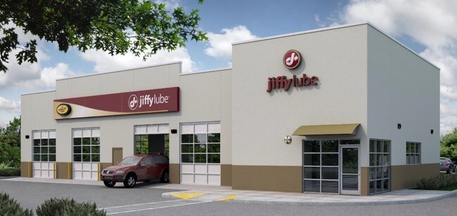
Commercialnec
Texas
B and X Area of moderate flood hazard, usually the area between the limits of the 100-year and 500-year floods.
0.79 AC
2024
Far Katy South
2025
Houston
673111
NEARBY LISTINGS FOR SALE OR LEASE
DEMOGRAPHICS near 4817 Fm 1463 Rd
1 mile
3 mile
5 mile
2025 Total Population
18,185
112,411
207,536
2030 Population
20,509
128,295
236,889
Pop Growth 2025-2030
+ 12.78%
+ 14.13%
+ 14.14%
Average Age
33
35
36
2025 Total Households
4,937
32,747
64,188
HH Growth 2025-2030
+ 13.25%
+ 14.74%
+ 14.60%
Median Household Inc
$178,266
$163,884
$151,288
Avg Household Size
3.70
3.40
3.20
2025 Avg HH Vehicles
2.00
2.00
2.00
Median Home Value
$540,467
$531,198
$491,598
Median Year Built
2011
2011
2010
Nearby Places
Map Layers
Map Styles
 Street
 Aerial
Transit
 Traffic
 Biking
Places
Listings with unknown addresses are not visible on the map
- Restaurants
- Banks
- Shops
- Fitness
- Groceries
SALE & LEASE HISTORY
LISTING DATE
SALE/LEASE

Oct 05, 2016
For Sale
Nearby Properties
Address
Land Use
TOTAL SIZE
Lot Size
Zoning
Address
Land Use
TOTAL SIZE
Lot Size
Zoning
39.24 AC
Address
Land Use
TOTAL SIZE
Lot Size
Zoning
786,753 SF
116.13 AC
Address
Land Use
TOTAL SIZE
Lot Size
Zoning
83.43 AC
Address
Land Use
TOTAL SIZE
Lot Size
Zoning
610,000 SF
99.39 AC
Y
Address
Land Use
TOTAL SIZE
Lot Size
Zoning
350,883 SF
29.41 AC
Address
Land Use
TOTAL SIZE
Lot Size
Zoning
165,097 SF
43.81 AC
Address
Land Use
TOTAL SIZE
Lot Size
Zoning
185,815 SF
30.28 AC
Address
Land Use
TOTAL SIZE
Lot Size
Zoning
21.54 AC
Address
Land Use
TOTAL SIZE
Lot Size
Zoning
Address
Land Use
TOTAL SIZE
Lot Size
Zoning
Address
Land Use
TOTAL SIZE
Lot Size
Zoning
15.87 AC
Address
Land Use
TOTAL SIZE
Lot Size
Zoning
174,906 SF
31.18 AC
Address
Land Use
TOTAL SIZE
Lot Size
Zoning
105,718 SF
14.52 AC
Address
Land Use
TOTAL SIZE
Lot Size
Zoning
14.80 AC
Address
Land Use
TOTAL SIZE
Lot Size
Zoning
202,589 SF
9.24 AC
J
Address
Land Use
TOTAL SIZE
Lot Size
Zoning
71.96 AC
Address
Land Use
TOTAL SIZE
Lot Size
Zoning
14.88 AC
Address
Land Use
TOTAL SIZE
Lot Size
Zoning
Address
Land Use
TOTAL SIZE
Lot Size
Zoning
Address
Land Use
TOTAL SIZE
Lot Size
Zoning
92,916 SF
7.96 AC
Address
Land Use
TOTAL SIZE
Lot Size
Zoning
117,000 SF
13.77 AC
Address
Land Use
TOTAL SIZE
Lot Size
Zoning
18,240 SF
66.52 AC
MYN
Address
Land Use
TOTAL SIZE
Lot Size
Zoning
120,000 SF
13.48 AC
Address
Land Use
TOTAL SIZE
Lot Size
Zoning
13.39 AC
Address
Land Use
TOTAL SIZE
Lot Size
Zoning
123,966 SF
13.71 AC
Address
Land Use
TOTAL SIZE
Lot Size
Zoning
123,960 SF
13.76 AC
Address
Land Use
TOTAL SIZE
Lot Size
Zoning
12.58 AC
Address
Land Use
TOTAL SIZE
Lot Size
Zoning
6,725 SF
23.26 AC
S
Address
Land Use
TOTAL SIZE
Lot Size
Zoning
123,154 SF
10.83 AC
Address
Land Use
TOTAL SIZE
Lot Size
Zoning
The World's #1 Commercial Real Estate Marketplace
Connect with us
© 2026 CoStar Group
The information above has been obtained from sources believed reliable. While we do not doubt its accuracy we have not verified it and make no guarantee, warranty or representation about it. It is your responsibility to independently confirm its accuracy and completeness. Any projections, opinions, assumptions, or estimates used are for example only and do not represent the current or future performance of the property. The value of this transaction to you depends on tax and other factors which should be evaluated by your tax, financial, and legal advisors. You and your advisors should conduct a careful, independent investigation of the property to determine to your satisfaction the suitability of the property for your needs.