Property Record
4817 Locust Grove Rd, Garland, TX 75043

NEARBY LISTINGS FOR SALE OR LEASE
Property Detail
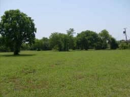
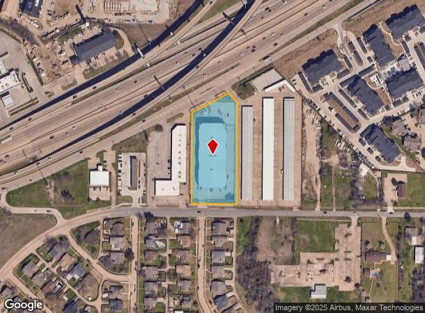
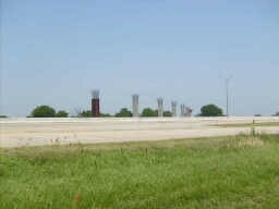
4817 Locust Grove Rd
Dallas-Fort Worth-Arlington, TX
Platinum Storage Locust Grove
26450590010010000
PLATINUM STORAGE LOCUST GROVE BLK 1 LT 1 ACS 2.35 INT202400250660 DD12052024 CO-DC 4505900100100 2CG45059001
Publicstorage
Dallas
X
Texas
48257C0025E
1
2024
2.35 AC
2025
Mesquite/Forney/Terrell
018147
Dallas/Ft Worth
80,535 SF
DEMOGRAPHICS near 4817 Locust Grove Rd
1 Mile
3 Mile
5 Mile
2024 Total Population
10,509
51,996
161,622
2029 Population
10,541
51,979
164,984
Pop Growth 2024-2029
+ 0.30%
(0.03%)
+ 2.08%
Average Age
37
38
38
2024 Total Households
3,884
18,952
55,908
HH Growth 2024-2029
+ 0.18%
(0.14%)
+ 2.18%
Median Household Inc
$60,129
$69,391
$74,602
Avg Household Size
2.60
2.70
2.80
2024 Avg HH Vehicles
2.00
2.00
2.00
Median Home Value
$239,468
$262,085
$253,432
Median Year Built
1986
1986
1984
Nearby Places
- Restaurants
- Banks
- Shops
- Fitness
- Groceries
PUBLIC TRANSPORTATION
AIRPORT
Dallas Love Field
DRIVE
WALK
Distance
Dallas Love Field
33 min
20.7 mi
Dallas-Fort Worth International
DRIVE
WALK
Distance
Dallas-Fort Worth International
45 min
37.4 mi
Freight Ports
Port of Shreveport
DRIVE
WALK
Distance
Port of Shreveport
206 min
187.0 mi
Nearby Properties
Address
Land Use
TOTAL SIZE
Lot Size
Zoning
Address
Land Use
TOTAL SIZE
Lot Size
Zoning
559,567 SF
10.85 AC
Z80
Address
Land Use
TOTAL SIZE
Lot Size
Zoning
441,557 SF
20.14 AC
Z239
Address
Land Use
TOTAL SIZE
Lot Size
Zoning
283,096 SF
10.18 AC
Z80
Address
Land Use
TOTAL SIZE
Lot Size
Zoning
260,782 SF
16.30 AC
Z77
Address
Land Use
TOTAL SIZE
Lot Size
Zoning
336,685 SF
18.51 AC
Z85
Address
Land Use
TOTAL SIZE
Lot Size
Zoning
336,035 SF
21.78 AC
Z160
Address
Land Use
TOTAL SIZE
Lot Size
Zoning
298,038 SF
9.06 AC
Z59
Address
Land Use
TOTAL SIZE
Lot Size
Zoning
224,063 SF
13.51 AC
Z10
Address
Land Use
TOTAL SIZE
Lot Size
Zoning
268,152 SF
13.86 AC
Z52
Address
Land Use
TOTAL SIZE
Lot Size
Zoning
710,600 SF
3.91 AC
Z80
Address
Land Use
TOTAL SIZE
Lot Size
Zoning
197,284 SF
10.70 AC
Z02
Address
Land Use
TOTAL SIZE
Lot Size
Zoning
178,125 SF
10.50 AC
Z77
Address
Land Use
TOTAL SIZE
Lot Size
Zoning
190,106 SF
12.31 AC
Z160
Address
Land Use
TOTAL SIZE
Lot Size
Zoning
229,054 SF
12.36 AC
Z160
Address
Land Use
TOTAL SIZE
Lot Size
Zoning
495,735 SF
2.92 AC
Z80
Address
Land Use
TOTAL SIZE
Lot Size
Zoning
138,183 SF
4.76 AC
Z80
Address
Land Use
TOTAL SIZE
Lot Size
Zoning
210,375 SF
7.54 AC
Address
Land Use
TOTAL SIZE
Lot Size
Zoning
173,559 SF
12.66 AC
Z160
Address
Land Use
TOTAL SIZE
Lot Size
Zoning
195,817 SF
9.28 AC
Z160
Address
Land Use
TOTAL SIZE
Lot Size
Zoning
126,465 SF
10.09 AC
Z239
Address
Land Use
TOTAL SIZE
Lot Size
Zoning
223,216 SF
13.79 AC
Z239
Address
Land Use
TOTAL SIZE
Lot Size
Zoning
66,131 SF
1.52 AC
Z85
Address
Land Use
TOTAL SIZE
Lot Size
Zoning
43.27 AC
Z80
Address
Land Use
TOTAL SIZE
Lot Size
Zoning
92,413 SF
4.98 AC
Z85
Address
Land Use
TOTAL SIZE
Lot Size
Zoning
123,400 SF
6.33 AC
Z239
Address
Land Use
TOTAL SIZE
Lot Size
Zoning
159,595 SF
13.66 AC
Z239
Address
Land Use
TOTAL SIZE
Lot Size
Zoning
83,154 SF
14.39 AC
Z386
Address
Land Use
TOTAL SIZE
Lot Size
Zoning
155,857 SF
4.02 AC
Z239
Address
Land Use
TOTAL SIZE
Lot Size
Zoning
130,696 SF
16.17 AC
Z85
Address
Land Use
TOTAL SIZE
Lot Size
Zoning
106,342 SF
7.39 AC
Z160
The World's #1 Commercial Real Estate Marketplace
Connect with us
© 2025 CoStar Group
The information above has been obtained from sources believed reliable. While we do not doubt its accuracy we have not verified it and make no guarantee, warranty or representation about it. It is your responsibility to independently confirm its accuracy and completeness. Any projections, opinions, assumptions, or estimates used are for example only and do not represent the current or future performance of the property. The value of this transaction to you depends on tax and other factors which should be evaluated by your tax, financial, and legal advisors. You and your advisors should conduct a careful, independent investigation of the property to determine to your satisfaction the suitability of the property for your needs.