Property Record
48185 Sd Highway 42, Brandon, SD 57005


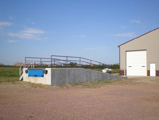

Property Detail
48185 Sd Highway 42
68543
TRACT 1E MCBETH ADDITION NE14 & SE14 27 101 48 SPLIT ROCK TOWNSHIP 101-48
Warehouse
Minnehaha
I1
South Dakota
B and X Area of moderate flood hazard, usually the area between the limits of the 100-year and 500-year floods.
2.05 AC
2024
Sioux Falls
2024
Other Market Areas
010402
Sioux Falls, SD-MN
11,924 SF
NEARBY LISTINGS FOR SALE OR LEASE
-
-
View all Brandon listings for sale on LoopNet.com
DEMOGRAPHICS near 48185 Sd Highway 42
1 mile
3 mile
5 mile
2025 Total Population
205
2,908
30,998
2030 Population
213
3,158
33,271
Pop Growth 2025-2030
+ 3.90%
+ 8.60%
+ 7.33%
Average Age
43
41
37
2025 Total Households
74
1,035
11,635
HH Growth 2025-2030
+ 4.05%
+ 8.99%
+ 7.68%
Median Household Inc
$136,250
$137,580
$92,935
Avg Household Size
2.70
2.70
2.60
2025 Avg HH Vehicles
3.00
3.00
2.00
Median Home Value
$494,444
$577,456
$386,873
Median Year Built
1983
2008
2010
Nearby Places
Map Layers
Map Styles
 Street
 Aerial
Transit
 Traffic
 Biking
Places
Listings with unknown addresses are not visible on the map
- Restaurants
- Banks
- Shops
- Fitness
- Groceries
PUBLIC TRANSPORTATION
AIRPORT
Joe Foss Field
Drive
Walk
Distance
Joe Foss Field
34 min
12.6 mi
Freight Ports
Port Milwaukee
Drive
Walk
Distance
Port Milwaukee
545 min
499.4 mi
Nearby Properties
Address
Land Use
TOTAL SIZE
Lot Size
Zoning
Address
Land Use
TOTAL SIZE
Lot Size
Zoning
17,117 SF
6.51 AC
PD;PLANNED
Address
Land Use
TOTAL SIZE
Lot Size
Zoning
7,549 SF
58.23 AC
A1
Address
Land Use
TOTAL SIZE
Lot Size
Zoning
6,480 SF
2.06 AC
Address
Land Use
TOTAL SIZE
Lot Size
Zoning
14,775 SF
1.91 AC
I1
Address
Land Use
TOTAL SIZE
Lot Size
Zoning
3,205 SF
1.96 AC
E
Address
Land Use
TOTAL SIZE
Lot Size
Zoning
34,020 SF
3.05 AC
C
Address
Land Use
TOTAL SIZE
Lot Size
Zoning
7,380 SF
2 AC
PD
Address
Land Use
TOTAL SIZE
Lot Size
Zoning
6,000 SF
1.84 AC
I1;LIGHT I
Address
Land Use
TOTAL SIZE
Lot Size
Zoning
2,400 SF
6.32 AC
A1
Address
Land Use
TOTAL SIZE
Lot Size
Zoning
119.60 AC
A1
Address
Land Use
TOTAL SIZE
Lot Size
Zoning
15.89 AC
A-1 AGRICU
Address
Land Use
TOTAL SIZE
Lot Size
Zoning
26.42 AC
A1
Address
Land Use
TOTAL SIZE
Lot Size
Zoning
1,280 SF
2.46 AC
I1
Address
Land Use
TOTAL SIZE
Lot Size
Zoning
6,032 SF
11.62 AC
A1
Address
Land Use
TOTAL SIZE
Lot Size
Zoning
9.24 AC
RC;CONSERV
Address
Land Use
TOTAL SIZE
Lot Size
Zoning
31.06 AC
RC
Address
Land Use
TOTAL SIZE
Lot Size
Zoning
768 SF
4.99 AC
A1
Address
Land Use
TOTAL SIZE
Lot Size
Zoning
6 AC
RC;CONSERV
Address
Land Use
TOTAL SIZE
Lot Size
Zoning
4,000 SF
1.88 AC
C
Address
Land Use
TOTAL SIZE
Lot Size
Zoning
20.47 AC
E
Address
Land Use
TOTAL SIZE
Lot Size
Zoning
2.47 AC
RR RURAL R
Address
Land Use
TOTAL SIZE
Lot Size
Zoning
9,000 SF
3.75 AC
C
Address
Land Use
TOTAL SIZE
Lot Size
Zoning
150 AC
Address
Land Use
TOTAL SIZE
Lot Size
Zoning
2,836 SF
0.99 AC
Address
Land Use
TOTAL SIZE
Lot Size
Zoning
141.70 AC
Address
Land Use
TOTAL SIZE
Lot Size
Zoning
8,000 SF
1.42 AC
I1
Address
Land Use
TOTAL SIZE
Lot Size
Zoning
5.05 AC
RR RURAL R
Address
Land Use
TOTAL SIZE
Lot Size
Zoning
4.48 AC
RR RURAL R
Address
Land Use
TOTAL SIZE
Lot Size
Zoning
4.48 AC
RR RURAL R
The World's #1 Commercial Real Estate Marketplace
Connect with us
© 2026 CoStar Group
The information above has been obtained from sources believed reliable. While we do not doubt its accuracy we have not verified it and make no guarantee, warranty or representation about it. It is your responsibility to independently confirm its accuracy and completeness. Any projections, opinions, assumptions, or estimates used are for example only and do not represent the current or future performance of the property. The value of this transaction to you depends on tax and other factors which should be evaluated by your tax, financial, and legal advisors. You and your advisors should conduct a careful, independent investigation of the property to determine to your satisfaction the suitability of the property for your needs.