Property Record
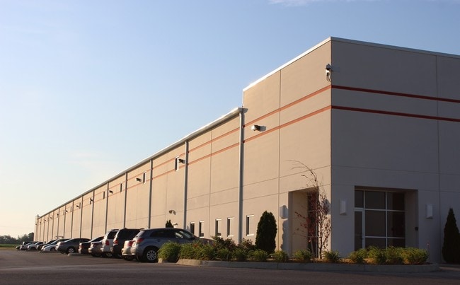
4820 Dale Dr, Lafayette, IN 47905


This Property Is For Sale
NEARBY LISTINGS FOR SALE OR LEASE
Property Detail
4820 Dale Dr
79-11-12-476-004.000-031
PT SE SEC 12 TWP 22 R4 0.211 A & 5.449 A& 10.00 A
Warehouse
Tippecanoe
X
Indiana
18157C0260D
87 SF
2024
Lafayette/Kokomo
2024
Other Market Areas
001800
Lafayette-West Lafayette, IN
175,740 SF
DEMOGRAPHICS near 4820 Dale Dr
1 Mile
3 Mile
5 Mile
2024 Total Population
114
15,498
62,938
2029 Population
118
15,973
64,578
Pop Growth 2024-2029
+ 3.51%
+ 3.06%
+ 2.61%
Average Age
40
35
37
2024 Total Households
42
6,136
25,752
HH Growth 2024-2029
+ 2.38%
+ 3.21%
+ 2.75%
Median Household Inc
$77,500
$58,923
$59,258
Avg Household Size
2.70
2.50
2.40
2024 Avg HH Vehicles
2.00
2.00
2.00
Median Home Value
$199,999
$217,941
$171,087
Median Year Built
1993
1997
1984
Nearby Places
Map Layers
Map Styles
 Street
 Aerial
- Restaurants
- Banks
- Shops
- Fitness
- Groceries
PUBLIC TRANSPORTATION
COMMUTER RAIL
DRIVE
WALK
Distance
13 min
7.1 mi
Nearby Properties
Address
Land Use
TOTAL SIZE
Lot Size
Zoning
Address
Land Use
TOTAL SIZE
Lot Size
Zoning
2,199,963 SF
0.06 AC
Address
Land Use
TOTAL SIZE
Lot Size
Zoning
68,943 SF
0.01 AC
Address
Land Use
TOTAL SIZE
Lot Size
Zoning
122,338 SF
0.01 AC
Address
Land Use
TOTAL SIZE
Lot Size
Zoning
507,320 SF
0.01 AC
Address
Land Use
TOTAL SIZE
Lot Size
Zoning
689,020 SF
0.01 AC
Address
Land Use
TOTAL SIZE
Lot Size
Zoning
117,351 SF
44 SF
Address
Land Use
TOTAL SIZE
Lot Size
Zoning
298,050 SF
50.91 AC
Address
Land Use
TOTAL SIZE
Lot Size
Zoning
32.01 AC
Address
Land Use
TOTAL SIZE
Lot Size
Zoning
270,827 SF
34.90 AC
Address
Land Use
TOTAL SIZE
Lot Size
Zoning
357,301 SF
45.62 AC
Address
Land Use
TOTAL SIZE
Lot Size
Zoning
77,226 SF
0.01 AC
Address
Land Use
TOTAL SIZE
Lot Size
Zoning
316,008 SF
27.04 AC
Address
Land Use
TOTAL SIZE
Lot Size
Zoning
140,973 SF
131 SF
Address
Land Use
TOTAL SIZE
Lot Size
Zoning
340,790 SF
131 SF
Address
Land Use
TOTAL SIZE
Lot Size
Zoning
70,686 SF
25.67 AC
Address
Land Use
TOTAL SIZE
Lot Size
Zoning
500,000 SF
174 SF
Address
Land Use
TOTAL SIZE
Lot Size
Zoning
160,572 SF
19.25 AC
Address
Land Use
TOTAL SIZE
Lot Size
Zoning
295,530 SF
87 SF
Address
Land Use
TOTAL SIZE
Lot Size
Zoning
70,889 SF
44 SF
Address
Land Use
TOTAL SIZE
Lot Size
Zoning
11.73 AC
Address
Land Use
TOTAL SIZE
Lot Size
Zoning
131,753 SF
44 SF
Address
Land Use
TOTAL SIZE
Lot Size
Zoning
141,778 SF
Address
Land Use
TOTAL SIZE
Lot Size
Zoning
213,760 SF
87 SF
Address
Land Use
TOTAL SIZE
Lot Size
Zoning
112,899 SF
15.03 AC
Address
Land Use
TOTAL SIZE
Lot Size
Zoning
0.01 AC
Address
Land Use
TOTAL SIZE
Lot Size
Zoning
183,801 SF
87 SF
Address
Land Use
TOTAL SIZE
Lot Size
Zoning
1.85 AC
Address
Land Use
TOTAL SIZE
Lot Size
Zoning
462,276 SF
0.01 AC
Address
Land Use
TOTAL SIZE
Lot Size
Zoning
68,404 SF
0.88 AC
Address
Land Use
TOTAL SIZE
Lot Size
Zoning
152,835 SF
10.04 AC
The World's #1 Commercial Real Estate Marketplace
Connect with us
© 2026 CoStar Group
The information above has been obtained from sources believed reliable. While we do not doubt its accuracy we have not verified it and make no guarantee, warranty or representation about it. It is your responsibility to independently confirm its accuracy and completeness. Any projections, opinions, assumptions, or estimates used are for example only and do not represent the current or future performance of the property. The value of this transaction to you depends on tax and other factors which should be evaluated by your tax, financial, and legal advisors. You and your advisors should conduct a careful, independent investigation of the property to determine to your satisfaction the suitability of the property for your needs.