Property Record
4820 E Interstate 40, Amarillo, TX 79103
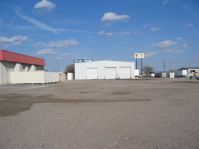


Property Detail
4820 E Interstate 40
Amarillo, TX
FAMOUS HEIGHTS ADDN # 42, LOT 02A, BLK 0001, 4.6200 ACRES
R-022-0300-0092-0
POTTER
Autorepair
Texas
B and X Area of moderate flood hazard, usually the area between the limits of the 100-year and 500-year floods.
02a
2024
4.62 AC
2025
Amarillo
010700
Other Market Areas
12,735 SF
NEARBY LISTINGS FOR SALE OR LEASE
DEMOGRAPHICS near 4820 E Interstate 40
1 mile
3 mile
5 mile
2025 Total Population
6,459
34,901
87,149
2030 Population
6,402
34,630
87,384
Pop Growth 2025-2030
(0.88%)
(0.78%)
+ 0.27%
Average Age
36
35
37
2025 Total Households
2,243
11,808
30,503
HH Growth 2025-2030
(0.94%)
(0.85%)
+ 0.29%
Median Household Inc
$53,882
$50,929
$50,807
Avg Household Size
2.90
2.90
2.70
2025 Avg HH Vehicles
2.00
2.00
2.00
Median Home Value
$126,703
$122,808
$134,212
Median Year Built
1963
1962
1959
Nearby Places
Map Layers
Map Styles
 Street
 Aerial
Transit
 Traffic
 Biking
Places
Listings with unknown addresses are not visible on the map
- Restaurants
- Banks
- Shops
- Fitness
- Groceries
PUBLIC TRANSPORTATION
AIRPORT
Rick Husband Amarillo International
Drive
Walk
Distance
Rick Husband Amarillo International
10 min
5.7 mi
Freight Ports
Tulsa Port Of Catoosa
Drive
Walk
Distance
Tulsa Port Of Catoosa
392 min
373.7 mi
Nearby Properties
Address
Land Use
TOTAL SIZE
Lot Size
Zoning
Address
Land Use
TOTAL SIZE
Lot Size
Zoning
414,471 SF
104.16 AC
LC
Address
Land Use
TOTAL SIZE
Lot Size
Zoning
325,220 SF
26.22 AC
PD
Address
Land Use
TOTAL SIZE
Lot Size
Zoning
89,206 SF
17.98 AC
Address
Land Use
TOTAL SIZE
Lot Size
Zoning
80,298 SF
7.75 AC
Address
Land Use
TOTAL SIZE
Lot Size
Zoning
80,476 SF
7.51 AC
I1
Address
Land Use
TOTAL SIZE
Lot Size
Zoning
127,654 SF
5.73 AC
HC
Address
Land Use
TOTAL SIZE
Lot Size
Zoning
276,741 SF
10.07 AC
GR
Address
Land Use
TOTAL SIZE
Lot Size
Zoning
205,577 SF
18.68 AC
I1
Address
Land Use
TOTAL SIZE
Lot Size
Zoning
69,116 SF
4.05 AC
Address
Land Use
TOTAL SIZE
Lot Size
Zoning
136,639 SF
18.07 AC
R2
Address
Land Use
TOTAL SIZE
Lot Size
Zoning
179,900 SF
4.68 AC
Address
Land Use
TOTAL SIZE
Lot Size
Zoning
1,604 SF
419.88 AC
A
Address
Land Use
TOTAL SIZE
Lot Size
Zoning
209,957 SF
24.24 AC
LC
Address
Land Use
TOTAL SIZE
Lot Size
Zoning
43,910 SF
101.33 AC
1F2HC
Address
Land Use
TOTAL SIZE
Lot Size
Zoning
83,769 SF
3.80 AC
MF1
Address
Land Use
TOTAL SIZE
Lot Size
Zoning
181,798 SF
17.27 AC
HC
Address
Land Use
TOTAL SIZE
Lot Size
Zoning
89,740 SF
2.71 AC
Address
Land Use
TOTAL SIZE
Lot Size
Zoning
92,341 SF
9.91 AC
R3
Address
Land Use
TOTAL SIZE
Lot Size
Zoning
93,274 SF
7.16 AC
HC
Address
Land Use
TOTAL SIZE
Lot Size
Zoning
49,499 SF
2.84 AC
HC
Address
Land Use
TOTAL SIZE
Lot Size
Zoning
87,936 SF
2.89 AC
Address
Land Use
TOTAL SIZE
Lot Size
Zoning
26,152 SF
2.65 AC
GR
Address
Land Use
TOTAL SIZE
Lot Size
Zoning
74,509 SF
2.49 AC
Address
Land Use
TOTAL SIZE
Lot Size
Zoning
37,134 SF
3.26 AC
Address
Land Use
TOTAL SIZE
Lot Size
Zoning
57,489 SF
2.48 AC
Address
Land Use
TOTAL SIZE
Lot Size
Zoning
66,756 SF
6.21 AC
Address
Land Use
TOTAL SIZE
Lot Size
Zoning
71,907 SF
8.54 AC
2F
Address
Land Use
TOTAL SIZE
Lot Size
Zoning
52,318 SF
1.78 AC
Address
Land Use
TOTAL SIZE
Lot Size
Zoning
15,448 SF
16.10 AC
Address
Land Use
TOTAL SIZE
Lot Size
Zoning
74,897 SF
7.33 AC
LC
The World's #1 Commercial Real Estate Marketplace
Connect with us
© 2026 CoStar Group
The information above has been obtained from sources believed reliable. While we do not doubt its accuracy we have not verified it and make no guarantee, warranty or representation about it. It is your responsibility to independently confirm its accuracy and completeness. Any projections, opinions, assumptions, or estimates used are for example only and do not represent the current or future performance of the property. The value of this transaction to you depends on tax and other factors which should be evaluated by your tax, financial, and legal advisors. You and your advisors should conduct a careful, independent investigation of the property to determine to your satisfaction the suitability of the property for your needs.