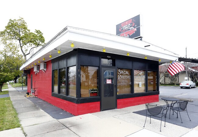
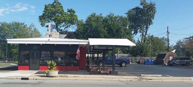
Property Record
4820 N Summit St, Toledo, OH 43611
NEARBY LISTINGS FOR SALE OR LEASE
Property Detail
4820 N Summit St
Toledo, OH
Lake View
09-52981
LAKE VIEW LOT 1 N 60 FT & W 20 FTN 60 FT LOT 2
Restaurantdrivein
Lucas
X
Ohio
39095C0103F
1,2
0
0.17 AC
2025
North Toledo
005502
Toledo
960 SF
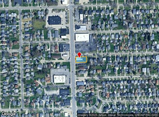
DEMOGRAPHICS near 4820 N Summit St
1 mile
3 mile
5 mile
2024 Total Population
7,979
22,112
89,951
2029 Population
7,773
21,824
89,726
Pop Growth 2024-2029
(2.58%)
(1.30%)
(0.25%)
Average Age
43
41
39
2024 Total Households
3,555
9,069
37,324
HH Growth 2024-2029
(2.73%)
(1.44%)
(0.39%)
Median Household Inc
$59,392
$51,817
$39,145
Avg Household Size
2.20
2.30
2.30
2024 Avg HH Vehicles
2.00
2.00
2.00
Median Home Value
$109,141
$106,224
$90,105
Median Year Built
1954
1957
1953
Nearby Places
Map Layers
Map Styles
 Street
 Aerial
Transit
 Traffic
 Biking
Places
Listings with unknown addresses are not visible on the map
- Restaurants
- Banks
- Shops
- Fitness
- Groceries
PUBLIC TRANSPORTATION
AIRPORT
Eugene F Kranz Toledo Express
Drive
Walk
Distance
Eugene F Kranz Toledo Express
38 min
28.4 mi
Freight Ports
Port of Baltimore
Drive
Walk
Distance
Port of Baltimore
1 min
399.0 mi
SALE & LEASE HISTORY
LISTING DATE
SALE/LEASE

Oct 10, 2017
For Sale
Jan 22, 2018
For Lease
Jan 22, 2018
For Sale
Dec 06, 2017
For Sale
Nearby Properties
Address
Land Use
TOTAL SIZE
Lot Size
Zoning
Address
Land Use
TOTAL SIZE
Lot Size
Zoning
569,999 SF
45.25 AC
10-MX
Address
Land Use
TOTAL SIZE
Lot Size
Zoning
286,525 SF
105.33 AC
10-RS6
Address
Land Use
TOTAL SIZE
Lot Size
Zoning
169.42 AC
10-IG
Address
Land Use
TOTAL SIZE
Lot Size
Zoning
Address
Land Use
TOTAL SIZE
Lot Size
Zoning
169.42 AC
10-IG
Address
Land Use
TOTAL SIZE
Lot Size
Zoning
33.48 AC
10-IG
Address
Land Use
TOTAL SIZE
Lot Size
Zoning
28.51 AC
10-IG
Address
Land Use
TOTAL SIZE
Lot Size
Zoning
230,400 SF
18 AC
10-CR
Address
Land Use
TOTAL SIZE
Lot Size
Zoning
334,732 SF
516.10 AC
40-M2
Address
Land Use
TOTAL SIZE
Lot Size
Zoning
90,113 SF
8.12 AC
21-PO
Address
Land Use
TOTAL SIZE
Lot Size
Zoning
175,978 SF
10.02 AC
10-IL
Address
Land Use
TOTAL SIZE
Lot Size
Zoning
27.41 AC
40-CI
Address
Land Use
TOTAL SIZE
Lot Size
Zoning
106.75 AC
AC = AG
Address
Land Use
TOTAL SIZE
Lot Size
Zoning
92,888 SF
20.24 AC
10-IL
Address
Land Use
TOTAL SIZE
Lot Size
Zoning
159,798 SF
8.32 AC
10-IL
Address
Land Use
TOTAL SIZE
Lot Size
Zoning
191,297 SF
28.74 AC
10-CRSO
Address
Land Use
TOTAL SIZE
Lot Size
Zoning
18,843 SF
30.05 AC
40-M2
Address
Land Use
TOTAL SIZE
Lot Size
Zoning
53,306 SF
2 AC
10-CO
Address
Land Use
TOTAL SIZE
Lot Size
Zoning
57,550 SF
1.61 AC
10-RM36
Address
Land Use
TOTAL SIZE
Lot Size
Zoning
70,404 SF
8.07 AC
10-RS6
Address
Land Use
TOTAL SIZE
Lot Size
Zoning
454,080 SF
54.59 AC
10-IG
Address
Land Use
TOTAL SIZE
Lot Size
Zoning
22.56 AC
10-IG
Address
Land Use
TOTAL SIZE
Lot Size
Zoning
398,978 SF
79.82 AC
40-M2
Address
Land Use
TOTAL SIZE
Lot Size
Zoning
42,780 SF
1 AC
10-CO
Address
Land Use
TOTAL SIZE
Lot Size
Zoning
202,584 SF
15.12 AC
10-IG
Address
Land Use
TOTAL SIZE
Lot Size
Zoning
3,391,887 SF
10-IG
Address
Land Use
TOTAL SIZE
Lot Size
Zoning
79,128 SF
9.01 AC
10-CRSO
Address
Land Use
TOTAL SIZE
Lot Size
Zoning
322,018 SF
20.24 AC
10-IG
Address
Land Use
TOTAL SIZE
Lot Size
Zoning
220,400 SF
13.32 AC
10-IG
Address
Land Use
TOTAL SIZE
Lot Size
Zoning
181,828 SF
17.74 AC
10-IG
The World's #1 Commercial Real Estate Marketplace
Connect with us
© 2026 CoStar Group
The information above has been obtained from sources believed reliable. While we do not doubt its accuracy we have not verified it and make no guarantee, warranty or representation about it. It is your responsibility to independently confirm its accuracy and completeness. Any projections, opinions, assumptions, or estimates used are for example only and do not represent the current or future performance of the property. The value of this transaction to you depends on tax and other factors which should be evaluated by your tax, financial, and legal advisors. You and your advisors should conduct a careful, independent investigation of the property to determine to your satisfaction the suitability of the property for your needs.