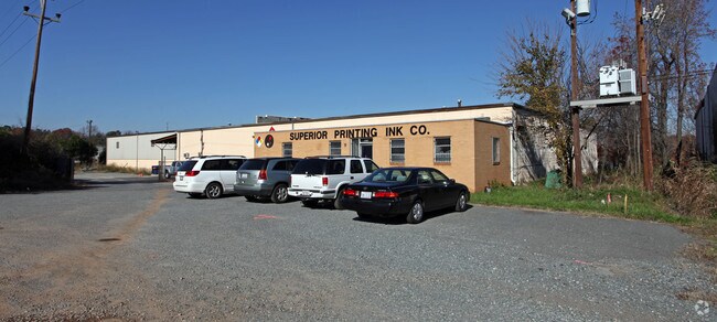
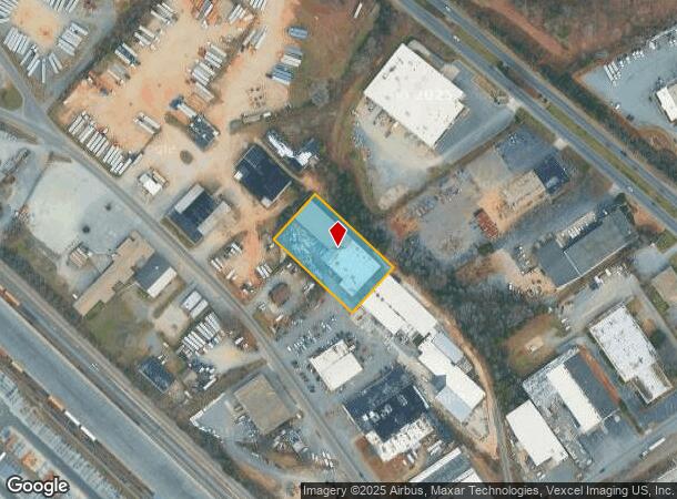
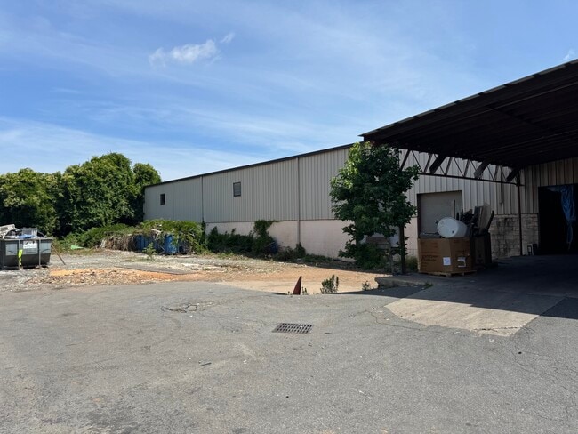
Property Record
4820 Rozzelles Ferry Rd, Charlotte, NC 28216

Current Lease Availabilities
NEARBY LISTINGS FOR SALE OR LEASE
Property Detail
4820 Rozzelles Ferry Rd
039-071-15
N A
Industrialgeneral
Mecklenburg
X
North Carolina
3710453500K
15
2024
0.13 AC
2025
I-85/Beatties Ford Rd
004400
Charlotte
23,336 SF
Charlotte-Concord-Gastonia, NC-SC
DEMOGRAPHICS near 4820 Rozzelles Ferry Rd
1 Mile
3 Mile
5 Mile
2024 Total Population
4,646
66,911
193,051
2029 Population
4,913
71,133
206,357
Pop Growth 2024-2029
+ 5.75%
+ 6.31%
+ 6.89%
Average Age
36
37
36
2024 Total Households
1,688
24,630
81,284
HH Growth 2024-2029
+ 5.75%
+ 6.43%
+ 7.23%
Median Household Inc
$38,708
$47,236
$60,436
Avg Household Size
2.60
2.60
2.30
2024 Avg HH Vehicles
2.00
2.00
2.00
Median Home Value
$123,101
$180,571
$232,180
Median Year Built
1968
1983
1999
Nearby Places
Map Layers
Map Styles
 Street
 Aerial
- Restaurants
- Banks
- Shops
- Fitness
- Groceries
PUBLIC TRANSPORTATION
COMMUTER RAIL
DRIVE
WALK
Distance
10 min
5.5 mi
AIRPORT
Charlotte/Douglas International
DRIVE
WALK
Distance
Charlotte/Douglas International
18 min
9.2 mi
Concord-Padgett Regional
DRIVE
WALK
Distance
Concord-Padgett Regional
25 min
16.6 mi
Nearby Properties
Address
Land Use
TOTAL SIZE
Lot Size
Zoning
Address
Land Use
TOTAL SIZE
Lot Size
Zoning
320,495 SF
10.03 AC
MUDDO
Address
Land Use
TOTAL SIZE
Lot Size
Zoning
375,318 SF
37.31 AC
B2
Address
Land Use
TOTAL SIZE
Lot Size
Zoning
308,793 SF
47.41 AC
R5
Address
Land Use
TOTAL SIZE
Lot Size
Zoning
311,541 SF
40.41 AC
INST
Address
Land Use
TOTAL SIZE
Lot Size
Zoning
58,666 SF
7.47 AC
Address
Land Use
TOTAL SIZE
Lot Size
Zoning
407,683 SF
37.23 AC
R22MF
Address
Land Use
TOTAL SIZE
Lot Size
Zoning
634,939 SF
42.26 AC
I1CD
Address
Land Use
TOTAL SIZE
Lot Size
Zoning
242,699 SF
20.50 AC
R17MF
Address
Land Use
TOTAL SIZE
Lot Size
Zoning
238,075 SF
9.52 AC
Address
Land Use
TOTAL SIZE
Lot Size
Zoning
536,042 SF
37.24 AC
R-22MF
Address
Land Use
TOTAL SIZE
Lot Size
Zoning
627,355 SF
45.41 AC
I2
Address
Land Use
TOTAL SIZE
Lot Size
Zoning
154,799 SF
6.09 AC
R12MF
Address
Land Use
TOTAL SIZE
Lot Size
Zoning
351,253 SF
27.85 AC
I-1(CD)
Address
Land Use
TOTAL SIZE
Lot Size
Zoning
152,910 SF
2.98 AC
MUDD-O
Address
Land Use
TOTAL SIZE
Lot Size
Zoning
229,084 SF
11.04 AC
Address
Land Use
TOTAL SIZE
Lot Size
Zoning
227,235 SF
44 AC
R12MF
Address
Land Use
TOTAL SIZE
Lot Size
Zoning
174,768 SF
9.28 AC
INST(CD)
Address
Land Use
TOTAL SIZE
Lot Size
Zoning
205,067 SF
9.94 AC
R5
Address
Land Use
TOTAL SIZE
Lot Size
Zoning
103,323 SF
12.89 AC
R-8
Address
Land Use
TOTAL SIZE
Lot Size
Zoning
346,795 SF
110.06 AC
I2
Address
Land Use
TOTAL SIZE
Lot Size
Zoning
15,869 SF
517.12 AC
R4
Address
Land Use
TOTAL SIZE
Lot Size
Zoning
2,967 SF
9.01 AC
R-17MF
Address
Land Use
TOTAL SIZE
Lot Size
Zoning
401,879 SF
20.57 AC
I-1
Address
Land Use
TOTAL SIZE
Lot Size
Zoning
237,032 SF
8.57 AC
I2
Address
Land Use
TOTAL SIZE
Lot Size
Zoning
88,624 SF
3.96 AC
MUDD-O
Address
Land Use
TOTAL SIZE
Lot Size
Zoning
361,253 SF
30.87 AC
I2
Address
Land Use
TOTAL SIZE
Lot Size
Zoning
79,972 SF
2.79 AC
R-22MF
Address
Land Use
TOTAL SIZE
Lot Size
Zoning
105,905 SF
0.90 AC
MUDD-O
Address
Land Use
TOTAL SIZE
Lot Size
Zoning
61,824 SF
10.19 AC
R-5
Address
Land Use
TOTAL SIZE
Lot Size
Zoning
269,210 SF
14.65 AC
I-1(CD)
The World's #1 Commercial Real Estate Marketplace
Connect with us
© 2025 CoStar Group
The information above has been obtained from sources believed reliable. While we do not doubt its accuracy we have not verified it and make no guarantee, warranty or representation about it. It is your responsibility to independently confirm its accuracy and completeness. Any projections, opinions, assumptions, or estimates used are for example only and do not represent the current or future performance of the property. The value of this transaction to you depends on tax and other factors which should be evaluated by your tax, financial, and legal advisors. You and your advisors should conduct a careful, independent investigation of the property to determine to your satisfaction the suitability of the property for your needs.