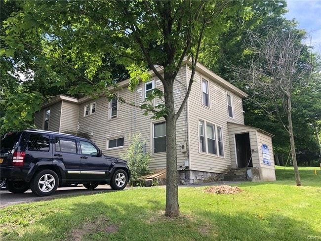
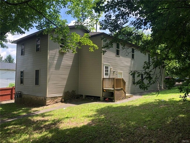
Property Record
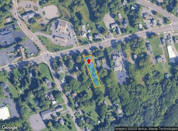
4822 W Seneca Tpke, Syracuse, NY 13215
NEARBY LISTINGS FOR SALE OR LEASE
Property Detail
4822 W Seneca Tpke
314200-029-000-0005-031-002-0000
Onondaga
Apartment
New York
X
31.002
36067C0218F
0.56 AC
2025
Outer S Onondaga County
2024
Syracuse
016300
Syracuse, NY
1,936 SF
DEMOGRAPHICS near 4822 W Seneca Tpke
1 Mile
3 Mile
5 Mile
2024 Total Population
4,553
68,651
169,442
2029 Population
4,423
67,366
165,944
Pop Growth 2024-2029
(2.86%)
(1.87%)
(2.06%)
Average Age
42
39
38
2024 Total Households
1,529
27,146
67,722
HH Growth 2024-2029
(2.62%)
(2.02%)
(2.12%)
Median Household Inc
$101,983
$48,640
$47,353
Avg Household Size
2.30
2.30
2.20
2024 Avg HH Vehicles
2.00
1.00
1.00
Median Home Value
$234,821
$141,193
$154,294
Median Year Built
1977
1954
1953
Nearby Places
- Restaurants
- Banks
- Shops
- Fitness
- Groceries
PUBLIC TRANSPORTATION
COMMUTER RAIL
Syracuse Regional Transportation Center (Empire Service - Amtrak, Lake Shore Limited - Amtrak, Maple Leaf - Amtrak)
DRIVE
WALK
Distance
Syracuse Regional Transportation Center (Empire Service - Amtrak, Lake Shore Limited - Amtrak, Maple Leaf - Amtrak)
13 min
6.3 mi
Syracuse (Toronto - New York - VIA Rail)
DRIVE
WALK
Distance
Syracuse (Toronto - New York - VIA Rail)
13 min
6.3 mi
AIRPORT
Syracuse Hancock International
DRIVE
WALK
Distance
Syracuse Hancock International
20 min
10.9 mi
Freight Ports
Albany, NY Port
DRIVE
WALK
Distance
Albany, NY Port
182 min
151.3 mi
SALE & LEASE HISTORY
LISTING DATE
SALE/LEASE

Jul 11, 2019
For Sale
Apr 12, 2022
For Sale
Nearby Properties
Address
Land Use
TOTAL SIZE
Lot Size
Zoning
Address
Land Use
TOTAL SIZE
Lot Size
Zoning
32,324 SF
157.80 AC
08 - GOVER
Address
Land Use
TOTAL SIZE
Lot Size
Zoning
412,577 SF
39.43 AC
08 - GOVER
Address
Land Use
TOTAL SIZE
Lot Size
Zoning
316,848 SF
10.72 AC
08 - GOVER
Address
Land Use
TOTAL SIZE
Lot Size
Zoning
168,000 SF
2.18 AC
06 - INDUS
Address
Land Use
TOTAL SIZE
Lot Size
Zoning
31,947 SF
1.23 AC
Address
Land Use
TOTAL SIZE
Lot Size
Zoning
23,650 SF
146.50 AC
06 - INDUS
Address
Land Use
TOTAL SIZE
Lot Size
Zoning
150,056 SF
48.64 AC
07 - MIXED
Address
Land Use
TOTAL SIZE
Lot Size
Zoning
8,784 SF
52.79 AC
Address
Land Use
TOTAL SIZE
Lot Size
Zoning
233,580 SF
10.73 AC
06 - INDUS
Address
Land Use
TOTAL SIZE
Lot Size
Zoning
58,012 SF
21.64 AC
02 - SINGL
Address
Land Use
TOTAL SIZE
Lot Size
Zoning
15,000 SF
59.65 AC
02 - SINGL
Address
Land Use
TOTAL SIZE
Lot Size
Zoning
245,765 SF
12
Address
Land Use
TOTAL SIZE
Lot Size
Zoning
303,913 SF
74.20 AC
02 - SINGL
Address
Land Use
TOTAL SIZE
Lot Size
Zoning
290,000 SF
11.44 AC
25
Address
Land Use
TOTAL SIZE
Lot Size
Zoning
248,704 SF
0.17 AC
01 - NOT Z
Address
Land Use
TOTAL SIZE
Lot Size
Zoning
176,250 SF
5.86 AC
25
Address
Land Use
TOTAL SIZE
Lot Size
Zoning
367,188 SF
22
Address
Land Use
TOTAL SIZE
Lot Size
Zoning
97,439 SF
24.52 AC
05 - COMME
Address
Land Use
TOTAL SIZE
Lot Size
Zoning
11,928 SF
12.30 AC
06 - INDUS
Address
Land Use
TOTAL SIZE
Lot Size
Zoning
79,676 SF
6.36 AC
06 - INDUS
Address
Land Use
TOTAL SIZE
Lot Size
Zoning
121,158 SF
0.74 AC
01 - NOT Z
Address
Land Use
TOTAL SIZE
Lot Size
Zoning
42,189 SF
8.60 AC
02 - SINGL
Address
Land Use
TOTAL SIZE
Lot Size
Zoning
147,250 SF
0.50 AC
02 - SINGL
Address
Land Use
TOTAL SIZE
Lot Size
Zoning
194,000 SF
9.61 AC
20
Address
Land Use
TOTAL SIZE
Lot Size
Zoning
97,722 SF
1.75 AC
06 - INDUS
Address
Land Use
TOTAL SIZE
Lot Size
Zoning
5,643 SF
0.38 AC
06 - INDUS
Address
Land Use
TOTAL SIZE
Lot Size
Zoning
66,402 SF
24.19 AC
07 - MIXED
Address
Land Use
TOTAL SIZE
Lot Size
Zoning
108,000 SF
3.15 AC
01 - NOT Z
Address
Land Use
TOTAL SIZE
Lot Size
Zoning
209,598 SF
8.07 AC
06 - INDUS
Address
Land Use
TOTAL SIZE
Lot Size
Zoning
209,598 SF
4.22 AC
06 - INDUS
The World's #1 Commercial Real Estate Marketplace
Connect with us
© 2025 CoStar Group
The information above has been obtained from sources believed reliable. While we do not doubt its accuracy we have not verified it and make no guarantee, warranty or representation about it. It is your responsibility to independently confirm its accuracy and completeness. Any projections, opinions, assumptions, or estimates used are for example only and do not represent the current or future performance of the property. The value of this transaction to you depends on tax and other factors which should be evaluated by your tax, financial, and legal advisors. You and your advisors should conduct a careful, independent investigation of the property to determine to your satisfaction the suitability of the property for your needs.