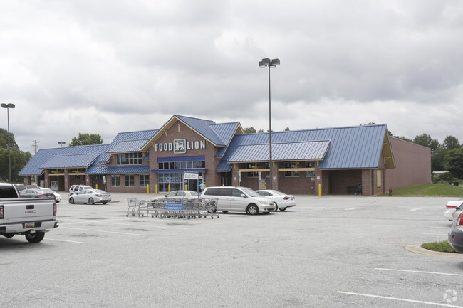
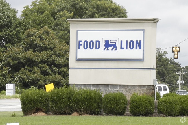
Property Record
4825 Highway 221, Roebuck, SC 29376

Property Detail
4825 Highway 221
6-33-07-013.00
SW CORNER US HWY 221 & SC HWY 215 PB 76-559 DB 52P-107 RD R/W TAKEN 42.143B TR 8 PB 158-709
Commercialnec
Spartanburg
B and X Area of moderate flood hazard, usually the area between the limits of the 100-year and 500-year floods.
South Carolina
0
4.57 AC
2025
Lower Spartanburg Cty
023803
Greenville/Spartanburg
36,374 SF
Spartanburg, SC
NEARBY LISTINGS FOR SALE OR LEASE
-
-
View all Roebuck listings for sale on LoopNet.com
DEMOGRAPHICS near 4825 Highway 221
1 mile
3 mile
5 mile
2025 Total Population
1,914
15,471
52,764
2030 Population
2,150
17,300
58,965
Pop Growth 2025-2030
+ 12.33%
+ 11.82%
+ 11.75%
Average Age
41
40
40
2025 Total Households
720
5,943
20,829
HH Growth 2025-2030
+ 12.36%
+ 11.88%
+ 11.81%
Median Household Inc
$65,064
$64,733
$60,603
Avg Household Size
2.50
2.50
2.50
2025 Avg HH Vehicles
2.00
2.00
2.00
Median Home Value
$244,323
$246,153
$240,151
Median Year Built
1994
1992
1987
Nearby Places
Map Layers
Map Styles
 Street
 Aerial
Layers
 Traffic
 Biking
Places
Listings with unknown addresses are not visible on the map
- Restaurants
- Banks
- Shops
- Fitness
- Groceries
PUBLIC TRANSPORTATION
COMMUTER RAIL
Drive
Walk
Distance
13 min
6.7 mi
AIRPORT
Greenville Spartanburg International
Drive
Walk
Distance
Greenville Spartanburg International
33 min
20.7 mi
Nearby Properties
Address
Land Use
TOTAL SIZE
Lot Size
Zoning
Address
Land Use
TOTAL SIZE
Lot Size
Zoning
600,000 SF
60.45 AC
Address
Land Use
TOTAL SIZE
Lot Size
Zoning
2,113 SF
178.24 AC
Address
Land Use
TOTAL SIZE
Lot Size
Zoning
1,475 SF
9.27 AC
Address
Land Use
TOTAL SIZE
Lot Size
Zoning
5,622 SF
50.27 AC
Address
Land Use
TOTAL SIZE
Lot Size
Zoning
1,112 SF
3 AC
Address
Land Use
TOTAL SIZE
Lot Size
Zoning
7,406 SF
0.74 AC
Address
Land Use
TOTAL SIZE
Lot Size
Zoning
5,913 SF
0.95 AC
Address
Land Use
TOTAL SIZE
Lot Size
Zoning
3,884 SF
10.50 AC
Address
Land Use
TOTAL SIZE
Lot Size
Zoning
4,007 SF
Address
Land Use
TOTAL SIZE
Lot Size
Zoning
3,813 SF
1.24 AC
Address
Land Use
TOTAL SIZE
Lot Size
Zoning
12.76 AC
Address
Land Use
TOTAL SIZE
Lot Size
Zoning
3,204 SF
0.25 AC
Address
Land Use
TOTAL SIZE
Lot Size
Zoning
3,335 SF
0.33 AC
Address
Land Use
TOTAL SIZE
Lot Size
Zoning
2,985 SF
0.14 AC
Address
Land Use
TOTAL SIZE
Lot Size
Zoning
3,372 SF
0.16 AC
Address
Land Use
TOTAL SIZE
Lot Size
Zoning
3,105 SF
0.16 AC
Address
Land Use
TOTAL SIZE
Lot Size
Zoning
2,476 SF
0.16 AC
Address
Land Use
TOTAL SIZE
Lot Size
Zoning
3,387 SF
0.80 AC
Address
Land Use
TOTAL SIZE
Lot Size
Zoning
2,454 SF
0.38 AC
Address
Land Use
TOTAL SIZE
Lot Size
Zoning
2,551 SF
0.74 AC
Address
Land Use
TOTAL SIZE
Lot Size
Zoning
2,429 SF
1.33 AC
Address
Land Use
TOTAL SIZE
Lot Size
Zoning
209,570 SF
24.36 AC
Address
Land Use
TOTAL SIZE
Lot Size
Zoning
2,157 SF
0.66 AC
Address
Land Use
TOTAL SIZE
Lot Size
Zoning
3,315 SF
0.28 AC
Address
Land Use
TOTAL SIZE
Lot Size
Zoning
3,163 SF
0.58 AC
Address
Land Use
TOTAL SIZE
Lot Size
Zoning
2,614 SF
0.58 AC
Address
Land Use
TOTAL SIZE
Lot Size
Zoning
3,724 SF
0.56 AC
Address
Land Use
TOTAL SIZE
Lot Size
Zoning
3,679 SF
0.19 AC
Address
Land Use
TOTAL SIZE
Lot Size
Zoning
4,178 SF
0.32 AC
The World's #1 Commercial Real Estate Marketplace
Connect with us
© 2026 CoStar Group
The information above has been obtained from sources believed reliable. While we do not doubt its accuracy we have not verified it and make no guarantee, warranty or representation about it. It is your responsibility to independently confirm its accuracy and completeness. Any projections, opinions, assumptions, or estimates used are for example only and do not represent the current or future performance of the property. The value of this transaction to you depends on tax and other factors which should be evaluated by your tax, financial, and legal advisors. You and your advisors should conduct a careful, independent investigation of the property to determine to your satisfaction the suitability of the property for your needs.