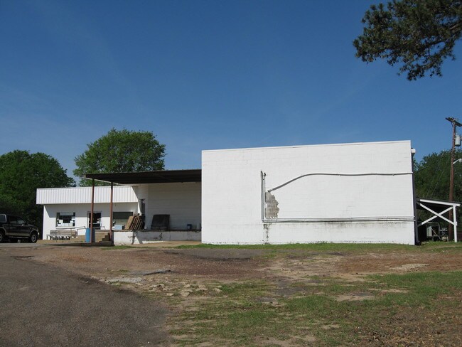
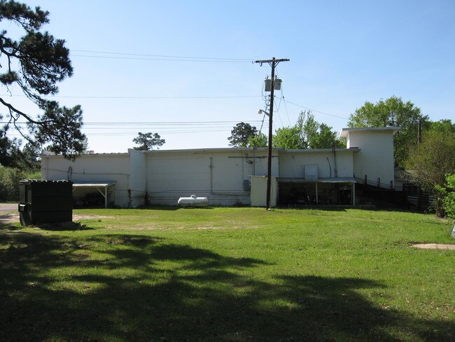
Property Record
4825 Pine Tree Rd, Longview, TX 75604

Property Detail
4825 Pine Tree Rd
19503
AB 92 G W HOOPER SUR TRS 63 & 63-01 SEC 4
Commercialnec
Gregg
B
Texas
AE The base floodplain where base flood elevations are provided. AE Zones are now used on new format FIRMs instead of A1-A30 Zones.
63 & 63
2025
3.19 AC
2025
Other Market Areas
010100
Longview, TX
3,666 SF
NEARBY LISTINGS FOR SALE OR LEASE
DEMOGRAPHICS near 4825 Pine Tree Rd
1 mile
3 mile
5 mile
2025 Total Population
2,667
29,582
55,452
2030 Population
2,711
30,069
56,471
Pop Growth 2025-2030
+ 1.65%
+ 1.65%
+ 1.84%
Average Age
36
37
38
2025 Total Households
933
10,923
21,784
HH Growth 2025-2030
+ 1.61%
+ 1.63%
+ 1.90%
Median Household Inc
$75,645
$72,453
$70,531
Avg Household Size
2.70
2.60
2.50
2025 Avg HH Vehicles
2.00
2.00
2.00
Median Home Value
$220,179
$227,941
$225,268
Median Year Built
1983
1979
1980
Nearby Places
Map Layers
Map Styles
 Street
 Aerial
Layers
 Traffic
 Biking
Places
Listings with unknown addresses are not visible on the map
- Restaurants
- Banks
- Shops
- Fitness
- Groceries
PUBLIC TRANSPORTATION
COMMUTER RAIL
Longview (Texas Eagle - Amtrak)
Drive
Walk
Distance
Longview (Texas Eagle - Amtrak)
15 min
9.9 mi
Freight Ports
Port of Shreveport
Drive
Walk
Distance
Port of Shreveport
96 min
82.1 mi
SALE & LEASE HISTORY
LISTING DATE
SALE/LEASE

Sep 26, 2017
For Sale
Jan 03, 2019
For Sale
Nearby Properties
Address
Land Use
TOTAL SIZE
Lot Size
Zoning
Address
Land Use
TOTAL SIZE
Lot Size
Zoning
Address
Land Use
TOTAL SIZE
Lot Size
Zoning
72,042 SF
63.78 AC
Address
Land Use
TOTAL SIZE
Lot Size
Zoning
77,400 SF
39.90 AC
Address
Land Use
TOTAL SIZE
Lot Size
Zoning
10,000 SF
26.40 AC
Address
Land Use
TOTAL SIZE
Lot Size
Zoning
77,400 SF
22.68 AC
B
Address
Land Use
TOTAL SIZE
Lot Size
Zoning
29,628 SF
5.81 AC
Address
Land Use
TOTAL SIZE
Lot Size
Zoning
45,932 SF
5.87 AC
Address
Land Use
TOTAL SIZE
Lot Size
Zoning
2,400 SF
7.55 AC
Address
Land Use
TOTAL SIZE
Lot Size
Zoning
17,150 SF
15.01 AC
Address
Land Use
TOTAL SIZE
Lot Size
Zoning
123,516 SF
13.89 AC
Address
Land Use
TOTAL SIZE
Lot Size
Zoning
7,656 SF
1.84 AC
Address
Land Use
TOTAL SIZE
Lot Size
Zoning
42,553 SF
6.53 AC
Address
Land Use
TOTAL SIZE
Lot Size
Zoning
20,662 SF
1.01 AC
Address
Land Use
TOTAL SIZE
Lot Size
Zoning
20,200 SF
4.53 AC
Address
Land Use
TOTAL SIZE
Lot Size
Zoning
2.82 AC
Address
Land Use
TOTAL SIZE
Lot Size
Zoning
37,132 SF
4.51 AC
Address
Land Use
TOTAL SIZE
Lot Size
Zoning
3,500 SF
12.41 AC
B
Address
Land Use
TOTAL SIZE
Lot Size
Zoning
13,857 SF
3.43 AC
Address
Land Use
TOTAL SIZE
Lot Size
Zoning
Address
Land Use
TOTAL SIZE
Lot Size
Zoning
900 SF
5.16 AC
Address
Land Use
TOTAL SIZE
Lot Size
Zoning
31,368 SF
3.34 AC
Address
Land Use
TOTAL SIZE
Lot Size
Zoning
13,502 SF
7.04 AC
Address
Land Use
TOTAL SIZE
Lot Size
Zoning
2,263 SF
2.02 AC
Address
Land Use
TOTAL SIZE
Lot Size
Zoning
37,009 SF
5.59 AC
Address
Land Use
TOTAL SIZE
Lot Size
Zoning
24,200 SF
4.36 AC
Address
Land Use
TOTAL SIZE
Lot Size
Zoning
8,712 SF
2.96 AC
Address
Land Use
TOTAL SIZE
Lot Size
Zoning
15,685 SF
2.78 AC
Address
Land Use
TOTAL SIZE
Lot Size
Zoning
2.75 AC
Address
Land Use
TOTAL SIZE
Lot Size
Zoning
912 SF
8.56 AC
Address
Land Use
TOTAL SIZE
Lot Size
Zoning
8,768 SF
161.88 AC
The World's #1 Commercial Real Estate Marketplace
Connect with us
© 2026 CoStar Group
The information above has been obtained from sources believed reliable. While we do not doubt its accuracy we have not verified it and make no guarantee, warranty or representation about it. It is your responsibility to independently confirm its accuracy and completeness. Any projections, opinions, assumptions, or estimates used are for example only and do not represent the current or future performance of the property. The value of this transaction to you depends on tax and other factors which should be evaluated by your tax, financial, and legal advisors. You and your advisors should conduct a careful, independent investigation of the property to determine to your satisfaction the suitability of the property for your needs.