Property Record
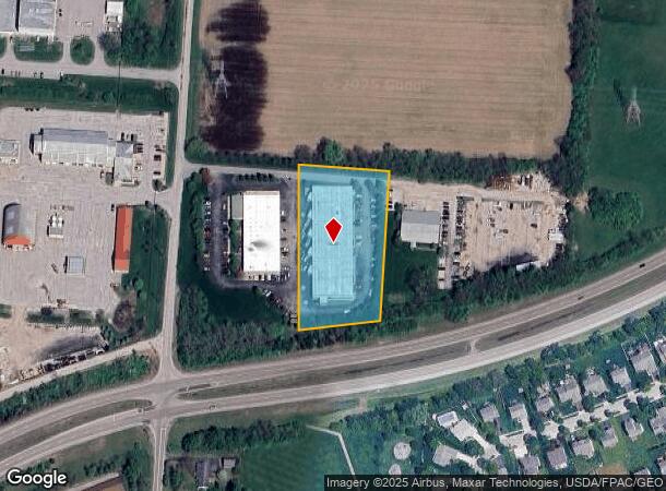
4826 Hendron Rd, Groveport, OH 43125

NEARBY LISTINGS FOR SALE OR LEASE
Property Detail
4826 Hendron Rd
185-002754
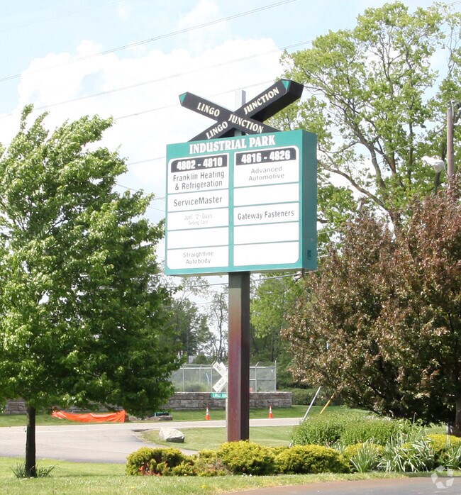
Kile Vs Swisher Partition
Warehouse
HENDRON RD R21 T11 S21 2.358 ACRES
X
Franklin
39129C0075J
Ohio
2024
2.36 AC
2024
Southeast
009495
Columbus
33,220 SF
Columbus, OH
DEMOGRAPHICS near 4826 Hendron Rd
1 Mile
3 Mile
5 Mile
2024 Total Population
2,011
28,225
118,679
2029 Population
2,019
28,258
118,926
Pop Growth 2024-2029
+ 0.40%
+ 0.12%
+ 0.21%
Average Age
39
39
38
2024 Total Households
817
11,226
46,590
HH Growth 2024-2029
+ 0.49%
+ 0.02%
+ 0.18%
Median Household Inc
$90,811
$67,167
$57,301
Avg Household Size
2.50
2.50
2.50
2024 Avg HH Vehicles
2.00
2.00
2.00
Median Home Value
$229,250
$170,002
$163,938
Median Year Built
1999
1984
1978
Nearby Places
Map Layers
Map Styles
 Street
 Aerial
- Restaurants
- Banks
- Shops
- Fitness
- Groceries
PUBLIC TRANSPORTATION
AIRPORT
Rickenbacker International
DRIVE
WALK
Distance
Rickenbacker International
11 min
5.1 mi
John Glenn Columbus International
DRIVE
WALK
Distance
John Glenn Columbus International
20 min
11.9 mi
Nearby Properties
Address
Land Use
TOTAL SIZE
Lot Size
Zoning
Address
Land Use
TOTAL SIZE
Lot Size
Zoning
471,215 SF
49.74 AC
Address
Land Use
TOTAL SIZE
Lot Size
Zoning
1,219,000 SF
59.32 AC
Address
Land Use
TOTAL SIZE
Lot Size
Zoning
1,021,020 SF
68.44 AC
Address
Land Use
TOTAL SIZE
Lot Size
Zoning
977,584 SF
70.14 AC
Address
Land Use
TOTAL SIZE
Lot Size
Zoning
1,280,501 SF
69.60 AC
Address
Land Use
TOTAL SIZE
Lot Size
Zoning
959,688 SF
55.34 AC
Address
Land Use
TOTAL SIZE
Lot Size
Zoning
778,272 SF
42.31 AC
Address
Land Use
TOTAL SIZE
Lot Size
Zoning
903,780 SF
45.43 AC
Address
Land Use
TOTAL SIZE
Lot Size
Zoning
720,200 SF
35.71 AC
Address
Land Use
TOTAL SIZE
Lot Size
Zoning
785,854 SF
30.85 AC
Address
Land Use
TOTAL SIZE
Lot Size
Zoning
541,910 SF
36.84 AC
Address
Land Use
TOTAL SIZE
Lot Size
Zoning
639,600 SF
43.91 AC
Address
Land Use
TOTAL SIZE
Lot Size
Zoning
743,315 SF
42.17 AC
Address
Land Use
TOTAL SIZE
Lot Size
Zoning
567,000 SF
23.08 AC
Address
Land Use
TOTAL SIZE
Lot Size
Zoning
68,492 SF
23.63 AC
Address
Land Use
TOTAL SIZE
Lot Size
Zoning
250,174 SF
178.12 AC
Address
Land Use
TOTAL SIZE
Lot Size
Zoning
754,000 SF
41.60 AC
Address
Land Use
TOTAL SIZE
Lot Size
Zoning
632,000 SF
35.98 AC
Address
Land Use
TOTAL SIZE
Lot Size
Zoning
668,447 SF
41.68 AC
Address
Land Use
TOTAL SIZE
Lot Size
Zoning
478,544 SF
23.04 AC
Address
Land Use
TOTAL SIZE
Lot Size
Zoning
478,544 SF
24.25 AC
Address
Land Use
TOTAL SIZE
Lot Size
Zoning
713,440 SF
40.94 AC
Address
Land Use
TOTAL SIZE
Lot Size
Zoning
462,840 SF
27.07 AC
Address
Land Use
TOTAL SIZE
Lot Size
Zoning
483,620 SF
28.80 AC
Address
Land Use
TOTAL SIZE
Lot Size
Zoning
446,160 SF
91.12 AC
Address
Land Use
TOTAL SIZE
Lot Size
Zoning
446,160 SF
22.71 AC
Address
Land Use
TOTAL SIZE
Lot Size
Zoning
107,200 SF
24.72 AC
Address
Land Use
TOTAL SIZE
Lot Size
Zoning
439,986 SF
23.71 AC
Address
Land Use
TOTAL SIZE
Lot Size
Zoning
352,500 SF
20.75 AC
Address
Land Use
TOTAL SIZE
Lot Size
Zoning
516,025 SF
24.18 AC
The World's #1 Commercial Real Estate Marketplace
Connect with us
© 2025 CoStar Group
The information above has been obtained from sources believed reliable. While we do not doubt its accuracy we have not verified it and make no guarantee, warranty or representation about it. It is your responsibility to independently confirm its accuracy and completeness. Any projections, opinions, assumptions, or estimates used are for example only and do not represent the current or future performance of the property. The value of this transaction to you depends on tax and other factors which should be evaluated by your tax, financial, and legal advisors. You and your advisors should conduct a careful, independent investigation of the property to determine to your satisfaction the suitability of the property for your needs.