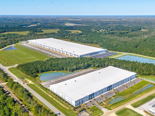
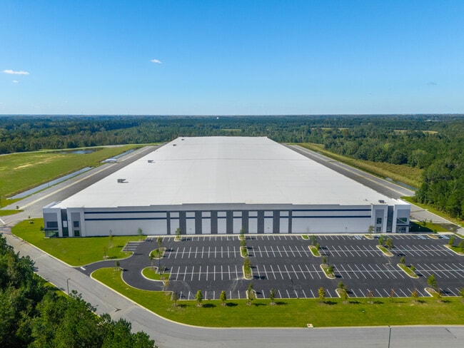
Property Record
4826 Highway 78 Rd, Saint George, SC 29477

Property Detail
4826 Highway 78 Rd
059-00-00-101
TRACT A
Vacantlandnec
DORCHESTER
I_DC
South Carolina
B and X Area of moderate flood hazard, usually the area between the limits of the 100-year and 500-year floods.
74.91 AC
2025
Dorchester County
2025
Charleston/N Charleston
010200
Charleston-North Charleston, SC
NEARBY LISTINGS FOR SALE OR LEASE
-
-
View all Saint George listings for lease on LoopNet.com
DEMOGRAPHICS near 4826 Highway 78 Rd
1 mile
3 mile
5 mile
2025 Total Population
140
3,705
6,558
2030 Population
155
4,087
7,248
Pop Growth 2025-2030
+ 10.71%
+ 10.31%
+ 10.52%
Average Age
44
44
44
2025 Total Households
61
1,579
2,783
HH Growth 2025-2030
+ 9.84%
+ 10.70%
+ 10.89%
Median Household Inc
$52,500
$42,500
$52,723
Avg Household Size
2.30
2.30
2.30
2025 Avg HH Vehicles
2.00
2.00
2.00
Median Home Value
$199,999
$207,746
$188,484
Median Year Built
1980
1981
1982
Nearby Places
Map Layers
Map Styles
 Street
 Aerial
Layers
 Traffic
 Biking
Places
Listings with unknown addresses are not visible on the map
- Restaurants
- Banks
- Shops
- Fitness
- Groceries
SALE & LEASE HISTORY
LISTING DATE
SALE/LEASE

Feb 04, 2022
For Lease
Nearby Properties
Address
Land Use
TOTAL SIZE
Lot Size
Zoning
Address
Land Use
TOTAL SIZE
Lot Size
Zoning
10,447 SF
82.62 AC
LC_SG
Address
Land Use
TOTAL SIZE
Lot Size
Zoning
272.68 AC
I_DC
Address
Land Use
TOTAL SIZE
Lot Size
Zoning
109,607 SF
89.62 AC
AR_DC
Address
Land Use
TOTAL SIZE
Lot Size
Zoning
100,500 SF
17.26 AC
I_DC
Address
Land Use
TOTAL SIZE
Lot Size
Zoning
445.13 AC
AR_DC
Address
Land Use
TOTAL SIZE
Lot Size
Zoning
37,376 SF
2.20 AC
RMD_SG
Address
Land Use
TOTAL SIZE
Lot Size
Zoning
331.23 AC
I_DC
Address
Land Use
TOTAL SIZE
Lot Size
Zoning
38,467 SF
3.70 AC
SFR_SG
Address
Land Use
TOTAL SIZE
Lot Size
Zoning
110.38 AC
I_DC
Address
Land Use
TOTAL SIZE
Lot Size
Zoning
62,937 SF
6.04 AC
SFR_SG
Address
Land Use
TOTAL SIZE
Lot Size
Zoning
88.83 AC
AR_DC
Address
Land Use
TOTAL SIZE
Lot Size
Zoning
176.06 AC
I_DC
Address
Land Use
TOTAL SIZE
Lot Size
Zoning
28,395 SF
5.24 AC
SFR_SG
Address
Land Use
TOTAL SIZE
Lot Size
Zoning
1,002.48 AC
AR_DC
Address
Land Use
TOTAL SIZE
Lot Size
Zoning
14,193 SF
0.37 AC
RMU_SG
Address
Land Use
TOTAL SIZE
Lot Size
Zoning
923.28 AC
AR_DC
Address
Land Use
TOTAL SIZE
Lot Size
Zoning
1.10 AC
CG_DC
Address
Land Use
TOTAL SIZE
Lot Size
Zoning
143.69 AC
I_DC
Address
Land Use
TOTAL SIZE
Lot Size
Zoning
33,158 SF
5 AC
SFR_SG
Address
Land Use
TOTAL SIZE
Lot Size
Zoning
52,080 SF
11.96 AC
I_DC
Address
Land Use
TOTAL SIZE
Lot Size
Zoning
46,681 SF
12.96 AC
SFR_SG
Address
Land Use
TOTAL SIZE
Lot Size
Zoning
65.72 AC
RMD_SG
Address
Land Use
TOTAL SIZE
Lot Size
Zoning
18,857 SF
2.08 AC
AR_DC
Address
Land Use
TOTAL SIZE
Lot Size
Zoning
358.40 AC
AR_DC
Address
Land Use
TOTAL SIZE
Lot Size
Zoning
31,372 SF
0.87 AC
RMU_SG
Address
Land Use
TOTAL SIZE
Lot Size
Zoning
38,783 SF
18.63 AC
RMD_SG
Address
Land Use
TOTAL SIZE
Lot Size
Zoning
20,766 SF
7.28 AC
RMU_SG
Address
Land Use
TOTAL SIZE
Lot Size
Zoning
7.90 AC
AR_DC
Address
Land Use
TOTAL SIZE
Lot Size
Zoning
310 AC
AR_DC
The World's #1 Commercial Real Estate Marketplace
Connect with us
© 2026 CoStar Group
The information above has been obtained from sources believed reliable. While we do not doubt its accuracy we have not verified it and make no guarantee, warranty or representation about it. It is your responsibility to independently confirm its accuracy and completeness. Any projections, opinions, assumptions, or estimates used are for example only and do not represent the current or future performance of the property. The value of this transaction to you depends on tax and other factors which should be evaluated by your tax, financial, and legal advisors. You and your advisors should conduct a careful, independent investigation of the property to determine to your satisfaction the suitability of the property for your needs.