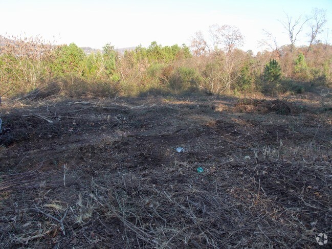
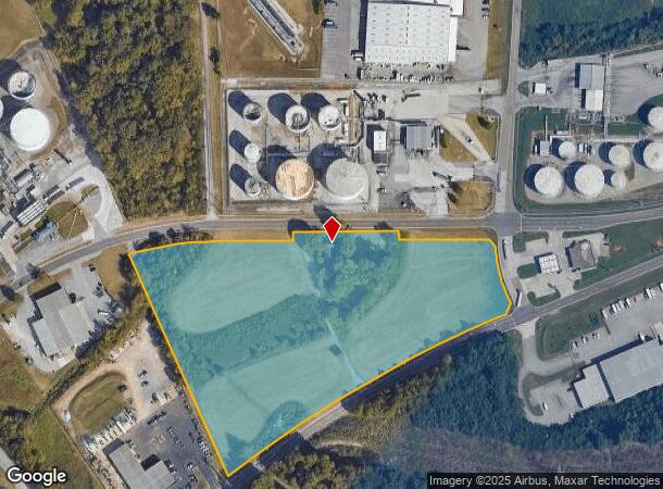
Property Record
4810 N Middlebrook Pike, Knoxville, TN 37921
NEARBY LISTINGS FOR SALE OR LEASE
Property Detail
4810 N Middlebrook Pike
Knoxville, TN
Greenbelt App #A-2686
093OA-021
Knox
Sfr
Tennessee
X
10.73 AC
47093C0278G
Bearden/Papermill/W Town
2,416 SF
Knoxville
DEMOGRAPHICS near 4810 N Middlebrook Pike
1 Mile
3 Mile
5 Mile
2024 Total Population
5,250
60,163
171,568
2029 Population
5,705
65,371
186,425
Pop Growth 2024-2029
+ 8.67%
+ 8.66%
+ 8.66%
Average Age
36
37
37
2024 Total Households
2,624
26,100
72,613
HH Growth 2024-2029
+ 8.92%
+ 8.87%
+ 9.11%
Median Household Inc
$40,960
$47,951
$51,455
Avg Household Size
1.90
2.20
2.20
2024 Avg HH Vehicles
2.00
2.00
2.00
Median Home Value
$192,571
$194,898
$233,390
Median Year Built
1977
1977
1978
Nearby Places
Map Layers
Map Styles
 Street
 Aerial
- Restaurants
- Banks
- Shops
- Fitness
- Groceries
PUBLIC TRANSPORTATION
AIRPORT
McGhee Tyson
DRIVE
WALK
Distance
McGhee Tyson
32 min
19.0 mi
Freight Ports
Georgia Ports - Savannah
DRIVE
WALK
Distance
Georgia Ports - Savannah
482 min
418.5 mi
Nearby Properties
Address
Land Use
TOTAL SIZE
Lot Size
Zoning
Address
Land Use
TOTAL SIZE
Lot Size
Zoning
154,163 SF
3.48 AC
Address
Land Use
TOTAL SIZE
Lot Size
Zoning
92,820 SF
6.10 AC
Address
Land Use
TOTAL SIZE
Lot Size
Zoning
6,072 SF
20.14 AC
Address
Land Use
TOTAL SIZE
Lot Size
Zoning
89,714 SF
9.98 AC
Address
Land Use
TOTAL SIZE
Lot Size
Zoning
63,562 SF
9.32 AC
Address
Land Use
TOTAL SIZE
Lot Size
Zoning
52,072 SF
18.05 AC
Address
Land Use
TOTAL SIZE
Lot Size
Zoning
71,762 SF
5.97 AC
Address
Land Use
TOTAL SIZE
Lot Size
Zoning
62,114 SF
3.60 AC
Address
Land Use
TOTAL SIZE
Lot Size
Zoning
110,402 SF
5.28 AC
Address
Land Use
TOTAL SIZE
Lot Size
Zoning
483 SF
15.56 AC
Address
Land Use
TOTAL SIZE
Lot Size
Zoning
13,078 SF
28.97 AC
Address
Land Use
TOTAL SIZE
Lot Size
Zoning
87,764 SF
5.59 AC
Address
Land Use
TOTAL SIZE
Lot Size
Zoning
204,085 SF
4.70 AC
Address
Land Use
TOTAL SIZE
Lot Size
Zoning
47,124 SF
2.61 AC
Address
Land Use
TOTAL SIZE
Lot Size
Zoning
225,330 SF
2.84 AC
Address
Land Use
TOTAL SIZE
Lot Size
Zoning
4,884 SF
22.38 AC
Address
Land Use
TOTAL SIZE
Lot Size
Zoning
107,893 SF
9.21 AC
Address
Land Use
TOTAL SIZE
Lot Size
Zoning
72,808 SF
6.38 AC
Address
Land Use
TOTAL SIZE
Lot Size
Zoning
35,784 SF
6.88 AC
Address
Land Use
TOTAL SIZE
Lot Size
Zoning
7,375 SF
9.72 AC
Address
Land Use
TOTAL SIZE
Lot Size
Zoning
93,238 SF
13.73 AC
Address
Land Use
TOTAL SIZE
Lot Size
Zoning
50,438 SF
7.84 AC
Address
Land Use
TOTAL SIZE
Lot Size
Zoning
116,552 SF
18.87 AC
Address
Land Use
TOTAL SIZE
Lot Size
Zoning
94,026 SF
5.07 AC
Address
Land Use
TOTAL SIZE
Lot Size
Zoning
11,187 SF
9.85 AC
Address
Land Use
TOTAL SIZE
Lot Size
Zoning
3,547 SF
2.12 AC
Address
Land Use
TOTAL SIZE
Lot Size
Zoning
Address
Land Use
TOTAL SIZE
Lot Size
Zoning
62,688 SF
4.08 AC
Address
Land Use
TOTAL SIZE
Lot Size
Zoning
28,227 SF
20.02 AC
Address
Land Use
TOTAL SIZE
Lot Size
Zoning
84,205 SF
4.80 AC
The World's #1 Commercial Real Estate Marketplace
Connect with us
© 2025 CoStar Group
The information above has been obtained from sources believed reliable. While we do not doubt its accuracy we have not verified it and make no guarantee, warranty or representation about it. It is your responsibility to independently confirm its accuracy and completeness. Any projections, opinions, assumptions, or estimates used are for example only and do not represent the current or future performance of the property. The value of this transaction to you depends on tax and other factors which should be evaluated by your tax, financial, and legal advisors. You and your advisors should conduct a careful, independent investigation of the property to determine to your satisfaction the suitability of the property for your needs.