Property Record
4828 Loop Central Dr, Houston, TX 77081
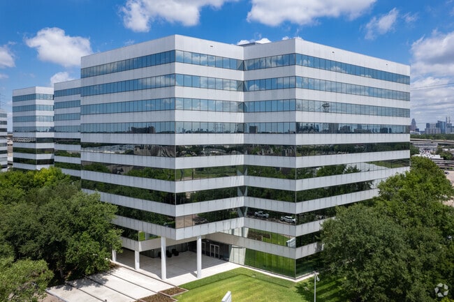


Property Detail
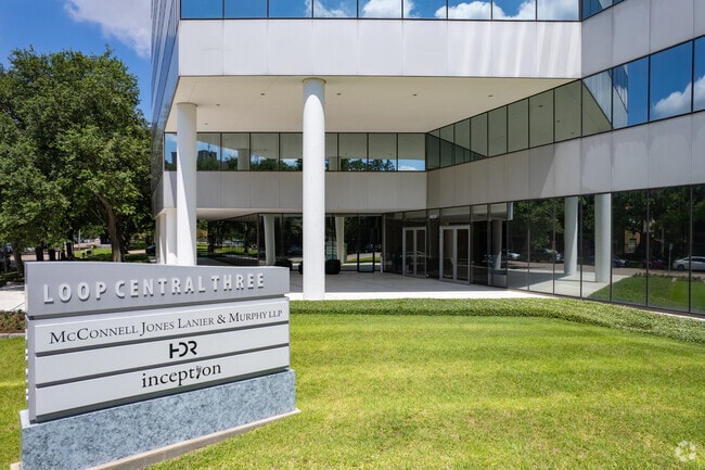
4828 Loop Central Dr
1144290000003
RES A3 LOOP CENTRAL
Officebuilding
HARRIS
B and X Area of moderate flood hazard, usually the area between the limits of the 100-year and 500-year floods.
Texas
2024
2.54 AC
2025
Bellaire
411700
Houston
361,284 SF
Houston-Pasadena-The Woodlands, TX
NEARBY LISTINGS FOR SALE OR LEASE
DEMOGRAPHICS near 4828 Loop Central Dr
1 mile
3 mile
5 mile
2024 Total Population
23,011
242,191
567,756
2029 Population
24,567
260,094
611,259
Pop Growth 2024-2029
+ 6.76%
+ 7.39%
+ 7.66%
Average Age
39
38
38
2024 Total Households
11,946
111,660
264,825
HH Growth 2024-2029
+ 6.89%
+ 7.66%
+ 8.01%
Median Household Inc
$96,452
$83,651
$83,600
Avg Household Size
1.90
2.10
2.10
2024 Avg HH Vehicles
2.00
2.00
2.00
Median Home Value
$750,875
$834,348
$605,451
Median Year Built
1996
1989
1989
Nearby Places
Map Layers
Map Styles
 Street
 Aerial
Transit
 Traffic
 Biking
Places
Listings with unknown addresses are not visible on the map
- Restaurants
- Banks
- Shops
- Fitness
- Groceries
PUBLIC TRANSPORTATION
COMMUTER RAIL
Houston (Sunset Limited - Amtrak)
Drive
Walk
Distance
Houston (Sunset Limited - Amtrak)
13 min
7.2 mi
AIRPORT
William P Hobby
Drive
Walk
Distance
William P Hobby
30 min
16.9 mi
George Bush Intcntl/Houston
Drive
Walk
Distance
George Bush Intcntl/Houston
34 min
27.1 mi
Freight Ports
Port of Houston
Drive
Walk
Distance
Port of Houston
26 min
16.3 mi
SALE & LEASE HISTORY
LISTING DATE
SALE/LEASE

Sep 24, 2016
For Lease
Apr 20, 2017
For Lease
Nearby Properties
Address
Land Use
TOTAL SIZE
Lot Size
Zoning
Address
Land Use
TOTAL SIZE
Lot Size
Zoning
576,253 SF
5.91 AC
Address
Land Use
TOTAL SIZE
Lot Size
Zoning
2,404,389 SF
16.01 AC
Address
Land Use
TOTAL SIZE
Lot Size
Zoning
716,631 SF
7.04 AC
Address
Land Use
TOTAL SIZE
Lot Size
Zoning
2,626,393 SF
6.70 AC
Address
Land Use
TOTAL SIZE
Lot Size
Zoning
1,880,742 SF
20.77 AC
Address
Land Use
TOTAL SIZE
Lot Size
Zoning
580,059 SF
2.48 AC
Address
Land Use
TOTAL SIZE
Lot Size
Zoning
329,832 SF
1.75 AC
Address
Land Use
TOTAL SIZE
Lot Size
Zoning
832,304 SF
6.24 AC
Address
Land Use
TOTAL SIZE
Lot Size
Zoning
1,062,592 SF
7.41 AC
Address
Land Use
TOTAL SIZE
Lot Size
Zoning
1,044,305 SF
3.16 AC
Address
Land Use
TOTAL SIZE
Lot Size
Zoning
608,704 SF
1.52 AC
Address
Land Use
TOTAL SIZE
Lot Size
Zoning
565,276 SF
1.35 AC
Address
Land Use
TOTAL SIZE
Lot Size
Zoning
1,009,859 SF
28.73 AC
Address
Land Use
TOTAL SIZE
Lot Size
Zoning
748,071 SF
4.13 AC
Address
Land Use
TOTAL SIZE
Lot Size
Zoning
771,702 SF
2.51 AC
Address
Land Use
TOTAL SIZE
Lot Size
Zoning
743,548 SF
3.40 AC
Address
Land Use
TOTAL SIZE
Lot Size
Zoning
464,134 SF
3.57 AC
Address
Land Use
TOTAL SIZE
Lot Size
Zoning
576,200 SF
2.65 AC
Address
Land Use
TOTAL SIZE
Lot Size
Zoning
701,043 SF
4.69 AC
Address
Land Use
TOTAL SIZE
Lot Size
Zoning
777,791 SF
47.90 AC
Address
Land Use
TOTAL SIZE
Lot Size
Zoning
612,663 SF
7 AC
Address
Land Use
TOTAL SIZE
Lot Size
Zoning
549,506 SF
2.05 AC
Address
Land Use
TOTAL SIZE
Lot Size
Zoning
958,147 SF
16.60 AC
Address
Land Use
TOTAL SIZE
Lot Size
Zoning
957,961 SF
4.56 AC
Address
Land Use
TOTAL SIZE
Lot Size
Zoning
392,218 SF
1.21 AC
Address
Land Use
TOTAL SIZE
Lot Size
Zoning
616,387 SF
2.58 AC
Address
Land Use
TOTAL SIZE
Lot Size
Zoning
310,967 SF
1.38 AC
Address
Land Use
TOTAL SIZE
Lot Size
Zoning
305,760 SF
2.22 AC
Address
Land Use
TOTAL SIZE
Lot Size
Zoning
444,589 SF
11 AC
Address
Land Use
TOTAL SIZE
Lot Size
Zoning
1,012,117 SF
3.29 AC
The World's #1 Commercial Real Estate Marketplace
Connect with us
© 2026 CoStar Group
The information above has been obtained from sources believed reliable. While we do not doubt its accuracy we have not verified it and make no guarantee, warranty or representation about it. It is your responsibility to independently confirm its accuracy and completeness. Any projections, opinions, assumptions, or estimates used are for example only and do not represent the current or future performance of the property. The value of this transaction to you depends on tax and other factors which should be evaluated by your tax, financial, and legal advisors. You and your advisors should conduct a careful, independent investigation of the property to determine to your satisfaction the suitability of the property for your needs.