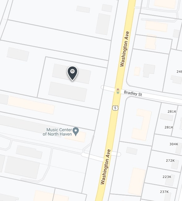
Property Record
483 Washington Ave, North Haven, CT 06473


Property Detail
483 Washington Ave
NRHV-000090-000000-000016
South Central Ct
Industrialgeneral
Connecticut
IL30
16
B and X Area of moderate flood hazard, usually the area between the limits of the 100-year and 500-year floods.
1.39 AC
2025
North Haven
2025
Westchester/So Connecticut
167202
New Haven, CT
NEARBY LISTINGS FOR SALE OR LEASE
-
-
View all North Haven listings for sale on LoopNet.com
DEMOGRAPHICS near 483 Washington Ave
1 mile
3 mile
5 mile
2025 Total Population
2,740
34,560
93,610
2030 Population
2,811
34,972
94,914
Pop Growth 2025-2030
+ 2.59%
+ 1.19%
+ 1.39%
Average Age
46
44
43
2025 Total Households
1,151
13,793
36,533
HH Growth 2025-2030
+ 2.61%
+ 1.13%
+ 1.35%
Median Household Inc
$93,913
$98,486
$102,179
Avg Household Size
2.40
2.40
2.40
2025 Avg HH Vehicles
2.00
2.00
2.00
Median Home Value
$340,078
$356,259
$356,546
Median Year Built
1971
1968
1970
Nearby Places
Map Layers
Map Styles
 Street
 Aerial
Layers
 Traffic
 Biking
Places
Listings with unknown addresses are not visible on the map
- Restaurants
- Banks
- Shops
- Fitness
- Groceries
PUBLIC TRANSPORTATION
COMMUTER RAIL
Drive
Walk
Distance
5 min
3.2 mi
Drive
Walk
Distance
6 min
3.5 mi
AIRPORT
Tweed/New Haven
Drive
Walk
Distance
Tweed/New Haven
23 min
12.0 mi
Freight Ports
Port of New Haven
Drive
Walk
Distance
Port of New Haven
17 min
10.8 mi
Nearby Properties
Address
Land Use
TOTAL SIZE
Lot Size
Zoning
Address
Land Use
TOTAL SIZE
Lot Size
Zoning
100 AC
LO15
Address
Land Use
TOTAL SIZE
Lot Size
Zoning
855,000 SF
142.06 AC
IL80
Address
Land Use
TOTAL SIZE
Lot Size
Zoning
52 AC
R18
Address
Land Use
TOTAL SIZE
Lot Size
Zoning
36,520 SF
4.64 AC
IL30
Address
Land Use
TOTAL SIZE
Lot Size
Zoning
85.08 AC
I40
Address
Land Use
TOTAL SIZE
Lot Size
Zoning
134,029 SF
27.54 AC
R20
Address
Land Use
TOTAL SIZE
Lot Size
Zoning
97,898 SF
11.40 AC
R20
Address
Land Use
TOTAL SIZE
Lot Size
Zoning
10.70 AC
IL30
Address
Land Use
TOTAL SIZE
Lot Size
Zoning
119,658 SF
7.48 AC
O12
Address
Land Use
TOTAL SIZE
Lot Size
Zoning
128,346 SF
15 AC
R18
Address
Land Use
TOTAL SIZE
Lot Size
Zoning
3.84 AC
CB40
Address
Land Use
TOTAL SIZE
Lot Size
Zoning
17,949 SF
8.02 AC
CB40
Address
Land Use
TOTAL SIZE
Lot Size
Zoning
9.80 AC
CA20
Address
Land Use
TOTAL SIZE
Lot Size
Zoning
15,432 SF
5.67 AC
CB40
Address
Land Use
TOTAL SIZE
Lot Size
Zoning
20.01 AC
R20
Address
Land Use
TOTAL SIZE
Lot Size
Zoning
4.45 AC
CB40
Address
Land Use
TOTAL SIZE
Lot Size
Zoning
8.90 AC
CB40
Address
Land Use
TOTAL SIZE
Lot Size
Zoning
91,455 SF
14.20 AC
RU-2
Address
Land Use
TOTAL SIZE
Lot Size
Zoning
7.21 AC
IL30
Address
Land Use
TOTAL SIZE
Lot Size
Zoning
12.36 AC
I40
Address
Land Use
TOTAL SIZE
Lot Size
Zoning
64,827 SF
24.94 AC
R40
Address
Land Use
TOTAL SIZE
Lot Size
Zoning
6.64 AC
CB40
Address
Land Use
TOTAL SIZE
Lot Size
Zoning
60,678 SF
21.50 AC
R40
Address
Land Use
TOTAL SIZE
Lot Size
Zoning
12,876 SF
12.24 AC
CB40
Address
Land Use
TOTAL SIZE
Lot Size
Zoning
88,351 SF
5.77 AC
IL30
Address
Land Use
TOTAL SIZE
Lot Size
Zoning
65,713 SF
15.66 AC
R40
Address
Land Use
TOTAL SIZE
Lot Size
Zoning
56,211 SF
7.15 AC
R20
Address
Land Use
TOTAL SIZE
Lot Size
Zoning
11.09 AC
CA20
Address
Land Use
TOTAL SIZE
Lot Size
Zoning
28.58 AC
DD40
Address
Land Use
TOTAL SIZE
Lot Size
Zoning
46,196 SF
4.24 AC
CB40
The World's #1 Commercial Real Estate Marketplace
Connect with us
© 2026 CoStar Group
The information above has been obtained from sources believed reliable. While we do not doubt its accuracy we have not verified it and make no guarantee, warranty or representation about it. It is your responsibility to independently confirm its accuracy and completeness. Any projections, opinions, assumptions, or estimates used are for example only and do not represent the current or future performance of the property. The value of this transaction to you depends on tax and other factors which should be evaluated by your tax, financial, and legal advisors. You and your advisors should conduct a careful, independent investigation of the property to determine to your satisfaction the suitability of the property for your needs.