Property Record
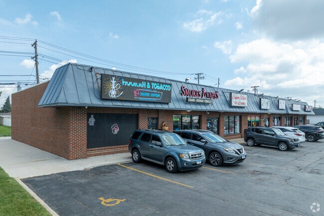
4826 W 79Th St, Burbank, IL 60459

NEARBY LISTINGS FOR SALE OR LEASE
Property Detail
4826 W 79Th St
Chicago-Naperville-Elgin, IL-IN-WI
Loyes 79Th & Cicero
19-28-422-019-0000
JAMES E (LOYES)(79TH) & (CICERO) SUB IN S 2/12 OF S 6 0 ACS OF EH SE SEC 28-38-13
Commercialnec
Cook
X
Illinois
17031C0630J
8,6
2023
0.72 AC
2024
Near South Cook
820902
Chicago
DEMOGRAPHICS near 4826 W 79Th St
1 Mile
3 Mile
5 Mile
2024 Total Population
18,904
193,463
539,796
2029 Population
18,251
185,369
515,603
Pop Growth 2024-2029
(3.45%)
(4.18%)
(4.48%)
Average Age
37
39
39
2024 Total Households
5,756
62,625
181,602
HH Growth 2024-2029
(3.72%)
(4.46%)
(4.69%)
Median Household Inc
$76,738
$67,796
$60,479
Avg Household Size
3.20
3.00
2.90
2024 Avg HH Vehicles
2.00
2.00
2.00
Median Home Value
$219,240
$226,513
$228,790
Median Year Built
1958
1957
1956
Nearby Places
Map Layers
Map Styles
 Street
 Aerial
- Restaurants
- Banks
- Shops
- Fitness
- Groceries
PUBLIC TRANSPORTATION
COMMUTER RAIL
Ashburn Station (SouthWest Service - Northeast Illinois Regional Commuter Railroad (Metra))
DRIVE
WALK
Distance
Ashburn Station (SouthWest Service - Northeast Illinois Regional Commuter Railroad (Metra))
4 min
2.1 mi
Wrightwood Station (SouthWest Service - Northeast Illinois Regional Commuter Railroad (Metra))
DRIVE
WALK
Distance
Wrightwood Station (SouthWest Service - Northeast Illinois Regional Commuter Railroad (Metra))
4 min
2.1 mi
AIRPORT
Chicago Midway International
DRIVE
WALK
Distance
Chicago Midway International
7 min
3.8 mi
Chicago O'Hare International
DRIVE
WALK
Distance
Chicago O'Hare International
41 min
28.3 mi
Freight Ports
Port Milwaukee
DRIVE
WALK
Distance
Port Milwaukee
121 min
93.7 mi
SALE & LEASE HISTORY
LISTING DATE
SALE/LEASE

Apr 19, 2019
For Lease
Nearby Properties
Address
Land Use
TOTAL SIZE
Lot Size
Zoning
Address
Land Use
TOTAL SIZE
Lot Size
Zoning
2,155,128 SF
63.23 AC
PMD13
Address
Land Use
TOTAL SIZE
Lot Size
Zoning
72,090 SF
10.19 AC
Address
Land Use
TOTAL SIZE
Lot Size
Zoning
798,998 SF
B3-2
Address
Land Use
TOTAL SIZE
Lot Size
Zoning
124,324 SF
11.26 AC
Address
Land Use
TOTAL SIZE
Lot Size
Zoning
266,580 SF
29.50 AC
Address
Land Use
TOTAL SIZE
Lot Size
Zoning
240,300 SF
3.72 AC
Address
Land Use
TOTAL SIZE
Lot Size
Zoning
51,762 SF
4 AC
Address
Land Use
TOTAL SIZE
Lot Size
Zoning
292,978 SF
22.31 AC
Address
Land Use
TOTAL SIZE
Lot Size
Zoning
796,454 SF
25.68 AC
PMD13
Address
Land Use
TOTAL SIZE
Lot Size
Zoning
1,615,006 SF
41.91 AC
PMD13
Address
Land Use
TOTAL SIZE
Lot Size
Zoning
139,493 SF
9.06 AC
PD 965
Address
Land Use
TOTAL SIZE
Lot Size
Zoning
134,078 SF
17.31 AC
Address
Land Use
TOTAL SIZE
Lot Size
Zoning
149,902 SF
3.62 AC
Address
Land Use
TOTAL SIZE
Lot Size
Zoning
102,534 SF
3.87 AC
Address
Land Use
TOTAL SIZE
Lot Size
Zoning
148,474 SF
17.68 AC
Address
Land Use
TOTAL SIZE
Lot Size
Zoning
93,438 SF
3.13 AC
Address
Land Use
TOTAL SIZE
Lot Size
Zoning
86,703 SF
3.37 AC
Address
Land Use
TOTAL SIZE
Lot Size
Zoning
28,406 SF
1.42 AC
Address
Land Use
TOTAL SIZE
Lot Size
Zoning
256,416 SF
9.07 AC
Address
Land Use
TOTAL SIZE
Lot Size
Zoning
101,034 SF
1.92 AC
Address
Land Use
TOTAL SIZE
Lot Size
Zoning
Address
Land Use
TOTAL SIZE
Lot Size
Zoning
90,808 SF
3.27 AC
Address
Land Use
TOTAL SIZE
Lot Size
Zoning
470,160 SF
23.66 AC
Address
Land Use
TOTAL SIZE
Lot Size
Zoning
127,197 SF
10.43 AC
Address
Land Use
TOTAL SIZE
Lot Size
Zoning
202,309 SF
13.02 AC
Address
Land Use
TOTAL SIZE
Lot Size
Zoning
45,196 SF
1.28 AC
Address
Land Use
TOTAL SIZE
Lot Size
Zoning
99,900 SF
12.45 AC
PD 1172
Address
Land Use
TOTAL SIZE
Lot Size
Zoning
92,021 SF
Address
Land Use
TOTAL SIZE
Lot Size
Zoning
166,292 SF
5.95 AC
PMD13
Address
Land Use
TOTAL SIZE
Lot Size
Zoning
876,321 SF
19.99 AC
PMD13
The World's #1 Commercial Real Estate Marketplace
Connect with us
© 2025 CoStar Group
The information above has been obtained from sources believed reliable. While we do not doubt its accuracy we have not verified it and make no guarantee, warranty or representation about it. It is your responsibility to independently confirm its accuracy and completeness. Any projections, opinions, assumptions, or estimates used are for example only and do not represent the current or future performance of the property. The value of this transaction to you depends on tax and other factors which should be evaluated by your tax, financial, and legal advisors. You and your advisors should conduct a careful, independent investigation of the property to determine to your satisfaction the suitability of the property for your needs.