Property Record
4830 Knightsbridge Blvd, Columbus, OH 43214


Current Lease Availabilities
NEARBY LISTINGS FOR SALE OR LEASE
Property Detail
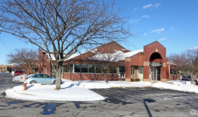
4830 Knightsbridge Blvd
010-074029
United States Military Lands
Medicalbuilding
OLENTANGY RIVER RD R18 T1 1/4T2 4.193 ACRES
X
Franklin
39049C0166K
Ohio
2024
4.19 AC
2024
Bethel Rd
007812
Columbus
35,746 SF
Columbus, OH
DEMOGRAPHICS near 4830 Knightsbridge Blvd
1 Mile
3 Mile
5 Mile
2024 Total Population
13,541
100,947
353,248
2029 Population
13,589
100,581
352,519
Pop Growth 2024-2029
+ 0.35%
(0.36%)
(0.21%)
Average Age
39
40
37
2024 Total Households
6,919
46,968
148,000
HH Growth 2024-2029
+ 0.49%
(0.30%)
(0.24%)
Median Household Inc
$69,926
$76,186
$65,256
Avg Household Size
1.90
2.10
2.20
2024 Avg HH Vehicles
2.00
2.00
2.00
Median Home Value
$321,664
$330,982
$295,006
Median Year Built
1976
1965
1971
Nearby Places
Map Layers
Map Styles
 Street
 Aerial
- Restaurants
- Banks
- Shops
- Fitness
- Groceries
PUBLIC TRANSPORTATION
AIRPORT
John Glenn Columbus International
DRIVE
WALK
Distance
John Glenn Columbus International
22 min
14.6 mi
Rickenbacker International
DRIVE
WALK
Distance
Rickenbacker International
33 min
23.0 mi
Freight Ports
Port of Toledo
DRIVE
WALK
Distance
Port of Toledo
176 min
137.6 mi
Nearby Properties
Address
Land Use
TOTAL SIZE
Lot Size
Zoning
Address
Land Use
TOTAL SIZE
Lot Size
Zoning
3,462,019 SF
54.42 AC
Address
Land Use
TOTAL SIZE
Lot Size
Zoning
182,845 SF
325.61 AC
Address
Land Use
TOTAL SIZE
Lot Size
Zoning
182,845 SF
325.61 AC
Address
Land Use
TOTAL SIZE
Lot Size
Zoning
240,144 SF
45.78 AC
Address
Land Use
TOTAL SIZE
Lot Size
Zoning
133,425 SF
20.51 AC
Address
Land Use
TOTAL SIZE
Lot Size
Zoning
260,092 SF
29.05 AC
Address
Land Use
TOTAL SIZE
Lot Size
Zoning
344,669 SF
8.45 AC
Address
Land Use
TOTAL SIZE
Lot Size
Zoning
517,875 SF
3.07 AC
Address
Land Use
TOTAL SIZE
Lot Size
Zoning
320,155 SF
84.68 AC
Address
Land Use
TOTAL SIZE
Lot Size
Zoning
234,504 SF
5.40 AC
Address
Land Use
TOTAL SIZE
Lot Size
Zoning
561,921 SF
6.81 AC
Address
Land Use
TOTAL SIZE
Lot Size
Zoning
265,341 SF
19.35 AC
Address
Land Use
TOTAL SIZE
Lot Size
Zoning
286,169 SF
11.08 AC
Address
Land Use
TOTAL SIZE
Lot Size
Zoning
438,301 SF
26.10 AC
Address
Land Use
TOTAL SIZE
Lot Size
Zoning
273,578 SF
0.94 AC
Address
Land Use
TOTAL SIZE
Lot Size
Zoning
425,872 SF
10.05 AC
Address
Land Use
TOTAL SIZE
Lot Size
Zoning
244,602 SF
27.30 AC
Address
Land Use
TOTAL SIZE
Lot Size
Zoning
254,059 SF
6.94 AC
Address
Land Use
TOTAL SIZE
Lot Size
Zoning
101,650 SF
5.07 AC
Address
Land Use
TOTAL SIZE
Lot Size
Zoning
397,193 SF
20.74 AC
Address
Land Use
TOTAL SIZE
Lot Size
Zoning
115,392 SF
25 AC
Address
Land Use
TOTAL SIZE
Lot Size
Zoning
273,112 SF
13.97 AC
Address
Land Use
TOTAL SIZE
Lot Size
Zoning
162,408 SF
1.73 AC
Address
Land Use
TOTAL SIZE
Lot Size
Zoning
86,934 SF
8.80 AC
Address
Land Use
TOTAL SIZE
Lot Size
Zoning
147,582 SF
5.75 AC
Address
Land Use
TOTAL SIZE
Lot Size
Zoning
170,237 SF
97.38 AC
Address
Land Use
TOTAL SIZE
Lot Size
Zoning
157,919 SF
13.18 AC
Address
Land Use
TOTAL SIZE
Lot Size
Zoning
131,040 SF
2.50 AC
Address
Land Use
TOTAL SIZE
Lot Size
Zoning
150,468 SF
24.57 AC
Address
Land Use
TOTAL SIZE
Lot Size
Zoning
138,100 SF
8.38 AC
The World's #1 Commercial Real Estate Marketplace
Connect with us
© 2025 CoStar Group
The information above has been obtained from sources believed reliable. While we do not doubt its accuracy we have not verified it and make no guarantee, warranty or representation about it. It is your responsibility to independently confirm its accuracy and completeness. Any projections, opinions, assumptions, or estimates used are for example only and do not represent the current or future performance of the property. The value of this transaction to you depends on tax and other factors which should be evaluated by your tax, financial, and legal advisors. You and your advisors should conduct a careful, independent investigation of the property to determine to your satisfaction the suitability of the property for your needs.