Property Record
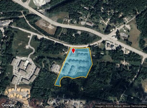
4832 Ruby Red Dr, Ooltewah, TN 37363
NEARBY LISTINGS FOR SALE OR LEASE
-
-
View all Ooltewah listings for sale on LoopNet.com
Property Detail
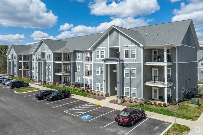
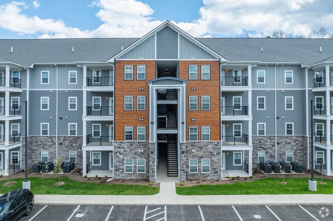
4832 Ruby Red Dr
Chattanooga, TN-GA
Summit Pointe Apartments
140-011
LT 1 THE JEWEL AT SUMMIT POINTE PB 47 PG 82 REV 119-165 REV 120-129 256 UNITS
Multifamilydwelling
Hamilton
X
Tennessee
47065C0378G
1
2024
13.33 AC
2024
Collegedale
011311
Chattanooga
287,820 SF
DEMOGRAPHICS near 4832 Ruby Red Dr
1 Mile
3 Mile
5 Mile
2024 Total Population
4,092
30,341
82,014
2029 Population
4,445
32,186
87,292
Pop Growth 2024-2029
+ 8.63%
+ 6.08%
+ 6.44%
Average Age
38
42
41
2024 Total Households
1,567
11,420
31,527
HH Growth 2024-2029
+ 8.36%
+ 6.27%
+ 6.63%
Median Household Inc
$65,901
$78,097
$80,105
Avg Household Size
2.50
2.50
2.50
2024 Avg HH Vehicles
2.00
2.00
2.00
Median Home Value
$212,547
$269,386
$262,439
Median Year Built
2002
1995
1992
Nearby Places
Map Layers
Map Styles
 Street
 Aerial
- Restaurants
- Banks
- Shops
- Fitness
- Groceries
PUBLIC TRANSPORTATION
AIRPORT
Lovell Field
DRIVE
WALK
Distance
Lovell Field
18 min
9.2 mi
Nearby Properties
Address
Land Use
TOTAL SIZE
Lot Size
Zoning
Address
Land Use
TOTAL SIZE
Lot Size
Zoning
2,025,141 SF
1,096 AC
M1
Address
Land Use
TOTAL SIZE
Lot Size
Zoning
0.53 AC
M1
Address
Land Use
TOTAL SIZE
Lot Size
Zoning
213,416 SF
56.75 AC
Address
Land Use
TOTAL SIZE
Lot Size
Zoning
1,015,861 SF
83.82 AC
M1
Address
Land Use
TOTAL SIZE
Lot Size
Zoning
242,788 SF
27 AC
Address
Land Use
TOTAL SIZE
Lot Size
Zoning
333,801 SF
15.44 AC
C2
Address
Land Use
TOTAL SIZE
Lot Size
Zoning
337,464 SF
21.82 AC
A
Address
Land Use
TOTAL SIZE
Lot Size
Zoning
320,068 SF
42.83 AC
R4
Address
Land Use
TOTAL SIZE
Lot Size
Zoning
319,975 SF
20.51 AC
Address
Land Use
TOTAL SIZE
Lot Size
Zoning
102,382 SF
29.80 AC
M2
Address
Land Use
TOTAL SIZE
Lot Size
Zoning
60,561 SF
M2
Address
Land Use
TOTAL SIZE
Lot Size
Zoning
237,764 SF
60.56 AC
Address
Land Use
TOTAL SIZE
Lot Size
Zoning
276,677 SF
20.13 AC
R4
Address
Land Use
TOTAL SIZE
Lot Size
Zoning
250,284 SF
16.45 AC
Address
Land Use
TOTAL SIZE
Lot Size
Zoning
91,460 SF
Address
Land Use
TOTAL SIZE
Lot Size
Zoning
254,362 SF
14.41 AC
R4
Address
Land Use
TOTAL SIZE
Lot Size
Zoning
223,968 SF
16.33 AC
Address
Land Use
TOTAL SIZE
Lot Size
Zoning
95,048 SF
14 AC
A
Address
Land Use
TOTAL SIZE
Lot Size
Zoning
2,460 SF
15.30 AC
R3
Address
Land Use
TOTAL SIZE
Lot Size
Zoning
253,440 SF
27.23 AC
A
Address
Land Use
TOTAL SIZE
Lot Size
Zoning
49,857 SF
1.93 AC
R1
Address
Land Use
TOTAL SIZE
Lot Size
Zoning
8,557 SF
14.30 AC
R2
Address
Land Use
TOTAL SIZE
Lot Size
Zoning
353,653 SF
25.90 AC
M1
Address
Land Use
TOTAL SIZE
Lot Size
Zoning
183,036 SF
11.49 AC
R4
Address
Land Use
TOTAL SIZE
Lot Size
Zoning
156,170 SF
6.60 AC
M1
Address
Land Use
TOTAL SIZE
Lot Size
Zoning
216,335 SF
27.21 AC
C2
Address
Land Use
TOTAL SIZE
Lot Size
Zoning
181,036 SF
6.27 AC
R3
Address
Land Use
TOTAL SIZE
Lot Size
Zoning
79,101 SF
8.53 AC
C2
Address
Land Use
TOTAL SIZE
Lot Size
Zoning
38,242 SF
4.30 AC
C2
The World's #1 Commercial Real Estate Marketplace
Connect with us
© 2025 CoStar Group
The information above has been obtained from sources believed reliable. While we do not doubt its accuracy we have not verified it and make no guarantee, warranty or representation about it. It is your responsibility to independently confirm its accuracy and completeness. Any projections, opinions, assumptions, or estimates used are for example only and do not represent the current or future performance of the property. The value of this transaction to you depends on tax and other factors which should be evaluated by your tax, financial, and legal advisors. You and your advisors should conduct a careful, independent investigation of the property to determine to your satisfaction the suitability of the property for your needs.