Property Record
4835 Decatur Blvd, Indianapolis, IN 46241


NEARBY LISTINGS FOR SALE OR LEASE
Property Detail
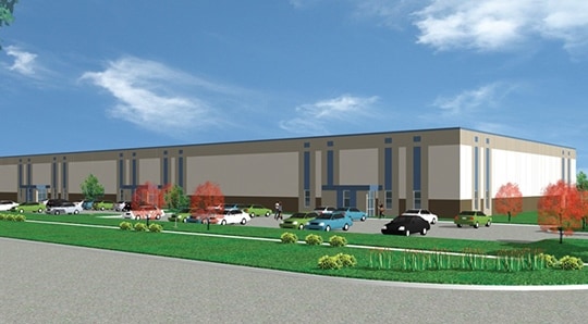
4835 Decatur Blvd
49-12-35-107-020.000-200
PT SE1/4 SW1/4 S35 T15 R2 264 & 721.68 W SE COR P.O.B. W103.32 NE94.28 NW476.26 NE783.23 SE499.93 SW755.67 S68.77 TO BEG 9.089 AC
Warehouse
Marion
X
Indiana
18097C0209F
9.09 AC
2023
Airport
2024
Indianapolis
390802
Indianapolis-Carmel-Anderson, IN
104,379 SF
DEMOGRAPHICS near 4835 Decatur Blvd
1 Mile
3 Mile
5 Mile
2024 Total Population
4,692
27,300
84,608
2029 Population
4,642
26,817
84,899
Pop Growth 2024-2029
(1.07%)
(1.77%)
+ 0.34%
Average Age
33
36
36
2024 Total Households
1,611
9,843
30,712
HH Growth 2024-2029
(1.24%)
(1.85%)
+ 0.47%
Median Household Inc
$59,625
$66,473
$63,564
Avg Household Size
2.80
2.70
2.70
2024 Avg HH Vehicles
2.00
2.00
2.00
Median Home Value
$158,447
$154,587
$155,346
Median Year Built
1995
1985
1987
Nearby Places
Map Layers
Map Styles
 Street
 Aerial
- Restaurants
- Banks
- Shops
- Fitness
- Groceries
PUBLIC TRANSPORTATION
COMMUTER RAIL
Indianapolis (Cardinal - Amtrak)
DRIVE
WALK
Distance
Indianapolis (Cardinal - Amtrak)
16 min
9.0 mi
AIRPORT
Indianapolis International
DRIVE
WALK
Distance
Indianapolis International
15 min
6.4 mi
Freight Ports
Port of Toledo
DRIVE
WALK
Distance
Port of Toledo
286 min
235.5 mi
SALE & LEASE HISTORY
LISTING DATE
SALE/LEASE

Sep 24, 2016
For Sale
Mar 28, 2017
For Sale
Nearby Properties
Address
Land Use
TOTAL SIZE
Lot Size
Zoning
Address
Land Use
TOTAL SIZE
Lot Size
Zoning
911,062 SF
54.40 AC
ZO01
Address
Land Use
TOTAL SIZE
Lot Size
Zoning
41.50 AC
Address
Land Use
TOTAL SIZE
Lot Size
Zoning
770,712 SF
56.53 AC
Address
Land Use
TOTAL SIZE
Lot Size
Zoning
665,724 SF
47.25 AC
ZO01
Address
Land Use
TOTAL SIZE
Lot Size
Zoning
798,160 SF
44.46 AC
ZO01
Address
Land Use
TOTAL SIZE
Lot Size
Zoning
997,763 SF
65.80 AC
ZO01
Address
Land Use
TOTAL SIZE
Lot Size
Zoning
695,702 SF
39.68 AC
ZO03
Address
Land Use
TOTAL SIZE
Lot Size
Zoning
462,275 SF
25.83 AC
ZO01
Address
Land Use
TOTAL SIZE
Lot Size
Zoning
7,028 SF
25.48 AC
ZO01
Address
Land Use
TOTAL SIZE
Lot Size
Zoning
434,240 SF
26.25 AC
ZO01
Address
Land Use
TOTAL SIZE
Lot Size
Zoning
9,750 SF
43.46 AC
ZO01
Address
Land Use
TOTAL SIZE
Lot Size
Zoning
423,757 SF
28.71 AC
Address
Land Use
TOTAL SIZE
Lot Size
Zoning
23.17 AC
Address
Land Use
TOTAL SIZE
Lot Size
Zoning
366,600 SF
29.05 AC
ZO01
Address
Land Use
TOTAL SIZE
Lot Size
Zoning
328,331 SF
39.63 AC
ZO01
Address
Land Use
TOTAL SIZE
Lot Size
Zoning
49,008 SF
4.80 AC
ZO01
Address
Land Use
TOTAL SIZE
Lot Size
Zoning
3,394 SF
25.27 AC
ZO01
Address
Land Use
TOTAL SIZE
Lot Size
Zoning
133,706 SF
83.24 AC
ZO01
Address
Land Use
TOTAL SIZE
Lot Size
Zoning
14.31 AC
Address
Land Use
TOTAL SIZE
Lot Size
Zoning
228,839 SF
27.60 AC
ZO01
Address
Land Use
TOTAL SIZE
Lot Size
Zoning
12,880 SF
42.54 AC
ZO01
Address
Land Use
TOTAL SIZE
Lot Size
Zoning
264,960 SF
16.85 AC
ZO01
Address
Land Use
TOTAL SIZE
Lot Size
Zoning
129,490 SF
27.92 AC
ZO01
Address
Land Use
TOTAL SIZE
Lot Size
Zoning
368,160 SF
26.50 AC
ZO01
Address
Land Use
TOTAL SIZE
Lot Size
Zoning
220,000 SF
15.63 AC
Address
Land Use
TOTAL SIZE
Lot Size
Zoning
561,652 SF
30.56 AC
ZO01
Address
Land Use
TOTAL SIZE
Lot Size
Zoning
3,815 SF
30.37 AC
ZO01
Address
Land Use
TOTAL SIZE
Lot Size
Zoning
246,646 SF
16.96 AC
ZO01
Address
Land Use
TOTAL SIZE
Lot Size
Zoning
187,200 SF
13.05 AC
Address
Land Use
TOTAL SIZE
Lot Size
Zoning
20,143 SF
17.10 AC
ZO01
The World's #1 Commercial Real Estate Marketplace
Connect with us
© 2026 CoStar Group
The information above has been obtained from sources believed reliable. While we do not doubt its accuracy we have not verified it and make no guarantee, warranty or representation about it. It is your responsibility to independently confirm its accuracy and completeness. Any projections, opinions, assumptions, or estimates used are for example only and do not represent the current or future performance of the property. The value of this transaction to you depends on tax and other factors which should be evaluated by your tax, financial, and legal advisors. You and your advisors should conduct a careful, independent investigation of the property to determine to your satisfaction the suitability of the property for your needs.