Property Record
484 137Th Avenue Cir, Madeira Beach, FL 33708
NEARBY LISTINGS FOR SALE OR LEASE
-
-
View all Madeira Beach listings for sale on LoopNet.com
Property Detail
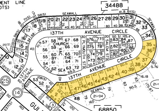
484 137Th Avenue Cir
Tampa-St. Petersburg-Clearwater, FL
Pierce Replat
15-31-15-68850-000-0010
GULF SHORES HARBOR SUB LOT 35 AND PART OF LOT 36 DESC AS COM NE COR OF LOT 39 TH CUR LT RAD 94.38FT ARC 96FT CB N42D1805E 89.25FT FOR POB TH CUR LT RAD 94.38FT ARC 39.04FT CB N02D1406E 38.76FT TH N80D2307E 75FT TH CUR RT RAD 169.38FT ARC 70.06FT CB S
Residentialacreage
Pinellas
AE
Florida
12103C0191H
35
2024
0.11 AC
2025
South Pinellas
027802
Tampa/St Petersburg
DEMOGRAPHICS near 484 137Th Avenue Cir
1 mile
3 mile
5 mile
2024 Total Population
5,259
39,205
147,086
2029 Population
5,570
40,076
148,860
Pop Growth 2024-2029
+ 5.91%
+ 2.22%
+ 1.21%
Average Age
54
52
49
2024 Total Households
2,895
19,799
70,019
HH Growth 2024-2029
+ 5.84%
+ 2.24%
+ 1.32%
Median Household Inc
$68,127
$70,031
$67,030
Avg Household Size
1.80
1.90
2.00
2024 Avg HH Vehicles
2.00
2.00
2.00
Median Home Value
$533,206
$383,305
$315,318
Median Year Built
1971
1971
1972
Nearby Places
Map Layers
Map Styles
 Street
 Aerial
Transit
 Traffic
 Biking
Places
Listings with unknown addresses are not visible on the map
- Restaurants
- Banks
- Shops
- Fitness
- Groceries
PUBLIC TRANSPORTATION
AIRPORT
St Pete-Clearwater International
Drive
Walk
Distance
St Pete-Clearwater International
35 min
16.1 mi
Tampa International
Drive
Walk
Distance
Tampa International
45 min
26.9 mi
Freight Ports
Port Manatee
Drive
Walk
Distance
Port Manatee
50 min
31.7 mi
Nearby Properties
Address
Land Use
TOTAL SIZE
Lot Size
Zoning
Address
Land Use
TOTAL SIZE
Lot Size
Zoning
2,167,184 SF
297.75 AC
PSP
Address
Land Use
TOTAL SIZE
Lot Size
Zoning
453,486 SF
15.73 AC
Address
Land Use
TOTAL SIZE
Lot Size
Zoning
328,466 SF
18.81 AC
Address
Land Use
TOTAL SIZE
Lot Size
Zoning
101,642 SF
1.43 AC
Address
Land Use
TOTAL SIZE
Lot Size
Zoning
150,235 SF
17.90 AC
Address
Land Use
TOTAL SIZE
Lot Size
Zoning
156,994 SF
29.11 AC
Address
Land Use
TOTAL SIZE
Lot Size
Zoning
142,281 SF
1.57 AC
Address
Land Use
TOTAL SIZE
Lot Size
Zoning
29,644 SF
19.13 AC
Address
Land Use
TOTAL SIZE
Lot Size
Zoning
145,619 SF
1.68 AC
Address
Land Use
TOTAL SIZE
Lot Size
Zoning
160,086 SF
1.18 AC
Address
Land Use
TOTAL SIZE
Lot Size
Zoning
204,891 SF
18.20 AC
Address
Land Use
TOTAL SIZE
Lot Size
Zoning
4,704 SF
3.36 AC
Address
Land Use
TOTAL SIZE
Lot Size
Zoning
176,209 SF
27.52 AC
Address
Land Use
TOTAL SIZE
Lot Size
Zoning
151,421 SF
1.86 AC
Address
Land Use
TOTAL SIZE
Lot Size
Zoning
49,898 SF
77.25 AC
Address
Land Use
TOTAL SIZE
Lot Size
Zoning
11,717 SF
28.71 AC
Address
Land Use
TOTAL SIZE
Lot Size
Zoning
84,008 SF
1.49 AC
Address
Land Use
TOTAL SIZE
Lot Size
Zoning
151,149 SF
8.84 AC
RM15
Address
Land Use
TOTAL SIZE
Lot Size
Zoning
6,531 SF
357.94 AC
PC
Address
Land Use
TOTAL SIZE
Lot Size
Zoning
Address
Land Use
TOTAL SIZE
Lot Size
Zoning
132,714 SF
14.83 AC
UZ
Address
Land Use
TOTAL SIZE
Lot Size
Zoning
15,405 SF
31.79 AC
CR
Address
Land Use
TOTAL SIZE
Lot Size
Zoning
5,590 SF
6.38 AC
Address
Land Use
TOTAL SIZE
Lot Size
Zoning
139,181 SF
22.21 AC
R2
Address
Land Use
TOTAL SIZE
Lot Size
Zoning
57,532 SF
6.96 AC
Address
Land Use
TOTAL SIZE
Lot Size
Zoning
68,675 SF
2.07 AC
Address
Land Use
TOTAL SIZE
Lot Size
Zoning
64,888 SF
1.39 AC
Address
Land Use
TOTAL SIZE
Lot Size
Zoning
23,571 SF
55.32 AC
PSP
Address
Land Use
TOTAL SIZE
Lot Size
Zoning
83,103 SF
12.59 AC
AE
Address
Land Use
TOTAL SIZE
Lot Size
Zoning
26,682 SF
1.26 AC
The World's #1 Commercial Real Estate Marketplace
Connect with us
© 2026 CoStar Group
The information above has been obtained from sources believed reliable. While we do not doubt its accuracy we have not verified it and make no guarantee, warranty or representation about it. It is your responsibility to independently confirm its accuracy and completeness. Any projections, opinions, assumptions, or estimates used are for example only and do not represent the current or future performance of the property. The value of this transaction to you depends on tax and other factors which should be evaluated by your tax, financial, and legal advisors. You and your advisors should conduct a careful, independent investigation of the property to determine to your satisfaction the suitability of the property for your needs.