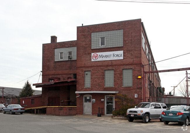
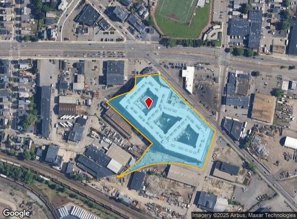
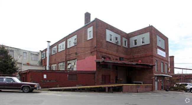
Property Record
474 2Nd St, Everett, MA 02149

NEARBY LISTINGS FOR SALE OR LEASE
Property Detail
474 2Nd St
EVER-000000-K000007-000088
Middlesex
Apartment
Massachusetts
AE
88
25017C0443F
4.68 AC
2025
Somerville/Chelsea
2025
Boston
342402
Boston-Cambridge-Newton, MA-NH
410,642 SF
DEMOGRAPHICS near 474 2Nd St
1 Mile
3 Mile
5 Mile
2024 Total Population
36,362
348,049
788,981
2029 Population
34,948
334,358
764,338
Pop Growth 2024-2029
(3.89%)
(3.93%)
(3.12%)
Average Age
37
38
38
2024 Total Households
13,140
141,673
328,940
HH Growth 2024-2029
(3.95%)
(3.94%)
(3.23%)
Median Household Inc
$77,085
$87,869
$96,988
Avg Household Size
2.70
2.40
2.20
2024 Avg HH Vehicles
1.00
1.00
1.00
Median Home Value
$593,536
$672,941
$749,429
Median Year Built
1948
1949
1949
Nearby Places
Map Layers
Map Styles
 Street
 Aerial
- Restaurants
- Banks
- Shops
- Fitness
- Groceries
PUBLIC TRANSPORTATION
COMMUTER RAIL
DRIVE
WALK
Distance
3 min
15 min
0.8 mi
Malden Center (Haverhill Line - Massachusetts Bay Transportation Authority Commuter Rail (Purple Line))
DRIVE
WALK
Distance
Malden Center (Haverhill Line - Massachusetts Bay Transportation Authority Commuter Rail (Purple Line))
5 min
2.6 mi
AIRPORT
General Edward Lawrence Logan International
DRIVE
WALK
Distance
General Edward Lawrence Logan International
10 min
4.1 mi
Freight Ports
Port of Boston
DRIVE
WALK
Distance
Port of Boston
14 min
7.2 mi
Nearby Properties
Address
Land Use
TOTAL SIZE
Lot Size
Zoning
Address
Land Use
TOTAL SIZE
Lot Size
Zoning
6.39 AC
C
Address
Land Use
TOTAL SIZE
Lot Size
Zoning
171,791 SF
166.88 AC
E
Address
Land Use
TOTAL SIZE
Lot Size
Zoning
1.13 AC
C
Address
Land Use
TOTAL SIZE
Lot Size
Zoning
646,546 SF
89.28 AC
ROD
Address
Land Use
TOTAL SIZE
Lot Size
Zoning
386,825 SF
10.67 AC
Address
Land Use
TOTAL SIZE
Lot Size
Zoning
6.14 AC
C
Address
Land Use
TOTAL SIZE
Lot Size
Zoning
526,171 SF
8.39 AC
A
Address
Land Use
TOTAL SIZE
Lot Size
Zoning
569,990 SF
0.46 AC
HR
Address
Land Use
TOTAL SIZE
Lot Size
Zoning
282,112 SF
2.51 AC
IA-1
Address
Land Use
TOTAL SIZE
Lot Size
Zoning
230,544 SF
2.25 AC
E
Address
Land Use
TOTAL SIZE
Lot Size
Zoning
43.90 AC
Address
Land Use
TOTAL SIZE
Lot Size
Zoning
234,450 SF
3.49 AC
I
Address
Land Use
TOTAL SIZE
Lot Size
Zoning
269,994 SF
2.88 AC
Address
Land Use
TOTAL SIZE
Lot Size
Zoning
297,396 SF
2.79 AC
CTED
Address
Land Use
TOTAL SIZE
Lot Size
Zoning
424,000 SF
2.63 AC
RC
Address
Land Use
TOTAL SIZE
Lot Size
Zoning
248,000 SF
0.58 AC
C
Address
Land Use
TOTAL SIZE
Lot Size
Zoning
241,400 SF
0.57 AC
C
Address
Land Use
TOTAL SIZE
Lot Size
Zoning
378,339 SF
3.02 AC
E
Address
Land Use
TOTAL SIZE
Lot Size
Zoning
Address
Land Use
TOTAL SIZE
Lot Size
Zoning
223,214 SF
1.01 AC
E
Address
Land Use
TOTAL SIZE
Lot Size
Zoning
236,000 SF
0.84 AC
C
Address
Land Use
TOTAL SIZE
Lot Size
Zoning
755,000 SF
3.36 AC
C
Address
Land Use
TOTAL SIZE
Lot Size
Zoning
365,569 SF
4.81 AC
C
Address
Land Use
TOTAL SIZE
Lot Size
Zoning
145,000 SF
0.69 AC
C
Address
Land Use
TOTAL SIZE
Lot Size
Zoning
156,684 SF
1.15 AC
PUD-6
Address
Land Use
TOTAL SIZE
Lot Size
Zoning
324,870 SF
9.37 AC
E
Address
Land Use
TOTAL SIZE
Lot Size
Zoning
339,600 SF
23.09 AC
CIV
Address
Land Use
TOTAL SIZE
Lot Size
Zoning
254,075 SF
3.70 AC
Address
Land Use
TOTAL SIZE
Lot Size
Zoning
613,125 SF
15.74 AC
RC
The World's #1 Commercial Real Estate Marketplace
Connect with us
© 2025 CoStar Group
The information above has been obtained from sources believed reliable. While we do not doubt its accuracy we have not verified it and make no guarantee, warranty or representation about it. It is your responsibility to independently confirm its accuracy and completeness. Any projections, opinions, assumptions, or estimates used are for example only and do not represent the current or future performance of the property. The value of this transaction to you depends on tax and other factors which should be evaluated by your tax, financial, and legal advisors. You and your advisors should conduct a careful, independent investigation of the property to determine to your satisfaction the suitability of the property for your needs.