Property Record
484 N Main St, Seneca, IL 61360
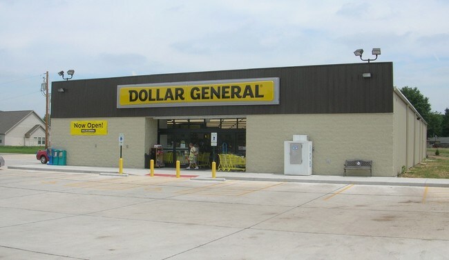

Property Detail
484 N Main St
Ottawa, IL
TOWN OF CROTTY, LTS 7, 8 & 9 BLK 8, LT 15 LYG E OF RT 170, LT 16 & PT LT 1 BLK 7 AS DESC DOC 2016-15284 &ALLCROTTYAVELYGBTWN
24-24-109022
La Salle
Commercialnec
Illinois
AE The base floodplain where base flood elevations are provided. AE Zones are now used on new format FIRMs instead of A1-A30 Zones.
7-1
2024
0.97 AC
2025
I-39 Corr/LaSalle County
962400
Chicago
10,760 SF
NEARBY LISTINGS FOR SALE OR LEASE
-
-
View all Seneca listings for sale on LoopNet.com
DEMOGRAPHICS near 484 N Main St
1 mile
3 mile
5 mile
2025 Total Population
1,828
3,511
7,045
2030 Population
1,832
3,500
7,008
Pop Growth 2025-2030
+ 0.22%
(0.31%)
(0.53%)
Average Age
40
41
41
2025 Total Households
675
1,335
2,788
HH Growth 2025-2030
+ 0.30%
(0.37%)
(0.57%)
Median Household Inc
$94,705
$91,853
$78,398
Avg Household Size
2.60
2.60
2.50
2025 Avg HH Vehicles
2.00
2.00
2.00
Median Home Value
$214,136
$235,937
$191,017
Median Year Built
1978
1981
1975
Nearby Places
Map Layers
Map Styles
 Street
 Aerial
Layers
 Traffic
 Biking
Places
Listings with unknown addresses are not visible on the map
- Restaurants
- Banks
- Shops
- Fitness
- Groceries
SALE & LEASE HISTORY
LISTING DATE
SALE/LEASE

Oct 13, 2016
For Sale
Nearby Properties
Address
Land Use
TOTAL SIZE
Lot Size
Zoning
Address
Land Use
TOTAL SIZE
Lot Size
Zoning
20.74 AC
Address
Land Use
TOTAL SIZE
Lot Size
Zoning
31,417 SF
12.46 AC
Address
Land Use
TOTAL SIZE
Lot Size
Zoning
226 SF
53.10 AC
Address
Land Use
TOTAL SIZE
Lot Size
Zoning
7,710 SF
17.28 AC
Address
Land Use
TOTAL SIZE
Lot Size
Zoning
4,350 SF
170.54 AC
Address
Land Use
TOTAL SIZE
Lot Size
Zoning
173.44 AC
Address
Land Use
TOTAL SIZE
Lot Size
Zoning
100 SF
159.50 AC
Address
Land Use
TOTAL SIZE
Lot Size
Zoning
157.88 AC
Address
Land Use
TOTAL SIZE
Lot Size
Zoning
124.04 AC
Address
Land Use
TOTAL SIZE
Lot Size
Zoning
36,000 SF
33.99 AC
Address
Land Use
TOTAL SIZE
Lot Size
Zoning
4,320 SF
11.54 AC
Address
Land Use
TOTAL SIZE
Lot Size
Zoning
7.45 AC
Address
Land Use
TOTAL SIZE
Lot Size
Zoning
3,114 SF
80.96 AC
Address
Land Use
TOTAL SIZE
Lot Size
Zoning
3,544 SF
80 AC
Address
Land Use
TOTAL SIZE
Lot Size
Zoning
79.76 AC
Address
Land Use
TOTAL SIZE
Lot Size
Zoning
2,120 SF
66.99 AC
Address
Land Use
TOTAL SIZE
Lot Size
Zoning
5,940 SF
0.92 AC
Address
Land Use
TOTAL SIZE
Lot Size
Zoning
3,444 SF
5.18 AC
Address
Land Use
TOTAL SIZE
Lot Size
Zoning
1,650 SF
30.28 AC
Address
Land Use
TOTAL SIZE
Lot Size
Zoning
1,384 SF
6 AC
Address
Land Use
TOTAL SIZE
Lot Size
Zoning
1,560 SF
8.87 AC
Address
Land Use
TOTAL SIZE
Lot Size
Zoning
27.51 AC
Address
Land Use
TOTAL SIZE
Lot Size
Zoning
38.94 AC
Address
Land Use
TOTAL SIZE
Lot Size
Zoning
30,000 SF
20.71 AC
Address
Land Use
TOTAL SIZE
Lot Size
Zoning
34.34 AC
Address
Land Use
TOTAL SIZE
Lot Size
Zoning
2,056 SF
39.89 AC
Address
Land Use
TOTAL SIZE
Lot Size
Zoning
1,414 SF
3.28 AC
Address
Land Use
TOTAL SIZE
Lot Size
Zoning
24,000 SF
26 AC
Address
Land Use
TOTAL SIZE
Lot Size
Zoning
3,600 SF
38.03 AC
The World's #1 Commercial Real Estate Marketplace
Connect with us
© 2026 CoStar Group
The information above has been obtained from sources believed reliable. While we do not doubt its accuracy we have not verified it and make no guarantee, warranty or representation about it. It is your responsibility to independently confirm its accuracy and completeness. Any projections, opinions, assumptions, or estimates used are for example only and do not represent the current or future performance of the property. The value of this transaction to you depends on tax and other factors which should be evaluated by your tax, financial, and legal advisors. You and your advisors should conduct a careful, independent investigation of the property to determine to your satisfaction the suitability of the property for your needs.