Property Record
4843 Airport Rd, Redding, CA 96002

This Property Is For Sale
NEARBY LISTINGS FOR SALE OR LEASE
-
-
No Photo
-
-
-
-
-
-
View all Redding listings for sale on LoopNet.com
Property Detail
4843 Airport Rd
Redding, CA
Airport Ranchos
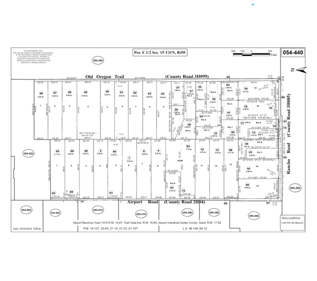
054-440-058-000
Shasta
Residentialnec
California
X
14,15
06089C1570H
5.11 AC
2024
Redding/Chico
2025
Other Market Areas
011401
DEMOGRAPHICS near 4843 Airport Rd
1 Mile
3 Mile
5 Mile
2024 Total Population
1,470
23,527
67,604
2029 Population
1,481
23,486
67,343
Pop Growth 2024-2029
+ 0.75%
(0.17%)
(0.39%)
Average Age
44
40
41
2024 Total Households
543
8,696
26,105
HH Growth 2024-2029
+ 0.92%
(0.16%)
(0.37%)
Median Household Inc
$100,421
$78,520
$67,403
Avg Household Size
2.60
2.60
2.50
2024 Avg HH Vehicles
2.00
2.00
2.00
Median Home Value
$498,871
$377,904
$348,921
Median Year Built
1998
1983
1980
Nearby Places
Map Layers
Map Styles
 Street
 Aerial
- Restaurants
- Banks
- Shops
- Fitness
- Groceries
PUBLIC TRANSPORTATION
COMMUTER RAIL
Redding Amtrak (Coast Starlight - Amtrak)
DRIVE
WALK
Distance
Redding Amtrak (Coast Starlight - Amtrak)
12 min
8.3 mi
AIRPORT
Redding Regional
DRIVE
WALK
Distance
Redding Regional
5 min
2.6 mi
Freight Ports
Port of Richmond
DRIVE
WALK
Distance
Port of Richmond
229 min
200.7 mi
Nearby Properties
Address
Land Use
TOTAL SIZE
Lot Size
Zoning
Address
Land Use
TOTAL SIZE
Lot Size
Zoning
151,773 SF
17.64 AC
Address
Land Use
TOTAL SIZE
Lot Size
Zoning
97,213 SF
7.94 AC
Address
Land Use
TOTAL SIZE
Lot Size
Zoning
73,000 SF
4.40 AC
Address
Land Use
TOTAL SIZE
Lot Size
Zoning
55,697 SF
5.08 AC
Address
Land Use
TOTAL SIZE
Lot Size
Zoning
81,800 SF
14.81 AC
Address
Land Use
TOTAL SIZE
Lot Size
Zoning
50,251 SF
4.06 AC
Address
Land Use
TOTAL SIZE
Lot Size
Zoning
11.90 AC
Address
Land Use
TOTAL SIZE
Lot Size
Zoning
10.28 AC
Address
Land Use
TOTAL SIZE
Lot Size
Zoning
90,832 SF
12.44 AC
C-2
Address
Land Use
TOTAL SIZE
Lot Size
Zoning
86,744 SF
9.25 AC
Address
Land Use
TOTAL SIZE
Lot Size
Zoning
20.19 AC
C-M
Address
Land Use
TOTAL SIZE
Lot Size
Zoning
72,000 SF
10.33 AC
Address
Land Use
TOTAL SIZE
Lot Size
Zoning
63,800 SF
3.69 AC
Address
Land Use
TOTAL SIZE
Lot Size
Zoning
3.83 AC
Address
Land Use
TOTAL SIZE
Lot Size
Zoning
22,276 SF
5.32 AC
Address
Land Use
TOTAL SIZE
Lot Size
Zoning
2,903 SF
1.54 AC
Address
Land Use
TOTAL SIZE
Lot Size
Zoning
33,929 SF
4.86 AC
Address
Land Use
TOTAL SIZE
Lot Size
Zoning
3.34 AC
Address
Land Use
TOTAL SIZE
Lot Size
Zoning
11.69 AC
Address
Land Use
TOTAL SIZE
Lot Size
Zoning
6.88 AC
Address
Land Use
TOTAL SIZE
Lot Size
Zoning
12,467 SF
2.97 AC
Address
Land Use
TOTAL SIZE
Lot Size
Zoning
59,085 SF
11.70 AC
Address
Land Use
TOTAL SIZE
Lot Size
Zoning
7.74 AC
Address
Land Use
TOTAL SIZE
Lot Size
Zoning
28,920 SF
1.37 AC
Address
Land Use
TOTAL SIZE
Lot Size
Zoning
22,006 SF
2.72 AC
Address
Land Use
TOTAL SIZE
Lot Size
Zoning
3.58 AC
Address
Land Use
TOTAL SIZE
Lot Size
Zoning
3,995 SF
1.31 AC
Address
Land Use
TOTAL SIZE
Lot Size
Zoning
51,588 SF
11.86 AC
Address
Land Use
TOTAL SIZE
Lot Size
Zoning
3.23 AC
Address
Land Use
TOTAL SIZE
Lot Size
Zoning
50,655 SF
2.87 AC
The World's #1 Commercial Real Estate Marketplace
Connect with us
© 2026 CoStar Group
The information above has been obtained from sources believed reliable. While we do not doubt its accuracy we have not verified it and make no guarantee, warranty or representation about it. It is your responsibility to independently confirm its accuracy and completeness. Any projections, opinions, assumptions, or estimates used are for example only and do not represent the current or future performance of the property. The value of this transaction to you depends on tax and other factors which should be evaluated by your tax, financial, and legal advisors. You and your advisors should conduct a careful, independent investigation of the property to determine to your satisfaction the suitability of the property for your needs.