Property Record
Sterrettania Rd, Erie, PA 16506
NEARBY LISTINGS FOR SALE OR LEASE
Property Detail
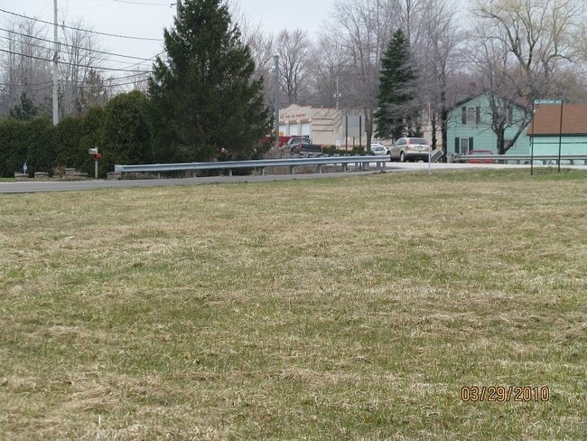
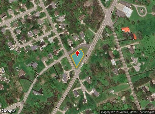
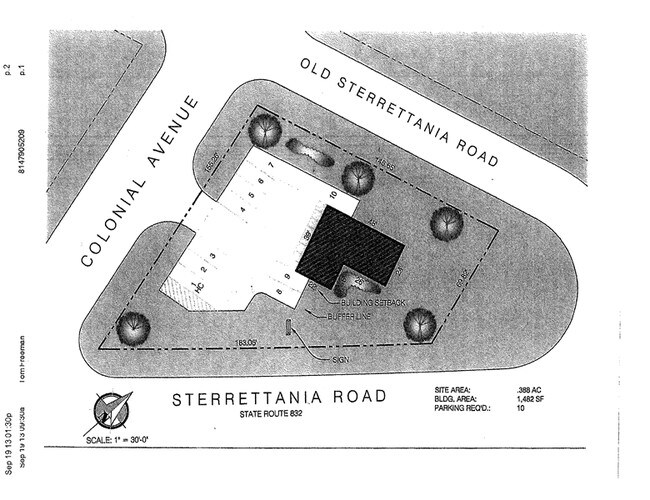
Sterrettania Rd
Erie, PA
Lenze Subdivision
33-127-564.0-001.00
STERRETTANIA RD 148.65X160IR
Residentialacreage
Erie
X
Pennsylvania
42049C0195D
0.44 AC
2025
Outlying Erie County
2025
Erie
010903
DEMOGRAPHICS near Sterrettania Rd
1 Mile
3 Mile
5 Mile
2024 Total Population
5,397
40,807
93,514
2029 Population
5,314
40,333
92,395
Pop Growth 2024-2029
(1.54%)
(1.16%)
(1.20%)
Average Age
43
43
43
2024 Total Households
2,043
17,399
40,272
HH Growth 2024-2029
(1.66%)
(1.26%)
(1.29%)
Median Household Inc
$109,537
$72,399
$64,927
Avg Household Size
2.60
2.30
2.30
2024 Avg HH Vehicles
2.00
2.00
2.00
Median Home Value
$253,672
$183,752
$167,739
Median Year Built
1985
1974
1963
Nearby Places
Map Layers
Map Styles
 Street
 Aerial
- Restaurants
- Banks
- Shops
- Fitness
- Groceries
PUBLIC TRANSPORTATION
COMMUTER RAIL
Erie Amtrak Station (Lake Shore Limited - Amtrak)
DRIVE
WALK
Distance
Erie Amtrak Station (Lake Shore Limited - Amtrak)
13 min
6.3 mi
AIRPORT
Erie International/Tom Ridge Field
DRIVE
WALK
Distance
Erie International/Tom Ridge Field
9 min
4.1 mi
Freight Ports
Port of Toledo
DRIVE
WALK
Distance
Port of Toledo
244 min
207.4 mi
SALE & LEASE HISTORY
LISTING DATE
SALE/LEASE

Sep 24, 2016
For Sale
Mar 27, 2017
For Lease
Jan 05, 2024
For Sale
Aug 15, 2017
For Sale
Nearby Properties
Address
Land Use
TOTAL SIZE
Lot Size
Zoning
Address
Land Use
TOTAL SIZE
Lot Size
Zoning
35,529 SF
84.04 AC
BB
Address
Land Use
TOTAL SIZE
Lot Size
Zoning
24.71 AC
AR
Address
Land Use
TOTAL SIZE
Lot Size
Zoning
56.46 AC
AR
Address
Land Use
TOTAL SIZE
Lot Size
Zoning
10,960 SF
29.82 AC
DR
Address
Land Use
TOTAL SIZE
Lot Size
Zoning
22.02 AC
AR
Address
Land Use
TOTAL SIZE
Lot Size
Zoning
227,718 SF
47.43 AC
DB
Address
Land Use
TOTAL SIZE
Lot Size
Zoning
127,756 SF
7.21 AC
RLB
Address
Land Use
TOTAL SIZE
Lot Size
Zoning
2,754 SF
26.83 AC
DB
Address
Land Use
TOTAL SIZE
Lot Size
Zoning
28.65 AC
AR
Address
Land Use
TOTAL SIZE
Lot Size
Zoning
171,966 SF
13.99 AC
RB
Address
Land Use
TOTAL SIZE
Lot Size
Zoning
3,340 SF
37.04 AC
AR
Address
Land Use
TOTAL SIZE
Lot Size
Zoning
35,669 SF
290.27 AC
LI
Address
Land Use
TOTAL SIZE
Lot Size
Zoning
177,906 SF
32.06 AC
AR
Address
Land Use
TOTAL SIZE
Lot Size
Zoning
100,586 SF
4.89 AC
AB
Address
Land Use
TOTAL SIZE
Lot Size
Zoning
4,600 SF
50.38 AC
R3
Address
Land Use
TOTAL SIZE
Lot Size
Zoning
48,645 SF
3.30 AC
Address
Land Use
TOTAL SIZE
Lot Size
Zoning
39,948 SF
5.02 AC
BB
Address
Land Use
TOTAL SIZE
Lot Size
Zoning
12,622 SF
AR
Address
Land Use
TOTAL SIZE
Lot Size
Zoning
37,032 SF
23.84 AC
Address
Land Use
TOTAL SIZE
Lot Size
Zoning
41,352 SF
12.21 AC
DR
Address
Land Use
TOTAL SIZE
Lot Size
Zoning
79,679 SF
13.94 AC
DB
Address
Land Use
TOTAL SIZE
Lot Size
Zoning
109,814 SF
9.66 AC
BB
Address
Land Use
TOTAL SIZE
Lot Size
Zoning
69,560 SF
3.36 AC
Address
Land Use
TOTAL SIZE
Lot Size
Zoning
10,096 SF
15.55 AC
DR
Address
Land Use
TOTAL SIZE
Lot Size
Zoning
18.93 AC
AR
Address
Land Use
TOTAL SIZE
Lot Size
Zoning
73,670 SF
7.60 AC
AR
Address
Land Use
TOTAL SIZE
Lot Size
Zoning
22.72 AC
AR
Address
Land Use
TOTAL SIZE
Lot Size
Zoning
2,199 SF
7.05 AC
BB
Address
Land Use
TOTAL SIZE
Lot Size
Zoning
3,188 SF
8.87 AC
R2
Address
Land Use
TOTAL SIZE
Lot Size
Zoning
16,329 SF
7.18 AC
BB
The World's #1 Commercial Real Estate Marketplace
Connect with us
© 2025 CoStar Group
The information above has been obtained from sources believed reliable. While we do not doubt its accuracy we have not verified it and make no guarantee, warranty or representation about it. It is your responsibility to independently confirm its accuracy and completeness. Any projections, opinions, assumptions, or estimates used are for example only and do not represent the current or future performance of the property. The value of this transaction to you depends on tax and other factors which should be evaluated by your tax, financial, and legal advisors. You and your advisors should conduct a careful, independent investigation of the property to determine to your satisfaction the suitability of the property for your needs.