Property Record
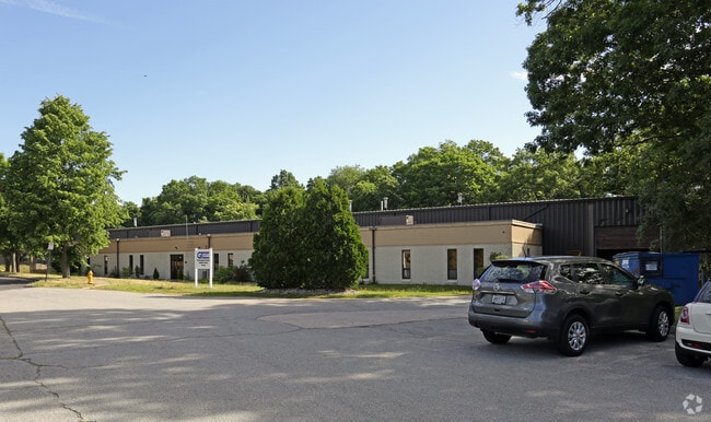
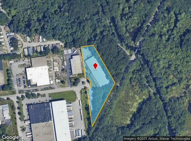
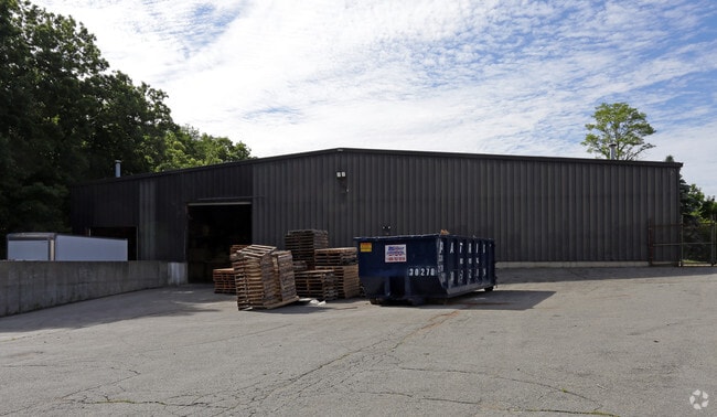
485 Narragansett Park Dr, Pawtucket, RI 02861
NEARBY LISTINGS FOR SALE OR LEASE
Property Detail
485 Narragansett Park Dr
PAWT-000042-000000-000042
Providence
Warehouse
Rhode Island
AE
42
44007C0327H
2.70 AC
2025
Pawtucket
2025
Providence
017000
Providence-Warwick, RI-MA
33,600 SF
DEMOGRAPHICS near 485 Narragansett Park Dr
1 Mile
3 Mile
5 Mile
2024 Total Population
6,837
89,577
252,877
2029 Population
6,853
88,724
250,791
Pop Growth 2024-2029
+ 0.23%
(0.95%)
(0.82%)
Average Age
45
41
39
2024 Total Households
2,881
37,868
101,964
HH Growth 2024-2029
+ 0.21%
(1.06%)
(0.80%)
Median Household Inc
$80,286
$66,609
$66,747
Avg Household Size
2.30
2.30
2.30
2024 Avg HH Vehicles
2.00
2.00
2.00
Median Home Value
$274,256
$301,454
$324,399
Median Year Built
1963
1951
1952
Nearby Places
- Restaurants
- Banks
- Shops
- Fitness
- Groceries
PUBLIC TRANSPORTATION
COMMUTER RAIL
DRIVE
WALK
Distance
8 min
3.7 mi
South Attleboro (Providence/Stoughton Line - Massachusetts Bay Transportation Authority Commuter Rail (Purple Line))
DRIVE
WALK
Distance
South Attleboro (Providence/Stoughton Line - Massachusetts Bay Transportation Authority Commuter Rail (Purple Line))
8 min
3.7 mi
AIRPORT
Rhode Island Tf Green International
DRIVE
WALK
Distance
Rhode Island Tf Green International
28 min
14.6 mi
General Edward Lawrence Logan International
DRIVE
WALK
Distance
General Edward Lawrence Logan International
65 min
44.4 mi
Worcester Regional
DRIVE
WALK
Distance
Worcester Regional
65 min
46.1 mi
Freight Ports
Port of Davisville, RI
DRIVE
WALK
Distance
Port of Davisville, RI
43 min
26.9 mi
SALE & LEASE HISTORY
LISTING DATE
SALE/LEASE

Sep 25, 2016
For Lease
Sep 24, 2016
For Sale
Nearby Properties
Address
Land Use
TOTAL SIZE
Lot Size
Zoning
Address
Land Use
TOTAL SIZE
Lot Size
Zoning
79.57 AC
O1
Address
Land Use
TOTAL SIZE
Lot Size
Zoning
28,208 SF
38.19 AC
PHB
Address
Land Use
TOTAL SIZE
Lot Size
Zoning
255,438 SF
174 SF
I-1-75
Address
Land Use
TOTAL SIZE
Lot Size
Zoning
193.69 AC
PO
Address
Land Use
TOTAL SIZE
Lot Size
Zoning
168,150 SF
2.77 AC
PO
Address
Land Use
TOTAL SIZE
Lot Size
Zoning
38.09 AC
CD
Address
Land Use
TOTAL SIZE
Lot Size
Zoning
21 AC
RM
Address
Land Use
TOTAL SIZE
Lot Size
Zoning
134,113 SF
0.74 AC
RM
Address
Land Use
TOTAL SIZE
Lot Size
Zoning
8.05 AC
C1
Address
Land Use
TOTAL SIZE
Lot Size
Zoning
18.01 AC
C3
Address
Land Use
TOTAL SIZE
Lot Size
Zoning
96,300 SF
3.79 AC
RM
Address
Land Use
TOTAL SIZE
Lot Size
Zoning
312,784 SF
11.53 AC
MO
Address
Land Use
TOTAL SIZE
Lot Size
Zoning
88,698 SF
1.44 AC
RM
Address
Land Use
TOTAL SIZE
Lot Size
Zoning
170,345 SF
3.76 AC
R6
Address
Land Use
TOTAL SIZE
Lot Size
Zoning
109,700 SF
3.73 AC
RT
Address
Land Use
TOTAL SIZE
Lot Size
Zoning
14.66 AC
CG
Address
Land Use
TOTAL SIZE
Lot Size
Zoning
171,290 SF
27.80 AC
R2
Address
Land Use
TOTAL SIZE
Lot Size
Zoning
214,701 SF
3.14 AC
RE
Address
Land Use
TOTAL SIZE
Lot Size
Zoning
2.97 AC
MB
Address
Land Use
TOTAL SIZE
Lot Size
Zoning
6.89 AC
RS
Address
Land Use
TOTAL SIZE
Lot Size
Zoning
339,222 SF
32.67 AC
PA
Address
Land Use
TOTAL SIZE
Lot Size
Zoning
55,103 SF
2.98 AC
RT
Address
Land Use
TOTAL SIZE
Lot Size
Zoning
200,200 SF
11.64 AC
I1
Address
Land Use
TOTAL SIZE
Lot Size
Zoning
189,308 SF
19.76 AC
I
Address
Land Use
TOTAL SIZE
Lot Size
Zoning
85,626 SF
2.22 AC
RT
Address
Land Use
TOTAL SIZE
Lot Size
Zoning
2.23 AC
RE
Address
Land Use
TOTAL SIZE
Lot Size
Zoning
153,005 SF
10.57 AC
DR
Address
Land Use
TOTAL SIZE
Lot Size
Zoning
117,360 SF
18.43 AC
I3
Address
Land Use
TOTAL SIZE
Lot Size
Zoning
146,404 SF
2.12 AC
MB
Address
Land Use
TOTAL SIZE
Lot Size
Zoning
46,521 SF
23.19 AC
PO
The World's #1 Commercial Real Estate Marketplace
Connect with us
© 2025 CoStar Group
The information above has been obtained from sources believed reliable. While we do not doubt its accuracy we have not verified it and make no guarantee, warranty or representation about it. It is your responsibility to independently confirm its accuracy and completeness. Any projections, opinions, assumptions, or estimates used are for example only and do not represent the current or future performance of the property. The value of this transaction to you depends on tax and other factors which should be evaluated by your tax, financial, and legal advisors. You and your advisors should conduct a careful, independent investigation of the property to determine to your satisfaction the suitability of the property for your needs.