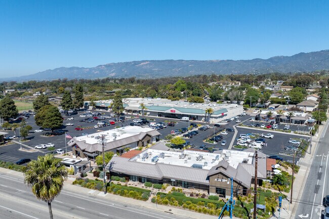
Property Record
4850 Hollister Ave, Santa Barbara, CA 93111


NEARBY LISTINGS FOR SALE OR LEASE
Property Detail
4850 Hollister Ave
Santa Maria-Santa Barbara, CA
Santa Barbara
065-040-047
California
Regionalshoppingcenterormallwithanchorstore
10.06 AC
2024
N Santa Barbara/Goleta
2025
Santa Barbara/Sta Maria/Goleta
003005
DEMOGRAPHICS near 4850 Hollister Ave
1 Mile
3 Mile
5 Mile
2024 Total Population
12,787
53,962
123,853
2029 Population
12,628
53,841
123,384
Pop Growth 2024-2029
(1.24%)
(0.22%)
(0.38%)
Average Age
42
44
40
2024 Total Households
4,226
20,374
46,010
HH Growth 2024-2029
(1.30%)
(0.17%)
(0.42%)
Median Household Inc
$122,635
$112,438
$97,296
Avg Household Size
2.80
2.50
2.50
2024 Avg HH Vehicles
2.00
2.00
2.00
Median Home Value
$977,118
$1,017,379
$1,042,259
Median Year Built
1967
1970
1968
Nearby Places
Map Layers
Map Styles
 Street
 Aerial
- Restaurants
- Banks
- Shops
- Fitness
- Groceries
PUBLIC TRANSPORTATION
COMMUTER RAIL
Goleta Amtrak (Pacific Surfliner - Amtrak)
DRIVE
WALK
Distance
Goleta Amtrak (Pacific Surfliner - Amtrak)
8 min
3.4 mi
Santa Barbara (Coast Starlight - Amtrak, Pacific Surfliner - Amtrak)
DRIVE
WALK
Distance
Santa Barbara (Coast Starlight - Amtrak, Pacific Surfliner - Amtrak)
10 min
6.8 mi
AIRPORT
Santa Barbara Municipal
DRIVE
WALK
Distance
Santa Barbara Municipal
22 min
5.7 mi
Freight Ports
The Port of Hueneme
DRIVE
WALK
Distance
The Port of Hueneme
62 min
46.1 mi
SALE & LEASE HISTORY
LISTING DATE
SALE/LEASE

Feb 26, 2018
For Lease
Nearby Properties
Address
Land Use
TOTAL SIZE
Lot Size
Zoning
Address
Land Use
TOTAL SIZE
Lot Size
Zoning
13,528 SF
9.35 AC
Address
Land Use
TOTAL SIZE
Lot Size
Zoning
20.78 AC
8R1
Address
Land Use
TOTAL SIZE
Lot Size
Zoning
5.30 AC
Address
Land Use
TOTAL SIZE
Lot Size
Zoning
1.43 AC
Address
Land Use
TOTAL SIZE
Lot Size
Zoning
Address
Land Use
TOTAL SIZE
Lot Size
Zoning
10.48 AC
C2SD2
Address
Land Use
TOTAL SIZE
Lot Size
Zoning
7.99 AC
Address
Land Use
TOTAL SIZE
Lot Size
Zoning
8.79 AC
C2SD2
Address
Land Use
TOTAL SIZE
Lot Size
Zoning
109,624 SF
9.11 AC
SC
Address
Land Use
TOTAL SIZE
Lot Size
Zoning
9.21 AC
R2
Address
Land Use
TOTAL SIZE
Lot Size
Zoning
34,688 SF
2.17 AC
Address
Land Use
TOTAL SIZE
Lot Size
Zoning
4.94 AC
CPSD2
Address
Land Use
TOTAL SIZE
Lot Size
Zoning
6.90 AC
Address
Land Use
TOTAL SIZE
Lot Size
Zoning
5.38 AC
Address
Land Use
TOTAL SIZE
Lot Size
Zoning
1.82 AC
Address
Land Use
TOTAL SIZE
Lot Size
Zoning
68,163 SF
4.04 AC
Address
Land Use
TOTAL SIZE
Lot Size
Zoning
Address
Land Use
TOTAL SIZE
Lot Size
Zoning
1.35 AC
C2SD2
Address
Land Use
TOTAL SIZE
Lot Size
Zoning
4.96 AC
Address
Land Use
TOTAL SIZE
Lot Size
Zoning
0.93 AC
Address
Land Use
TOTAL SIZE
Lot Size
Zoning
5.91 AC
DR20
Address
Land Use
TOTAL SIZE
Lot Size
Zoning
1,920 SF
1.99 AC
Address
Land Use
TOTAL SIZE
Lot Size
Zoning
Address
Land Use
TOTAL SIZE
Lot Size
Zoning
5.44 AC
R3SD2
Address
Land Use
TOTAL SIZE
Lot Size
Zoning
14.08 AC
E3
Address
Land Use
TOTAL SIZE
Lot Size
Zoning
4.08 AC
C1SD2
Address
Land Use
TOTAL SIZE
Lot Size
Zoning
5.29 AC
C2SD2
Address
Land Use
TOTAL SIZE
Lot Size
Zoning
1.11 AC
Address
Land Use
TOTAL SIZE
Lot Size
Zoning
18.94 AC
Address
Land Use
TOTAL SIZE
Lot Size
Zoning
4.18 AC
The World's #1 Commercial Real Estate Marketplace
Connect with us
© 2025 CoStar Group
The information above has been obtained from sources believed reliable. While we do not doubt its accuracy we have not verified it and make no guarantee, warranty or representation about it. It is your responsibility to independently confirm its accuracy and completeness. Any projections, opinions, assumptions, or estimates used are for example only and do not represent the current or future performance of the property. The value of this transaction to you depends on tax and other factors which should be evaluated by your tax, financial, and legal advisors. You and your advisors should conduct a careful, independent investigation of the property to determine to your satisfaction the suitability of the property for your needs.