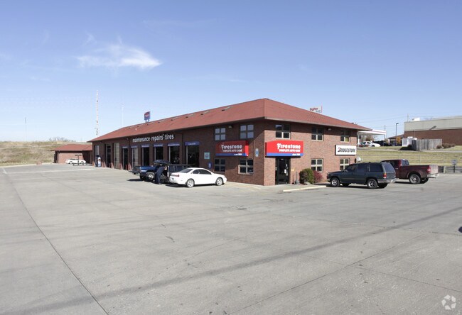
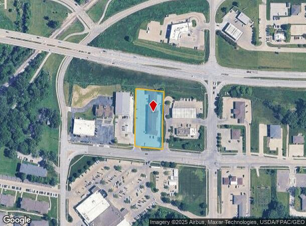
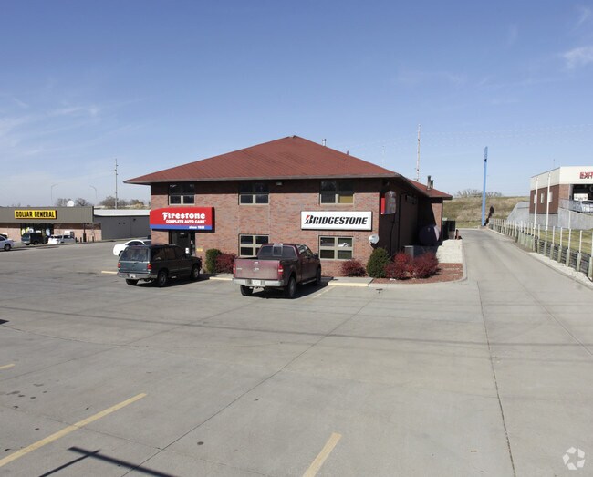
Property Record
4850 Maple Dr, Pleasant Hill, IA 50327
NEARBY LISTINGS FOR SALE OR LEASE
Property Detail
4850 Maple Dr
Des Moines-West Des Moines, IA
Hall Plat 1
221-00170802001
LT 2 & PARCEL A BEG SE COR THN N 337.51F NW 22.05F S 337.29F SE 22.05F TO POB LT 3 HALL PLAT 1
Autorepair
Polk
X
Iowa
19153C0360F
2,3
2024
1.24 AC
2025
Northeast
010803
Des Moines
11,926 SF
DEMOGRAPHICS near 4850 Maple Dr
1 mile
3 mile
5 mile
2024 Total Population
6,751
42,811
105,575
2029 Population
7,002
44,581
110,101
Pop Growth 2024-2029
+ 3.72%
+ 4.13%
+ 4.29%
Average Age
41
39
38
2024 Total Households
2,725
16,646
40,429
HH Growth 2024-2029
+ 3.85%
+ 4.26%
+ 4.52%
Median Household Inc
$69,519
$64,662
$64,650
Avg Household Size
2.40
2.50
2.50
2024 Avg HH Vehicles
2.00
2.00
2.00
Median Home Value
$233,786
$175,186
$176,473
Median Year Built
1990
1974
1977
Nearby Places
Map Layers
Map Styles
 Street
 Aerial
Transit
 Traffic
 Biking
Places
Listings with unknown addresses are not visible on the map
- Restaurants
- Banks
- Shops
- Fitness
- Groceries
PUBLIC TRANSPORTATION
AIRPORT
Des Moines International
Drive
Walk
Distance
Des Moines International
23 min
11.3 mi
Nearby Properties
Address
Land Use
TOTAL SIZE
Lot Size
Zoning
Address
Land Use
TOTAL SIZE
Lot Size
Zoning
350,879 SF
16.14 AC
Address
Land Use
TOTAL SIZE
Lot Size
Zoning
475,929 SF
49.86 AC
M2
Address
Land Use
TOTAL SIZE
Lot Size
Zoning
320,429 SF
22.34 AC
R3
Address
Land Use
TOTAL SIZE
Lot Size
Zoning
191,408 SF
8.21 AC
Address
Land Use
TOTAL SIZE
Lot Size
Zoning
90,325 SF
5.49 AC
PUD
Address
Land Use
TOTAL SIZE
Lot Size
Zoning
129,276 SF
7.63 AC
Address
Land Use
TOTAL SIZE
Lot Size
Zoning
175,854 SF
22.81 AC
Address
Land Use
TOTAL SIZE
Lot Size
Zoning
188,160 SF
18.65 AC
Address
Land Use
TOTAL SIZE
Lot Size
Zoning
1,890,511 SF
39.03 AC
M-2
Address
Land Use
TOTAL SIZE
Lot Size
Zoning
155,276 SF
6.66 AC
R-4
Address
Land Use
TOTAL SIZE
Lot Size
Zoning
201,072 SF
26.81 AC
Address
Land Use
TOTAL SIZE
Lot Size
Zoning
191,408 SF
8.21 AC
Address
Land Use
TOTAL SIZE
Lot Size
Zoning
119,872 SF
10.87 AC
Address
Land Use
TOTAL SIZE
Lot Size
Zoning
47,267 SF
22.69 AC
R-4
Address
Land Use
TOTAL SIZE
Lot Size
Zoning
126,830 SF
6.53 AC
Address
Land Use
TOTAL SIZE
Lot Size
Zoning
39,936 SF
4.62 AC
R-4
Address
Land Use
TOTAL SIZE
Lot Size
Zoning
101,681 SF
5.78 AC
Address
Land Use
TOTAL SIZE
Lot Size
Zoning
45,004 SF
5.68 AC
Address
Land Use
TOTAL SIZE
Lot Size
Zoning
65,079 SF
6.19 AC
R-2
Address
Land Use
TOTAL SIZE
Lot Size
Zoning
55,091 SF
1.40 AC
Address
Land Use
TOTAL SIZE
Lot Size
Zoning
70,148 SF
5.52 AC
Address
Land Use
TOTAL SIZE
Lot Size
Zoning
66,300 SF
8.96 AC
R-4
Address
Land Use
TOTAL SIZE
Lot Size
Zoning
89,286 SF
14.49 AC
R1-60
Address
Land Use
TOTAL SIZE
Lot Size
Zoning
31,544 SF
9.38 AC
R1-80
Address
Land Use
TOTAL SIZE
Lot Size
Zoning
123,059 SF
27.23 AC
M2
Address
Land Use
TOTAL SIZE
Lot Size
Zoning
51,023 SF
5.49 AC
R160
Address
Land Use
TOTAL SIZE
Lot Size
Zoning
64,734 SF
4.48 AC
Address
Land Use
TOTAL SIZE
Lot Size
Zoning
70,920 SF
2.80 AC
Address
Land Use
TOTAL SIZE
Lot Size
Zoning
136,535 SF
9.66 AC
M-1
Address
Land Use
TOTAL SIZE
Lot Size
Zoning
71,730 SF
6.39 AC
I-2
The World's #1 Commercial Real Estate Marketplace
Connect with us
© 2026 CoStar Group
The information above has been obtained from sources believed reliable. While we do not doubt its accuracy we have not verified it and make no guarantee, warranty or representation about it. It is your responsibility to independently confirm its accuracy and completeness. Any projections, opinions, assumptions, or estimates used are for example only and do not represent the current or future performance of the property. The value of this transaction to you depends on tax and other factors which should be evaluated by your tax, financial, and legal advisors. You and your advisors should conduct a careful, independent investigation of the property to determine to your satisfaction the suitability of the property for your needs.