Property Record
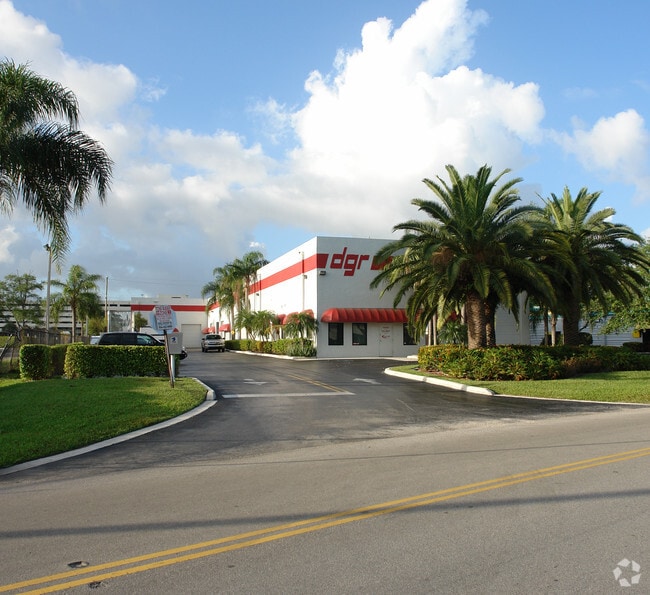
4850 Sw 52Nd St, Davie, FL 33314


NEARBY LISTINGS FOR SALE OR LEASE
Property Detail
4850 Sw 52Nd St
Fort Lauderdale-Pompano Beach-Sunrise, FL
Davie Commerce Center 114-14 B
50-41-36-15-0190
DAVIE COMMERCE CENTER 114-14 B POR OF LOTS 16,18 & 19 & A POR OF VAC SW 52ND ST DESC AS COMM AT SE COR OF SAID PLAT,WLY 651.04 TO POB,CONT WLY 107,NLY 325.01 TO P/C,NELY ARC DIST OF 110.87,SLY 350.17 TO POB AS DESC IN OR 16503/571 AKA: PT OF PARCEL K
Warehouse
Broward
AE
Florida
12011C0562J
16,18
2024
0.82 AC
2025
Southeast Broward
070102
South Florida
14,679 SF
DEMOGRAPHICS near 4850 Sw 52Nd St
1 Mile
3 Mile
5 Mile
2024 Total Population
9,125
116,932
351,826
2029 Population
8,855
115,552
348,608
Pop Growth 2024-2029
(2.96%)
(1.18%)
(0.91%)
Average Age
38
39
40
2024 Total Households
3,235
42,181
129,671
HH Growth 2024-2029
(3.71%)
(1.72%)
(1.29%)
Median Household Inc
$49,530
$66,511
$64,355
Avg Household Size
2.70
2.60
2.60
2024 Avg HH Vehicles
2.00
2.00
2.00
Median Home Value
$341,208
$349,651
$340,705
Median Year Built
1973
1976
1973
Nearby Places
Map Layers
Map Styles
 Street
 Aerial
- Restaurants
- Banks
- Shops
- Fitness
- Groceries
PUBLIC TRANSPORTATION
COMMUTER RAIL
Fort Lauderdale/Hollywood International Airport (Mangonia Park - Miami Airport - Tri-Rail, Tri-County Commuter - Tri-Rail, West Palm Beach - MiamiCentral - Tri-Rail)
DRIVE
WALK
Distance
Fort Lauderdale/Hollywood International Airport (Mangonia Park - Miami Airport - Tri-Rail, Tri-County Commuter - Tri-Rail, West Palm Beach - MiamiCentral - Tri-Rail)
8 min
3.5 mi
Sheridan Street (Tri-County Commuter - South Florida Regional Transportation Authority (Tri-Rail))
DRIVE
WALK
Distance
Sheridan Street (Tri-County Commuter - South Florida Regional Transportation Authority (Tri-Rail))
11 min
4.9 mi
AIRPORT
Fort Lauderdale/Hollywood International
DRIVE
WALK
Distance
Fort Lauderdale/Hollywood International
10 min
4.4 mi
Miami International
DRIVE
WALK
Distance
Miami International
43 min
30.3 mi
Freight Ports
Port Everglades
DRIVE
WALK
Distance
Port Everglades
13 min
7.3 mi
SALE & LEASE HISTORY
LISTING DATE
SALE/LEASE

Mar 17, 2017
For Lease
Nearby Properties
Address
Land Use
TOTAL SIZE
Lot Size
Zoning
Address
Land Use
TOTAL SIZE
Lot Size
Zoning
4,212,940 SF
69.36 AC
N/A
Address
Land Use
TOTAL SIZE
Lot Size
Zoning
4,069,966 SF
161.58 AC
RAC-AV
Address
Land Use
TOTAL SIZE
Lot Size
Zoning
589,748 SF
27.34 AC
RAC-RTE
Address
Land Use
TOTAL SIZE
Lot Size
Zoning
1,357,572 SF
126.23 AC
RAC-ED
Address
Land Use
TOTAL SIZE
Lot Size
Zoning
550,907 SF
26.92 AC
RAC-RTE
Address
Land Use
TOTAL SIZE
Lot Size
Zoning
475,897 SF
14.91 AC
RAC-RTE
Address
Land Use
TOTAL SIZE
Lot Size
Zoning
409,340 SF
15.49 AC
RAC-RTE
Address
Land Use
TOTAL SIZE
Lot Size
Zoning
635,706 SF
9.58 AC
GRIFFIN CO
Address
Land Use
TOTAL SIZE
Lot Size
Zoning
456,384 SF
81.33 AC
RAC-ED
Address
Land Use
TOTAL SIZE
Lot Size
Zoning
576,167 SF
27 AC
RAC-RTE
Address
Land Use
TOTAL SIZE
Lot Size
Zoning
334,723 SF
7.47 AC
RAC-AV
Address
Land Use
TOTAL SIZE
Lot Size
Zoning
416,469 SF
2.28 AC
M-PM
Address
Land Use
TOTAL SIZE
Lot Size
Zoning
339,273 SF
20.48 AC
RM-16
Address
Land Use
TOTAL SIZE
Lot Size
Zoning
350,663 SF
16.86 AC
RAC-RTE
Address
Land Use
TOTAL SIZE
Lot Size
Zoning
356,053 SF
8.12 AC
RAC-RTE
Address
Land Use
TOTAL SIZE
Lot Size
Zoning
326,240 SF
45.28 AC
N/A
Address
Land Use
TOTAL SIZE
Lot Size
Zoning
218,137 SF
7.13 AC
RM-2
Address
Land Use
TOTAL SIZE
Lot Size
Zoning
385,242 SF
66.40 AC
N/A
Address
Land Use
TOTAL SIZE
Lot Size
Zoning
292,581 SF
13.64 AC
RM-16
Address
Land Use
TOTAL SIZE
Lot Size
Zoning
281,510 SF
11.39 AC
PMUD
Address
Land Use
TOTAL SIZE
Lot Size
Zoning
291,551 SF
29.64 AC
C-3
Address
Land Use
TOTAL SIZE
Lot Size
Zoning
222,024 SF
13.64 AC
RM-16
Address
Land Use
TOTAL SIZE
Lot Size
Zoning
379,906 SF
39.73 AC
N/A
Address
Land Use
TOTAL SIZE
Lot Size
Zoning
287,160 SF
16.39 AC
RM-18
Address
Land Use
TOTAL SIZE
Lot Size
Zoning
337,994 SF
3.03 AC
RAC-ND4
Address
Land Use
TOTAL SIZE
Lot Size
Zoning
237,370 SF
12.51 AC
RM-16
Address
Land Use
TOTAL SIZE
Lot Size
Zoning
312,636 SF
24.06 AC
I-G
Address
Land Use
TOTAL SIZE
Lot Size
Zoning
236,654 SF
14.10 AC
RM-16
Address
Land Use
TOTAL SIZE
Lot Size
Zoning
247,577 SF
39.47 AC
RAC-ED
Address
Land Use
TOTAL SIZE
Lot Size
Zoning
175,332 SF
4.05 AC
RAC-RTE
The World's #1 Commercial Real Estate Marketplace
Connect with us
© 2026 CoStar Group
The information above has been obtained from sources believed reliable. While we do not doubt its accuracy we have not verified it and make no guarantee, warranty or representation about it. It is your responsibility to independently confirm its accuracy and completeness. Any projections, opinions, assumptions, or estimates used are for example only and do not represent the current or future performance of the property. The value of this transaction to you depends on tax and other factors which should be evaluated by your tax, financial, and legal advisors. You and your advisors should conduct a careful, independent investigation of the property to determine to your satisfaction the suitability of the property for your needs.