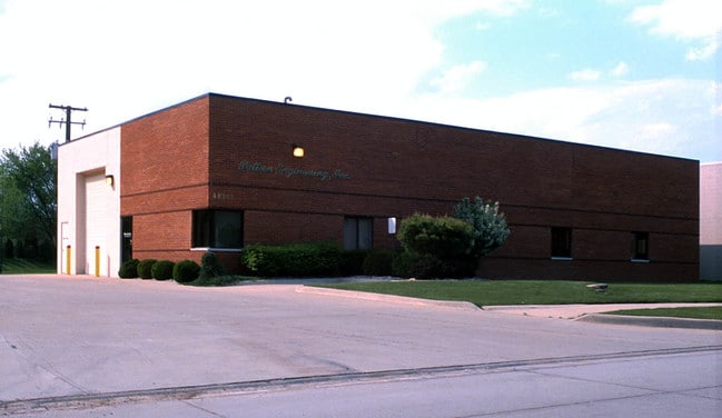
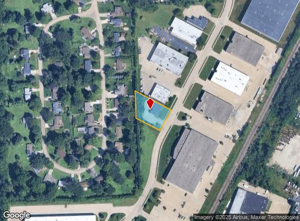
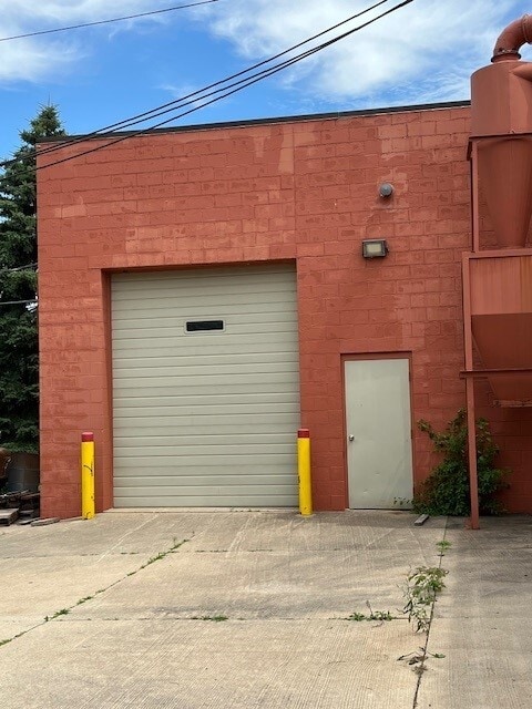
Property Record
48501 Structural Dr, Chesterfield, MI 48051
NEARBY LISTINGS FOR SALE OR LEASE
Property Detail
48501 Structural Dr
Detroit-Warren-Dearborn, MI
Industrial Park
15-09-30-103-027
SOUTH 130 FT OF NORTHERLY 446.73 FT OF LOT 24 OF INDUSTRIAL PARK 22 AS MEASURED ALONG WESTERLY R.O.W. OF STRUCTURAL DR.
Lightindustrial
Macomb
X
Michigan
26099C0265G
24
2025
0.60 AC
2025
Groesbeck North
221100
Detroit
5,200 SF
DEMOGRAPHICS near 48501 Structural Dr
1 Mile
3 Mile
5 Mile
2024 Total Population
6,256
53,079
136,767
2029 Population
6,238
52,883
135,824
Pop Growth 2024-2029
(0.29%)
(0.37%)
(0.69%)
Average Age
42
40
40
2024 Total Households
2,446
20,069
52,231
HH Growth 2024-2029
(0.33%)
(0.28%)
(0.64%)
Median Household Inc
$87,125
$85,805
$84,810
Avg Household Size
2.50
2.60
2.60
2024 Avg HH Vehicles
2.00
2.00
2.00
Median Home Value
$262,884
$275,064
$277,096
Median Year Built
1995
1996
1993
Nearby Places
Map Layers
Map Styles
 Street
 Aerial
- Restaurants
- Banks
- Shops
- Fitness
- Groceries
PUBLIC TRANSPORTATION
AIRPORT
Windsor International
DRIVE
WALK
Distance
Windsor International
63 min
40.3 mi
Freight Ports
Port of Toledo
DRIVE
WALK
Distance
Port of Toledo
113 min
90.6 mi
SALE & LEASE HISTORY
LISTING DATE
SALE/LEASE

Jul 25, 2024
For Sale
Nearby Properties
Address
Land Use
TOTAL SIZE
Lot Size
Zoning
Address
Land Use
TOTAL SIZE
Lot Size
Zoning
808,240 SF
60.31 AC
RM 3 MU
Address
Land Use
TOTAL SIZE
Lot Size
Zoning
404,160 SF
22.52 AC
I-1
Address
Land Use
TOTAL SIZE
Lot Size
Zoning
181,094 SF
14.89 AC
C3 GEN
Address
Land Use
TOTAL SIZE
Lot Size
Zoning
196,459 SF
19.18 AC
I-1
Address
Land Use
TOTAL SIZE
Lot Size
Zoning
143,731 SF
16.25 AC
C2 SHO
Address
Land Use
TOTAL SIZE
Lot Size
Zoning
229,878 SF
19.93 AC
C4 MULT
Address
Land Use
TOTAL SIZE
Lot Size
Zoning
42,385 SF
25.55 AC
B-2
Address
Land Use
TOTAL SIZE
Lot Size
Zoning
134,327 SF
10.02 AC
I-1
Address
Land Use
TOTAL SIZE
Lot Size
Zoning
167,281 SF
16.12 AC
C3 GEN
Address
Land Use
TOTAL SIZE
Lot Size
Zoning
600 SF
18.79 AC
R2L
Address
Land Use
TOTAL SIZE
Lot Size
Zoning
124,956 SF
15.78 AC
C2 SHO
Address
Land Use
TOTAL SIZE
Lot Size
Zoning
115,349 SF
14.39 AC
C3
Address
Land Use
TOTAL SIZE
Lot Size
Zoning
45,864 SF
4.60 AC
C2
Address
Land Use
TOTAL SIZE
Lot Size
Zoning
149,652 SF
8.04 AC
SP-1
Address
Land Use
TOTAL SIZE
Lot Size
Zoning
88,452 SF
8.36 AC
C3 GEN
Address
Land Use
TOTAL SIZE
Lot Size
Zoning
204,318 SF
27.75 AC
C3 GEN
Address
Land Use
TOTAL SIZE
Lot Size
Zoning
136,474 SF
12.62 AC
I-1
Address
Land Use
TOTAL SIZE
Lot Size
Zoning
98,014 SF
8.69 AC
I-1
Address
Land Use
TOTAL SIZE
Lot Size
Zoning
679,606 SF
29.98 AC
M2 GEN
Address
Land Use
TOTAL SIZE
Lot Size
Zoning
123,184 SF
10.02 AC
I-1
Address
Land Use
TOTAL SIZE
Lot Size
Zoning
5,541 SF
130.51 AC
MHP MO
Address
Land Use
TOTAL SIZE
Lot Size
Zoning
218,662 SF
16.61 AC
M2 GEN
Address
Land Use
TOTAL SIZE
Lot Size
Zoning
138,834 SF
16.46 AC
I-1
Address
Land Use
TOTAL SIZE
Lot Size
Zoning
72,184 SF
69.68 AC
M2 GEN
Address
Land Use
TOTAL SIZE
Lot Size
Zoning
84,112 SF
8.01 AC
I-1
Address
Land Use
TOTAL SIZE
Lot Size
Zoning
54,865 SF
14 AC
C4
Address
Land Use
TOTAL SIZE
Lot Size
Zoning
118,368 SF
14.46 AC
RM 3 MU
Address
Land Use
TOTAL SIZE
Lot Size
Zoning
184,401 SF
19.98 AC
RM 3 MU
Address
Land Use
TOTAL SIZE
Lot Size
Zoning
134,490 SF
6.09 AC
C4 MULT
Address
Land Use
TOTAL SIZE
Lot Size
Zoning
219,080 SF
20.05 AC
C4 MULT
The World's #1 Commercial Real Estate Marketplace
Connect with us
© 2026 CoStar Group
The information above has been obtained from sources believed reliable. While we do not doubt its accuracy we have not verified it and make no guarantee, warranty or representation about it. It is your responsibility to independently confirm its accuracy and completeness. Any projections, opinions, assumptions, or estimates used are for example only and do not represent the current or future performance of the property. The value of this transaction to you depends on tax and other factors which should be evaluated by your tax, financial, and legal advisors. You and your advisors should conduct a careful, independent investigation of the property to determine to your satisfaction the suitability of the property for your needs.