Property Record
4851 E Prosperity Pl, Decatur, IL 62521

Property Detail
4851 E Prosperity Pl
Decatur, IL
SEC 29-16-3E~LAND OF LINCOLN~LT 2~5000/157
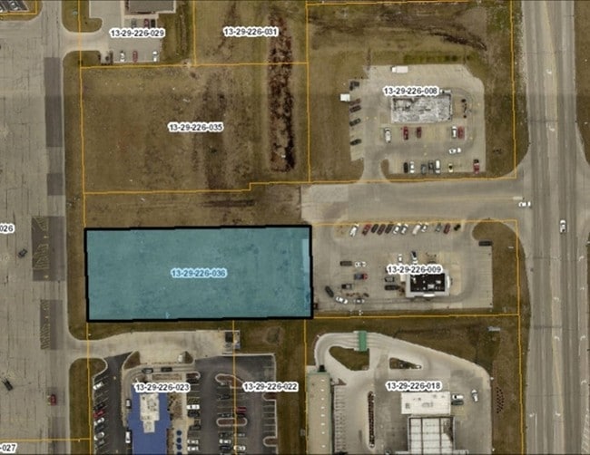
09-13-29-226-036
Macon
Commercialbuilding
Illinois
MUNICIPAL
2
B and X Area of moderate flood hazard, usually the area between the limits of the 100-year and 500-year floods.
0.91 AC
2024
Springfield/Decatur
2024
Other Market Areas
002402
NEARBY LISTINGS FOR SALE OR LEASE
DEMOGRAPHICS near 4851 E Prosperity Pl
1 mile
3 mile
5 mile
2025 Total Population
2,105
19,533
46,497
2030 Population
2,029
18,998
46,037
Pop Growth 2025-2030
(3.61%)
(2.74%)
(0.99%)
Average Age
45
44
41
2025 Total Households
910
8,617
19,977
HH Growth 2025-2030
(3.74%)
(2.84%)
(1.07%)
Median Household Inc
$84,319
$77,952
$58,820
Avg Household Size
2.30
2.20
2.20
2025 Avg HH Vehicles
2.00
2.00
2.00
Median Home Value
$148,717
$152,920
$116,858
Median Year Built
1968
1968
1962
Nearby Places
Map Layers
Map Styles
 Street
 Aerial
Transit
 Traffic
 Biking
Places
Listings with unknown addresses are not visible on the map
- Restaurants
- Banks
- Shops
- Fitness
- Groceries
Nearby Properties
Address
Land Use
TOTAL SIZE
Lot Size
Zoning
Address
Land Use
TOTAL SIZE
Lot Size
Zoning
23.63 AC
MUNICIPAL
Address
Land Use
TOTAL SIZE
Lot Size
Zoning
Address
Land Use
TOTAL SIZE
Lot Size
Zoning
25.59 AC
MUNICIPAL
Address
Land Use
TOTAL SIZE
Lot Size
Zoning
Address
Land Use
TOTAL SIZE
Lot Size
Zoning
6.36 AC
MUNICIPAL
Address
Land Use
TOTAL SIZE
Lot Size
Zoning
2.61 AC
MUNICIPAL
Address
Land Use
TOTAL SIZE
Lot Size
Zoning
21,555 SF
4.99 AC
MUNICIPAL
Address
Land Use
TOTAL SIZE
Lot Size
Zoning
1 AC
MUNICIPAL
Address
Land Use
TOTAL SIZE
Lot Size
Zoning
4.64 AC
MUNICIPAL
Address
Land Use
TOTAL SIZE
Lot Size
Zoning
1.24 AC
MUNICIPAL
Address
Land Use
TOTAL SIZE
Lot Size
Zoning
6.20 AC
MUNICIPAL
Address
Land Use
TOTAL SIZE
Lot Size
Zoning
7.74 AC
MUNICIPAL
Address
Land Use
TOTAL SIZE
Lot Size
Zoning
4.05 AC
MUNICIPAL
Address
Land Use
TOTAL SIZE
Lot Size
Zoning
1.24 AC
MUNICIPAL
Address
Land Use
TOTAL SIZE
Lot Size
Zoning
6.28 AC
MUNICIPAL
Address
Land Use
TOTAL SIZE
Lot Size
Zoning
3.47 AC
MUNICIPAL
Address
Land Use
TOTAL SIZE
Lot Size
Zoning
8.22 AC
MUNICIPAL
Address
Land Use
TOTAL SIZE
Lot Size
Zoning
6.96 AC
MUNICIPAL
Address
Land Use
TOTAL SIZE
Lot Size
Zoning
2.89 AC
MUNICIPAL
Address
Land Use
TOTAL SIZE
Lot Size
Zoning
2.21 AC
MUNICIPAL
Address
Land Use
TOTAL SIZE
Lot Size
Zoning
2.24 AC
MUNICIPAL
Address
Land Use
TOTAL SIZE
Lot Size
Zoning
1.67 AC
MUNICIPAL
Address
Land Use
TOTAL SIZE
Lot Size
Zoning
48.84 AC
MUNICIPAL
Address
Land Use
TOTAL SIZE
Lot Size
Zoning
0.85 AC
MUNICIPAL
Address
Land Use
TOTAL SIZE
Lot Size
Zoning
2.69 AC
MUNICIPAL
Address
Land Use
TOTAL SIZE
Lot Size
Zoning
7.87 AC
MUNICIPAL
Address
Land Use
TOTAL SIZE
Lot Size
Zoning
5,544 SF
1.30 AC
MUNICIPAL
Address
Land Use
TOTAL SIZE
Lot Size
Zoning
1.70 AC
MUNICIPAL
Address
Land Use
TOTAL SIZE
Lot Size
Zoning
2.08 AC
MUNICIPAL
Address
Land Use
TOTAL SIZE
Lot Size
Zoning
7.63 AC
MUNICIPAL
The World's #1 Commercial Real Estate Marketplace
Connect with us
© 2026 CoStar Group
The information above has been obtained from sources believed reliable. While we do not doubt its accuracy we have not verified it and make no guarantee, warranty or representation about it. It is your responsibility to independently confirm its accuracy and completeness. Any projections, opinions, assumptions, or estimates used are for example only and do not represent the current or future performance of the property. The value of this transaction to you depends on tax and other factors which should be evaluated by your tax, financial, and legal advisors. You and your advisors should conduct a careful, independent investigation of the property to determine to your satisfaction the suitability of the property for your needs.