Property Record
4855 Baumgartner Rd, Saint Louis, MO 63129


Property Detail
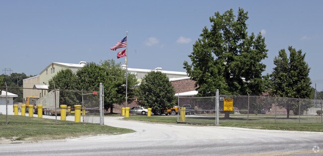
4855 Baumgartner Rd
32K-24-0472
SURVEY 2968-43-6 & SURVEY 2968-43-6 BDY ADJ TRACT PT A BDY ADJ PARCEL PT B1 (AKA JH BERRA BECO BDY ADJ)
Industrialgeneral
ST. LOUIS
M1
Missouri
B and X Area of moderate flood hazard, usually the area between the limits of the 100-year and 500-year floods.
10.05 AC
2024
South County
2025
St. Louis
220449
St. Louis, MO-IL
41,760 SF
NEARBY LISTINGS FOR SALE OR LEASE
DEMOGRAPHICS near 4855 Baumgartner Rd
1 mile
3 mile
5 mile
2025 Total Population
4,616
70,001
136,773
2030 Population
4,539
69,135
135,626
Pop Growth 2025-2030
(1.67%)
(1.24%)
(0.84%)
Average Age
42
44
43
2025 Total Households
1,752
29,263
57,035
HH Growth 2025-2030
(1.66%)
(1.23%)
(0.87%)
Median Household Inc
$114,423
$92,017
$86,106
Avg Household Size
2.60
2.40
2.40
2025 Avg HH Vehicles
2.00
2.00
2.00
Median Home Value
$282,776
$288,648
$271,381
Median Year Built
1983
1979
1976
Nearby Places
Map Layers
Map Styles
 Street
 Aerial
Layers
 Traffic
 Biking
Places
Listings with unknown addresses are not visible on the map
- Restaurants
- Banks
- Shops
- Fitness
- Groceries
PUBLIC TRANSPORTATION
AIRPORT
St Louis Lambert International
Drive
Walk
Distance
St Louis Lambert International
41 min
25.4 mi
Scott AFB/Midamerica St Louis
Drive
Walk
Distance
Scott AFB/Midamerica St Louis
58 min
39.9 mi
Nearby Properties
Address
Land Use
TOTAL SIZE
Lot Size
Zoning
Address
Land Use
TOTAL SIZE
Lot Size
Zoning
76,892 SF
Address
Land Use
TOTAL SIZE
Lot Size
Zoning
31.25 AC
R2
Address
Land Use
TOTAL SIZE
Lot Size
Zoning
225,758 SF
16.85 AC
R4
Address
Land Use
TOTAL SIZE
Lot Size
Zoning
140,783 SF
15.51 AC
C-8
Address
Land Use
TOTAL SIZE
Lot Size
Zoning
342,288 SF
19.97 AC
R7
Address
Land Use
TOTAL SIZE
Lot Size
Zoning
27.92 AC
R2
Address
Land Use
TOTAL SIZE
Lot Size
Zoning
53,714 SF
59.99 AC
FPNU
Address
Land Use
TOTAL SIZE
Lot Size
Zoning
26.62 AC
R3
Address
Land Use
TOTAL SIZE
Lot Size
Zoning
221,771 SF
25.15 AC
CT1
Address
Land Use
TOTAL SIZE
Lot Size
Zoning
237,114 SF
18.12 AC
M1
Address
Land Use
TOTAL SIZE
Lot Size
Zoning
163,144 SF
14.14 AC
C-8
Address
Land Use
TOTAL SIZE
Lot Size
Zoning
1,268 SF
19.85 AC
R2
Address
Land Use
TOTAL SIZE
Lot Size
Zoning
315,332 SF
53.99 AC
CT1
Address
Land Use
TOTAL SIZE
Lot Size
Zoning
143,076 SF
18.99 AC
C-8
Address
Land Use
TOTAL SIZE
Lot Size
Zoning
127,090 SF
11.28 AC
C-8
Address
Land Use
TOTAL SIZE
Lot Size
Zoning
188,205 SF
14.86 AC
R2
Address
Land Use
TOTAL SIZE
Lot Size
Zoning
205,040 SF
13.93 AC
M
Address
Land Use
TOTAL SIZE
Lot Size
Zoning
58,287 SF
18.90 AC
NU
Address
Land Use
TOTAL SIZE
Lot Size
Zoning
183,528 SF
20.63 AC
R6A
Address
Land Use
TOTAL SIZE
Lot Size
Zoning
150,857 SF
7.73 AC
R6A
Address
Land Use
TOTAL SIZE
Lot Size
Zoning
59,500 SF
17.78 AC
M
Address
Land Use
TOTAL SIZE
Lot Size
Zoning
36,724 SF
16.28 AC
C-8
Address
Land Use
TOTAL SIZE
Lot Size
Zoning
130,680 SF
9.99 AC
R7
Address
Land Use
TOTAL SIZE
Lot Size
Zoning
170,620 SF
8.62 AC
CT1
Address
Land Use
TOTAL SIZE
Lot Size
Zoning
8.89 AC
R3
Address
Land Use
TOTAL SIZE
Lot Size
Zoning
6,761 SF
17.28 AC
R3
Address
Land Use
TOTAL SIZE
Lot Size
Zoning
147,060 SF
7.42 AC
R6
Address
Land Use
TOTAL SIZE
Lot Size
Zoning
170,082 SF
5.49 AC
R6
Address
Land Use
TOTAL SIZE
Lot Size
Zoning
151,960 SF
10.88 AC
R2
Address
Land Use
TOTAL SIZE
Lot Size
Zoning
143,779 SF
15.65 AC
R6A
The World's #1 Commercial Real Estate Marketplace
Connect with us
© 2026 CoStar Group
The information above has been obtained from sources believed reliable. While we do not doubt its accuracy we have not verified it and make no guarantee, warranty or representation about it. It is your responsibility to independently confirm its accuracy and completeness. Any projections, opinions, assumptions, or estimates used are for example only and do not represent the current or future performance of the property. The value of this transaction to you depends on tax and other factors which should be evaluated by your tax, financial, and legal advisors. You and your advisors should conduct a careful, independent investigation of the property to determine to your satisfaction the suitability of the property for your needs.