Property Record
4856 Veracity Pt, Sanford, FL 32771


NEARBY LISTINGS FOR SALE OR LEASE
-
-
View all Sanford listings for sale on LoopNet.com
Property Detail
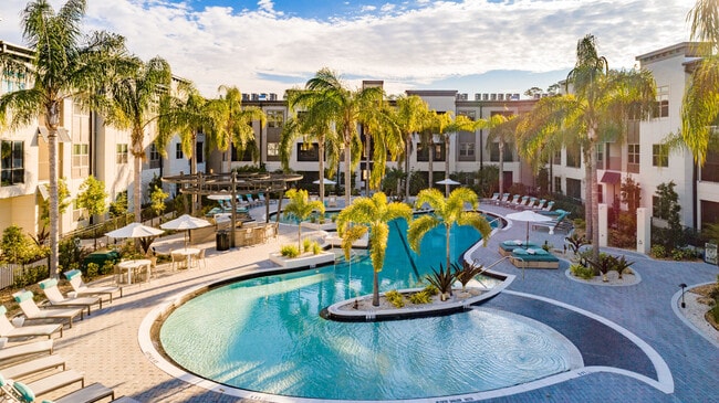
4856 Veracity Pt
Orlando-Kissimmee-Sanford, FL
Acreage & Unrec
20-19-30-300-0040-0000
SEC 20 TWP 19S RGE 30E BEG 1764.07 FT N & 210.95 FT E OF S 1/4 COR RUN S 76.10 FT E TO WLY R/W I-4 NLY ALONG R/W TO A PT 50 FT S OF N LI OF S 5/8 OF E 1/2 W 335.02 FT SWLY ALONG CURVE 1306.88 FT W 1267.16 FT S 100 FT W TO W LI SANFORD GRANT S 24 DEG
Multifamilydwelling
Seminole
A
Florida
12127C0730H
i
2025
22.55 AC
2025
Sanford
020706
Orlando
1,096 SF
DEMOGRAPHICS near 4856 Veracity Pt
1 Mile
3 Mile
5 Mile
2024 Total Population
6,772
43,442
109,581
2029 Population
7,147
45,918
116,022
Pop Growth 2024-2029
+ 5.54%
+ 5.70%
+ 5.88%
Average Age
39
39
40
2024 Total Households
2,654
17,136
42,690
HH Growth 2024-2029
+ 5.80%
+ 5.93%
+ 6.01%
Median Household Inc
$91,852
$85,955
$71,597
Avg Household Size
2.50
2.50
2.50
2024 Avg HH Vehicles
2.00
2.00
2.00
Median Home Value
$435,227
$365,617
$328,241
Median Year Built
2006
2004
1996
Nearby Places
Map Layers
Map Styles
 Street
 Aerial
- Restaurants
- Banks
- Shops
- Fitness
- Groceries
PUBLIC TRANSPORTATION
COMMUTER RAIL
Debary (SunRail - Florida Department of Transportation)
DRIVE
WALK
Distance
Debary (SunRail - Florida Department of Transportation)
8 min
4.2 mi
Sanford (SunRail - Florida Department of Transportation)
DRIVE
WALK
Distance
Sanford (SunRail - Florida Department of Transportation)
9 min
4.3 mi
AIRPORT
Orlando Sanford International
DRIVE
WALK
Distance
Orlando Sanford International
19 min
11.0 mi
Orlando International
DRIVE
WALK
Distance
Orlando International
47 min
37.9 mi
Freight Ports
Port Canaveral
DRIVE
WALK
Distance
Port Canaveral
84 min
70.8 mi
Nearby Properties
Address
Land Use
TOTAL SIZE
Lot Size
Zoning
Address
Land Use
TOTAL SIZE
Lot Size
Zoning
3,206 SF
47.56 AC
PUD
Address
Land Use
TOTAL SIZE
Lot Size
Zoning
1,225 SF
17 AC
Address
Land Use
TOTAL SIZE
Lot Size
Zoning
1,992 SF
4.76 AC
A1
Address
Land Use
TOTAL SIZE
Lot Size
Zoning
11.65 AC
Address
Land Use
TOTAL SIZE
Lot Size
Zoning
36.94 AC
A1
Address
Land Use
TOTAL SIZE
Lot Size
Zoning
18,728 SF
22.36 AC
Address
Land Use
TOTAL SIZE
Lot Size
Zoning
2,181 SF
4.92 AC
A1
Address
Land Use
TOTAL SIZE
Lot Size
Zoning
425,407 SF
19.88 AC
Address
Land Use
TOTAL SIZE
Lot Size
Zoning
600 SF
20.98 AC
PD
Address
Land Use
TOTAL SIZE
Lot Size
Zoning
312 SF
10.47 AC
Address
Land Use
TOTAL SIZE
Lot Size
Zoning
0.93 AC
A1
Address
Land Use
TOTAL SIZE
Lot Size
Zoning
6.25 AC
Address
Land Use
TOTAL SIZE
Lot Size
Zoning
23,184 SF
31.05 AC
PUD
Address
Land Use
TOTAL SIZE
Lot Size
Zoning
4,254 SF
23.23 AC
PUD
Address
Land Use
TOTAL SIZE
Lot Size
Zoning
24,382 SF
18.45 AC
A1
Address
Land Use
TOTAL SIZE
Lot Size
Zoning
311,881 SF
10.52 AC
PCD
Address
Land Use
TOTAL SIZE
Lot Size
Zoning
381,678 SF
15.85 AC
Address
Land Use
TOTAL SIZE
Lot Size
Zoning
120,877 SF
12 AC
Address
Land Use
TOTAL SIZE
Lot Size
Zoning
250 SF
14.29 AC
RMOI
Address
Land Use
TOTAL SIZE
Lot Size
Zoning
21,266 SF
14.61 AC
Address
Land Use
TOTAL SIZE
Lot Size
Zoning
365,546 SF
50.24 AC
M1A
Address
Land Use
TOTAL SIZE
Lot Size
Zoning
220,400 SF
13.45 AC
Address
Land Use
TOTAL SIZE
Lot Size
Zoning
2.42 AC
A1
Address
Land Use
TOTAL SIZE
Lot Size
Zoning
269,490 SF
24.57 AC
PD
Address
Land Use
TOTAL SIZE
Lot Size
Zoning
3,433 SF
11.15 AC
Address
Land Use
TOTAL SIZE
Lot Size
Zoning
213,600 SF
8.79 AC
PUD
Address
Land Use
TOTAL SIZE
Lot Size
Zoning
62,547 SF
15.16 AC
Address
Land Use
TOTAL SIZE
Lot Size
Zoning
1,001 SF
12.02 AC
MR3
Address
Land Use
TOTAL SIZE
Lot Size
Zoning
208,074 SF
13.17 AC
The World's #1 Commercial Real Estate Marketplace
Connect with us
© 2026 CoStar Group
The information above has been obtained from sources believed reliable. While we do not doubt its accuracy we have not verified it and make no guarantee, warranty or representation about it. It is your responsibility to independently confirm its accuracy and completeness. Any projections, opinions, assumptions, or estimates used are for example only and do not represent the current or future performance of the property. The value of this transaction to you depends on tax and other factors which should be evaluated by your tax, financial, and legal advisors. You and your advisors should conduct a careful, independent investigation of the property to determine to your satisfaction the suitability of the property for your needs.