Property Record
486 E Upper River Rd, Decatur, AL 35603

Save to a Folder
{{folder.Name}}
{{folder.ListingIds.length}} Properties
{{folder.ListingIds.length}} Property
Create a New Folder
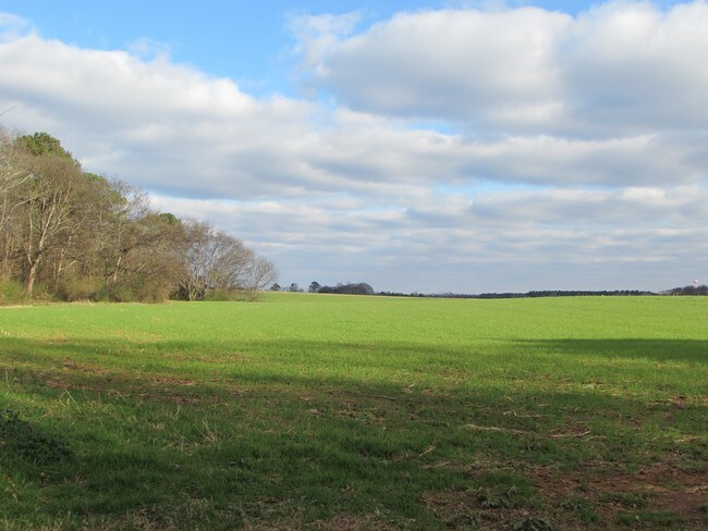
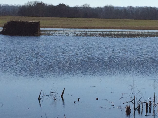
Property Detail
486 E Upper River Rd
11-03-06-0-000-002.000
BEG AT NW COR OF SEC 6, T6S, R3W, TH E ALG N BDRY OF SD SEC 3330'S; TH SO 630'S, TH W 748.17', TH SO 39.58', TH W 200', TH SO
Miscellaneous
MORGAN
B and X Area of moderate flood hazard, usually the area between the limits of the 100-year and 500-year floods.
Alabama
2025
46 AC
2025
Alabama North Area
005404
Other Market Areas
1,621 SF
Decatur, AL
NEARBY LISTINGS FOR SALE OR LEASE
DEMOGRAPHICS near 486 E Upper River Rd
1 mile
3 mile
5 mile
2025 Total Population
458
5,063
20,242
2030 Population
482
5,228
20,826
Pop Growth 2025-2030
+ 5.24%
+ 3.26%
+ 2.89%
Average Age
40
42
41
2025 Total Households
167
1,940
8,134
HH Growth 2025-2030
+ 5.39%
+ 3.30%
+ 3.00%
Median Household Inc
$160,185
$113,714
$89,946
Avg Household Size
2.80
2.60
2.40
2025 Avg HH Vehicles
3.00
3.00
2.00
Median Home Value
$315,574
$296,939
$262,132
Median Year Built
2009
2000
1981
Nearby Places
Map Layers
Map Styles
 Street
 Aerial
Layers
 Traffic
 Biking
Places
Listings with unknown addresses are not visible on the map
- Restaurants
- Banks
- Shops
- Fitness
- Groceries
PUBLIC TRANSPORTATION
AIRPORT
Huntsville International-Carl T Jones Field
Drive
Walk
Distance
Huntsville International-Carl T Jones Field
28 min
19.1 mi
Freight Ports
Port of Mobile
Drive
Walk
Distance
Port of Mobile
364 min
331.3 mi
SALE & LEASE HISTORY
LISTING DATE
SALE/LEASE

Jul 24, 2017
For Sale
Nearby Properties
Address
Land Use
TOTAL SIZE
Lot Size
Zoning
Address
Land Use
TOTAL SIZE
Lot Size
Zoning
42,616 SF
19 AC
Address
Land Use
TOTAL SIZE
Lot Size
Zoning
31,720 SF
6 AC
Address
Land Use
TOTAL SIZE
Lot Size
Zoning
13,509 SF
6.94 AC
Address
Land Use
TOTAL SIZE
Lot Size
Zoning
22,632 SF
2 AC
Address
Land Use
TOTAL SIZE
Lot Size
Zoning
28,590 SF
3.40 AC
Address
Land Use
TOTAL SIZE
Lot Size
Zoning
5,066 SF
3.80 AC
Address
Land Use
TOTAL SIZE
Lot Size
Zoning
32,006 SF
1.43 AC
Address
Land Use
TOTAL SIZE
Lot Size
Zoning
21,220 SF
3.50 AC
Address
Land Use
TOTAL SIZE
Lot Size
Zoning
23,932 SF
1.40 AC
Address
Land Use
TOTAL SIZE
Lot Size
Zoning
14,700 SF
4.40 AC
Address
Land Use
TOTAL SIZE
Lot Size
Zoning
3,939 SF
1.30 AC
Address
Land Use
TOTAL SIZE
Lot Size
Zoning
549 SF
1.20 AC
Address
Land Use
TOTAL SIZE
Lot Size
Zoning
6,400 SF
15 AC
Address
Land Use
TOTAL SIZE
Lot Size
Zoning
10,250 SF
4.70 AC
Address
Land Use
TOTAL SIZE
Lot Size
Zoning
9,140 SF
5 AC
Address
Land Use
TOTAL SIZE
Lot Size
Zoning
13,804 SF
12 AC
Address
Land Use
TOTAL SIZE
Lot Size
Zoning
10,998 SF
1.50 AC
Address
Land Use
TOTAL SIZE
Lot Size
Zoning
1,625 SF
2.70 AC
Address
Land Use
TOTAL SIZE
Lot Size
Zoning
9,900 SF
2.50 AC
Address
Land Use
TOTAL SIZE
Lot Size
Zoning
4,640 SF
2.20 AC
Address
Land Use
TOTAL SIZE
Lot Size
Zoning
12,000 SF
6.80 AC
Address
Land Use
TOTAL SIZE
Lot Size
Zoning
3,360 SF
0.40 AC
Address
Land Use
TOTAL SIZE
Lot Size
Zoning
9,350 SF
1.90 AC
Address
Land Use
TOTAL SIZE
Lot Size
Zoning
6,054 SF
6 AC
Address
Land Use
TOTAL SIZE
Lot Size
Zoning
2,352 SF
0.70 AC
Address
Land Use
TOTAL SIZE
Lot Size
Zoning
4,224 SF
1.70 AC
Address
Land Use
TOTAL SIZE
Lot Size
Zoning
12,690 SF
4.60 AC
Address
Land Use
TOTAL SIZE
Lot Size
Zoning
6,365 SF
1.50 AC
Address
Land Use
TOTAL SIZE
Lot Size
Zoning
3,272 SF
1.93 AC
Address
Land Use
TOTAL SIZE
Lot Size
Zoning
5,304 SF
0.90 AC
The World's #1 Commercial Real Estate Marketplace
Connect with us
© 2026 CoStar Group
The information above has been obtained from sources believed reliable. While we do not doubt its accuracy we have not verified it and make no guarantee, warranty or representation about it. It is your responsibility to independently confirm its accuracy and completeness. Any projections, opinions, assumptions, or estimates used are for example only and do not represent the current or future performance of the property. The value of this transaction to you depends on tax and other factors which should be evaluated by your tax, financial, and legal advisors. You and your advisors should conduct a careful, independent investigation of the property to determine to your satisfaction the suitability of the property for your needs.