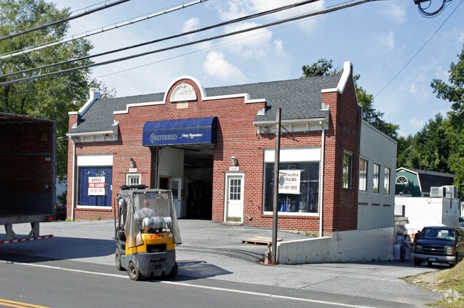
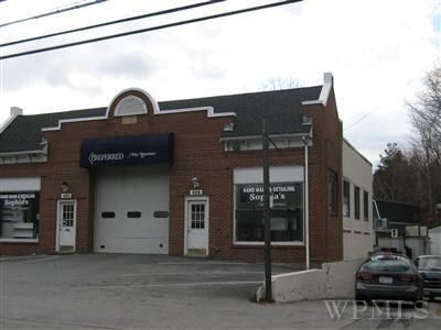
Property Record
486 Lexington Ave, Mount Kisco, NY 10549
NEARBY LISTINGS FOR SALE OR LEASE
Property Detail
486 Lexington Ave
New York-Jersey City-White Plains, NY-NJ
Property Subdivided For Frank Dellecave
5601-080-064-00001-000-0009
Westchester
Autorepair
New York
X
9.000
36119C0153F
0.20 AC
2025
North
2024
Westchester/So Connecticut
013000
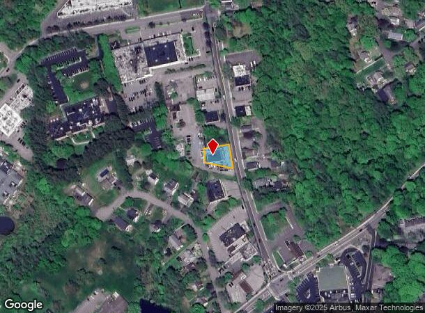
DEMOGRAPHICS near 486 Lexington Ave
1 Mile
3 Mile
5 Mile
2024 Total Population
5,793
24,611
62,424
2029 Population
5,564
24,094
61,247
Pop Growth 2024-2029
(3.95%)
(2.10%)
(1.89%)
Average Age
40
41
41
2024 Total Households
2,025
8,580
20,970
HH Growth 2024-2029
(4.25%)
(2.26%)
(2.07%)
Median Household Inc
$109,261
$147,723
$174,635
Avg Household Size
2.80
2.80
2.80
2024 Avg HH Vehicles
2.00
2.00
2.00
Median Home Value
$650,985
$769,039
$799,929
Median Year Built
1961
1964
1964
Nearby Places
- Restaurants
- Banks
- Shops
- Fitness
- Groceries
PUBLIC TRANSPORTATION
COMMUTER RAIL
Mount Kisco Station (Harlem Line - Metro-North Commuter Railroad Company (Metro-North))
DRIVE
WALK
Distance
Mount Kisco Station (Harlem Line - Metro-North Commuter Railroad Company (Metro-North))
3 min
1.8 mi
Chappaqua Station (Harlem Line - Metro-North Commuter Railroad Company (Metro-North))
DRIVE
WALK
Distance
Chappaqua Station (Harlem Line - Metro-North Commuter Railroad Company (Metro-North))
7 min
3.8 mi
AIRPORT
Westchester County
DRIVE
WALK
Distance
Westchester County
19 min
12.5 mi
LaGuardia
DRIVE
WALK
Distance
LaGuardia
55 min
38.2 mi
New York Stewart International
DRIVE
WALK
Distance
New York Stewart International
73 min
42.8 mi
Freight Ports
NY - Red Hook Container Terminal
DRIVE
WALK
Distance
NY - Red Hook Container Terminal
67 min
46.4 mi
Nearby Properties
Address
Land Use
TOTAL SIZE
Lot Size
Zoning
Address
Land Use
TOTAL SIZE
Lot Size
Zoning
12.77 AC
H
Address
Land Use
TOTAL SIZE
Lot Size
Zoning
158.56 AC
Address
Land Use
TOTAL SIZE
Lot Size
Zoning
31 AC
ML
Address
Land Use
TOTAL SIZE
Lot Size
Zoning
20.54 AC
Address
Land Use
TOTAL SIZE
Lot Size
Zoning
450,000 SF
59.25 AC
Address
Land Use
TOTAL SIZE
Lot Size
Zoning
Address
Land Use
TOTAL SIZE
Lot Size
Zoning
85.40 AC
R-1A
Address
Land Use
TOTAL SIZE
Lot Size
Zoning
46.35 AC
R1
Address
Land Use
TOTAL SIZE
Lot Size
Zoning
Address
Land Use
TOTAL SIZE
Lot Size
Zoning
4.86 AC
OG
Address
Land Use
TOTAL SIZE
Lot Size
Zoning
3.70 AC
OG
Address
Land Use
TOTAL SIZE
Lot Size
Zoning
4.29 AC
OG
Address
Land Use
TOTAL SIZE
Lot Size
Zoning
2.20 AC
CB-2
Address
Land Use
TOTAL SIZE
Lot Size
Zoning
12.34 AC
R-1A
Address
Land Use
TOTAL SIZE
Lot Size
Zoning
11.71 AC
Address
Land Use
TOTAL SIZE
Lot Size
Zoning
25 AC
R-1A
Address
Land Use
TOTAL SIZE
Lot Size
Zoning
7.62 AC
RM-29
Address
Land Use
TOTAL SIZE
Lot Size
Zoning
100,000 SF
0.79 AC
Address
Land Use
TOTAL SIZE
Lot Size
Zoning
3.67 AC
CL
Address
Land Use
TOTAL SIZE
Lot Size
Zoning
3.13 AC
MG
Address
Land Use
TOTAL SIZE
Lot Size
Zoning
2.20 AC
CB-2
Address
Land Use
TOTAL SIZE
Lot Size
Zoning
55 AC
R-1A
Address
Land Use
TOTAL SIZE
Lot Size
Zoning
3,814 SF
97.89 AC
R-2A
Address
Land Use
TOTAL SIZE
Lot Size
Zoning
2.05 AC
RT-6
Address
Land Use
TOTAL SIZE
Lot Size
Zoning
6.26 AC
GC
Address
Land Use
TOTAL SIZE
Lot Size
Zoning
Address
Land Use
TOTAL SIZE
Lot Size
Zoning
1,743 SF
3.79 AC
R-1/4
Address
Land Use
TOTAL SIZE
Lot Size
Zoning
4.20 AC
MG
Address
Land Use
TOTAL SIZE
Lot Size
Zoning
2.38 AC
CR
Address
Land Use
TOTAL SIZE
Lot Size
Zoning
1,476 SF
8.15 AC
BR
The World's #1 Commercial Real Estate Marketplace
Connect with us
© 2025 CoStar Group
The information above has been obtained from sources believed reliable. While we do not doubt its accuracy we have not verified it and make no guarantee, warranty or representation about it. It is your responsibility to independently confirm its accuracy and completeness. Any projections, opinions, assumptions, or estimates used are for example only and do not represent the current or future performance of the property. The value of this transaction to you depends on tax and other factors which should be evaluated by your tax, financial, and legal advisors. You and your advisors should conduct a careful, independent investigation of the property to determine to your satisfaction the suitability of the property for your needs.