Property Record
4860 62Nd Ave N, Pinellas Park, FL 33781
NEARBY LISTINGS FOR SALE OR LEASE
Property Detail
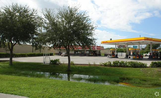
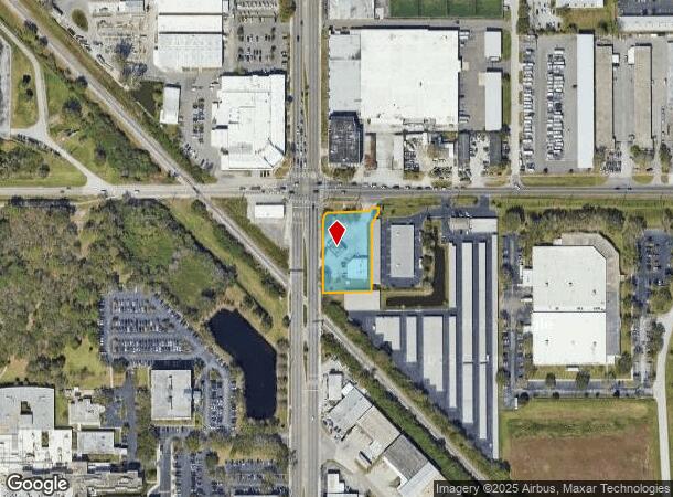
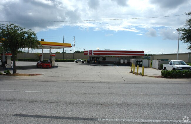
4860 62Nd Ave N
Tampa-St. Petersburg-Clearwater, FL
Rbb Circle K
33-30-16-73640-000-0010
RBB CIRCLE K LOT 1 & THAT PART OF LOT 2 DESC BEG NW COR OF SD LOT 2 TH S89D5612E 22.7FT TH S00D2714W 13.53FT TH S31D1544W 44.32FT TH N00D2714E 51.44FT TO POB
Storebuilding
Pinellas
X
Florida
12103C0204H
1,2
2024
0.88 AC
2025
South Pinellas
024701
Tampa/St Petersburg
3,700 SF
DEMOGRAPHICS near 4860 62Nd Ave N
1 Mile
3 Mile
5 Mile
2024 Total Population
12,652
122,672
273,866
2029 Population
12,629
122,783
274,310
Pop Growth 2024-2029
(0.18%)
+ 0.09%
+ 0.16%
Average Age
42
44
44
2024 Total Households
5,262
53,040
123,814
HH Growth 2024-2029
(0.34%)
+ 0.04%
+ 0.01%
Median Household Inc
$48,966
$54,014
$60,220
Avg Household Size
2.30
2.20
2.10
2024 Avg HH Vehicles
2.00
2.00
2.00
Median Home Value
$206,687
$207,064
$245,201
Median Year Built
1970
1970
1970
Nearby Places
Map Layers
Map Styles
 Street
 Aerial
- Restaurants
- Banks
- Shops
- Fitness
- Groceries
PUBLIC TRANSPORTATION
AIRPORT
St Pete-Clearwater International
DRIVE
WALK
Distance
St Pete-Clearwater International
18 min
8.1 mi
Tampa International
DRIVE
WALK
Distance
Tampa International
28 min
18.3 mi
Freight Ports
Port Manatee
DRIVE
WALK
Distance
Port Manatee
41 min
30.4 mi
Nearby Properties
Address
Land Use
TOTAL SIZE
Lot Size
Zoning
Address
Land Use
TOTAL SIZE
Lot Size
Zoning
372,013 SF
10.10 AC
Address
Land Use
TOTAL SIZE
Lot Size
Zoning
447,664 SF
34.44 AC
Address
Land Use
TOTAL SIZE
Lot Size
Zoning
346,420 SF
17.95 AC
Address
Land Use
TOTAL SIZE
Lot Size
Zoning
372,436 SF
22.30 AC
Address
Land Use
TOTAL SIZE
Lot Size
Zoning
404,063 SF
12.98 AC
Address
Land Use
TOTAL SIZE
Lot Size
Zoning
404,899 SF
35.35 AC
Address
Land Use
TOTAL SIZE
Lot Size
Zoning
358,681 SF
11.70 AC
Address
Land Use
TOTAL SIZE
Lot Size
Zoning
240,736 SF
58.40 AC
Address
Land Use
TOTAL SIZE
Lot Size
Zoning
324,579 SF
16.97 AC
Address
Land Use
TOTAL SIZE
Lot Size
Zoning
309,526 SF
36.85 AC
C2
Address
Land Use
TOTAL SIZE
Lot Size
Zoning
300,546 SF
6.49 AC
Address
Land Use
TOTAL SIZE
Lot Size
Zoning
170,146 SF
17.78 AC
Address
Land Use
TOTAL SIZE
Lot Size
Zoning
206,685 SF
16.75 AC
RPD5
Address
Land Use
TOTAL SIZE
Lot Size
Zoning
267,649 SF
17.86 AC
Address
Land Use
TOTAL SIZE
Lot Size
Zoning
281,993 SF
85.13 AC
Address
Land Use
TOTAL SIZE
Lot Size
Zoning
193,194 SF
13.53 AC
Address
Land Use
TOTAL SIZE
Lot Size
Zoning
360,137 SF
37.64 AC
AE
Address
Land Use
TOTAL SIZE
Lot Size
Zoning
172,600 SF
20.57 AC
Address
Land Use
TOTAL SIZE
Lot Size
Zoning
172,768 SF
15.05 AC
RPD20
Address
Land Use
TOTAL SIZE
Lot Size
Zoning
125,218 SF
13.51 AC
Address
Land Use
TOTAL SIZE
Lot Size
Zoning
88,793 SF
13.78 AC
IL
Address
Land Use
TOTAL SIZE
Lot Size
Zoning
113,365 SF
13.32 AC
Address
Land Use
TOTAL SIZE
Lot Size
Zoning
226,561 SF
24.34 AC
Address
Land Use
TOTAL SIZE
Lot Size
Zoning
116,358 SF
12.74 AC
Address
Land Use
TOTAL SIZE
Lot Size
Zoning
248,572 SF
15.22 AC
PSP
Address
Land Use
TOTAL SIZE
Lot Size
Zoning
116,080 SF
12.42 AC
Address
Land Use
TOTAL SIZE
Lot Size
Zoning
99,589 SF
41.77 AC
Address
Land Use
TOTAL SIZE
Lot Size
Zoning
145,047 SF
12.03 AC
Address
Land Use
TOTAL SIZE
Lot Size
Zoning
136,376 SF
15.11 AC
Address
Land Use
TOTAL SIZE
Lot Size
Zoning
146,680 SF
57.94 AC
The World's #1 Commercial Real Estate Marketplace
Connect with us
© 2025 CoStar Group
The information above has been obtained from sources believed reliable. While we do not doubt its accuracy we have not verified it and make no guarantee, warranty or representation about it. It is your responsibility to independently confirm its accuracy and completeness. Any projections, opinions, assumptions, or estimates used are for example only and do not represent the current or future performance of the property. The value of this transaction to you depends on tax and other factors which should be evaluated by your tax, financial, and legal advisors. You and your advisors should conduct a careful, independent investigation of the property to determine to your satisfaction the suitability of the property for your needs.