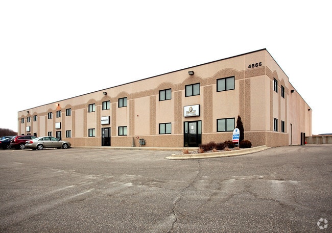
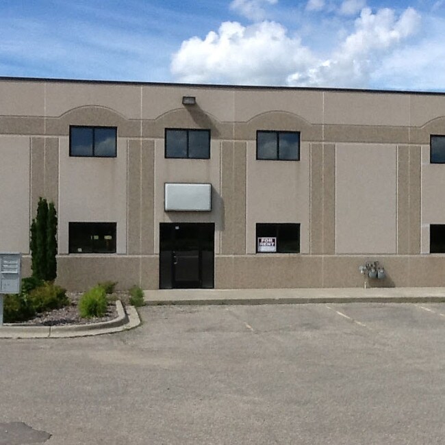
Property Record
4865 19Th St Nw, Rochester, MN 55901
NEARBY LISTINGS FOR SALE OR LEASE
Property Detail
4865 19Th St Nw
Rochester, MN
West 19 Bus Plaza Cic305
74.29.23.075795
Olmsted
Condominium
Minnesota
X
0.49 AC
27109C0141F
Rochester
6,000 SF
Other Market Areas
DEMOGRAPHICS near 4865 19Th St Nw
1 Mile
3 Mile
5 Mile
2024 Total Population
4,189
41,242
100,504
2029 Population
4,303
42,001
102,983
Pop Growth 2024-2029
+ 2.72%
+ 1.84%
+ 2.47%
Average Age
37
38
39
2024 Total Households
1,568
16,505
42,018
HH Growth 2024-2029
+ 2.74%
+ 1.74%
+ 2.52%
Median Household Inc
$115,109
$87,910
$80,436
Avg Household Size
2.60
2.40
2.30
2024 Avg HH Vehicles
2.00
2.00
2.00
Median Home Value
$275,399
$278,462
$277,214
Median Year Built
1999
1990
1985
Nearby Places
Map Layers
Map Styles
 Street
 Aerial
- Restaurants
- Banks
- Shops
- Fitness
- Groceries
PUBLIC TRANSPORTATION
AIRPORT
Rochester International
DRIVE
WALK
Distance
Rochester International
17 min
12.3 mi
Freight Ports
Port Milwaukee
DRIVE
WALK
Distance
Port Milwaukee
311 min
281.8 mi
SALE & LEASE HISTORY
LISTING DATE
SALE/LEASE

Sep 26, 2016
For Lease
Sep 22, 2017
For Lease
Oct 31, 2017
For Lease
Oct 27, 2022
For Sale
Oct 01, 2019
For Lease
Nov 21, 2024
For Sale
Nov 14, 2023
For Sale
Jan 12, 2021
For Lease
Dec 08, 2016
For Lease
Aug 02, 2021
For Sale
Nearby Properties
Address
Land Use
TOTAL SIZE
Lot Size
Zoning
Address
Land Use
TOTAL SIZE
Lot Size
Zoning
1,232,028 SF
2.03 AC
Address
Land Use
TOTAL SIZE
Lot Size
Zoning
2.77 AC
Address
Land Use
TOTAL SIZE
Lot Size
Zoning
271,310 SF
27.90 AC
Address
Land Use
TOTAL SIZE
Lot Size
Zoning
4,612 SF
21.16 AC
Address
Land Use
TOTAL SIZE
Lot Size
Zoning
960 SF
38.12 AC
Address
Land Use
TOTAL SIZE
Lot Size
Zoning
236,769 SF
33.30 AC
Address
Land Use
TOTAL SIZE
Lot Size
Zoning
12,016 SF
20.31 AC
Address
Land Use
TOTAL SIZE
Lot Size
Zoning
2,420 SF
10.37 AC
Address
Land Use
TOTAL SIZE
Lot Size
Zoning
195,039 SF
8.25 AC
Address
Land Use
TOTAL SIZE
Lot Size
Zoning
53.73 AC
Address
Land Use
TOTAL SIZE
Lot Size
Zoning
167.09 AC
Address
Land Use
TOTAL SIZE
Lot Size
Zoning
4.63 AC
Address
Land Use
TOTAL SIZE
Lot Size
Zoning
250,864 SF
4.43 AC
Address
Land Use
TOTAL SIZE
Lot Size
Zoning
2,300 SF
6.38 AC
Address
Land Use
TOTAL SIZE
Lot Size
Zoning
3,024 SF
4.93 AC
Address
Land Use
TOTAL SIZE
Lot Size
Zoning
3,915 SF
12.56 AC
Address
Land Use
TOTAL SIZE
Lot Size
Zoning
Address
Land Use
TOTAL SIZE
Lot Size
Zoning
117,897 SF
34.12 AC
Address
Land Use
TOTAL SIZE
Lot Size
Zoning
72,675 SF
11.25 AC
Address
Land Use
TOTAL SIZE
Lot Size
Zoning
132,566 SF
2.85 AC
Address
Land Use
TOTAL SIZE
Lot Size
Zoning
77,176 SF
11.05 AC
Address
Land Use
TOTAL SIZE
Lot Size
Zoning
528 SF
15.22 AC
Address
Land Use
TOTAL SIZE
Lot Size
Zoning
341 SF
5.46 AC
Address
Land Use
TOTAL SIZE
Lot Size
Zoning
4,994 SF
7.92 AC
Address
Land Use
TOTAL SIZE
Lot Size
Zoning
44,352 SF
10.93 AC
Address
Land Use
TOTAL SIZE
Lot Size
Zoning
23.22 AC
Address
Land Use
TOTAL SIZE
Lot Size
Zoning
23,268 SF
10.22 AC
Address
Land Use
TOTAL SIZE
Lot Size
Zoning
11,984 SF
6.52 AC
Address
Land Use
TOTAL SIZE
Lot Size
Zoning
176,455 SF
9.03 AC
Address
Land Use
TOTAL SIZE
Lot Size
Zoning
55.70 AC
The World's #1 Commercial Real Estate Marketplace
Connect with us
© 2025 CoStar Group
The information above has been obtained from sources believed reliable. While we do not doubt its accuracy we have not verified it and make no guarantee, warranty or representation about it. It is your responsibility to independently confirm its accuracy and completeness. Any projections, opinions, assumptions, or estimates used are for example only and do not represent the current or future performance of the property. The value of this transaction to you depends on tax and other factors which should be evaluated by your tax, financial, and legal advisors. You and your advisors should conduct a careful, independent investigation of the property to determine to your satisfaction the suitability of the property for your needs.